Climate risk assessment: Chelsea, Massachusetts
Current and future storm surge and stormwater flood risk under climate change in Chelsea, Massachusetts

Summary
Floods are some of the most devastating natural disasters and are expected to worsen under climate change due to intensification of extreme precipitation and sea level rise. In this study, present and future flood risk in Chelsea, MA are examined through changes in the 1% annual chance flood event. Future rainfall and storm surge are estimated for two time periods, 2041–2060 (2050) and 2071–2090 (2080) representing the mid and late 21st century, respectively, using a regional climate model and established sea level rise rates for the Boston area.
The output of these simulations show that the historical 1% annual chance rainfall event will be 3x and 3.5x as likely in 2050 and 2080, respectively. The historical 1% annual chance storm surge event will be 3.8x as likely in 2050 and occur at least once a year by 2080.
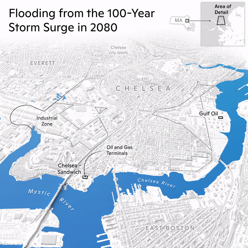
Using these estimates as inputs into a flood model reveals significant increases in flood risk across Chelsea. The percentage of land area in Chelsea inundated by the historical 1% annual storm surge event will increase from 14% in the present time period to 19% in 2050 and 34% in 2080. While storm surge events cause the greatest flood extents, the 1% annual chance rainfall event impacts the greatest number of buildings in the present time period and 2050. However, the 1% annual chance of joint rainfall and storm surge events impacts the greatest number of buildings in 2080. This finding underscores the need for including pluvial flood modeling in federal flood maps.
Introduction
The combustion of fossil fuels, deforestation, and other human activities release greenhouse gases (GHGs). These, in turn, have increased global average temperature at unprecedented rates. From 1901–2016, global average temperatures have already risen by 1°C (1.8°F;Hayhoe et al., 2018).The rate of warming is not attributable to natural variability, has no natural explanation, and is unequivocally the result of human influence (IPCC, 2021). The Paris Agreement aims to prevent the most catastrophic impacts of climate change by limiting global warming to 2°C (3.6°F). The response of Earth’s natural systems to the rapidly warming climate and human disruption will impact our quality of life for generations to come. Understanding and preparing for these changes is critical.
The impacts climate change has on the frequency and severity of physical hazards will put many communities at risk. Physical hazards include extreme precipitation events, severe storms, extreme heat events, and flooding. Socioeconomic consequences include adverse public health outcomes, loss of critical infrastructure, and agricultural yield reduction among others.
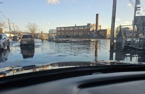
Flooding is the costliest and deadliest natural disaster in the United States (Perry, 2000; Miller et al., 2008). Flooding comprises three main risks: hazard, exposure, and vulnerability. Hazard refers to a destructive event (i.e. flooding), exposure represents the local community elements (e.g. people, buildings, infrastructure) that could be impacted by flooding, and vulnerability is the susceptibility of those community elements to consequences of flooding (e.g. lack of resilience planning).
Due to climate change, much of the Northeastern United States is expected to see an intensification of extreme precipitation events, and, therefore, flood events (Dupigny-Giroux, 2018). Already, increased rainfall intensities in the Northeast are expected to outpace any other region in the United States. In addition, accelerating sea level rise will lead to an increase in sunny day flooding and storm surges. Much of the infrastructure, such as drainage and sewer systems, in the Northeast is nearing its planned life expectancy, and climate-related events will put further strain on these infrastructure systems.
This focuses on flooding in Chelsea, MA and will examine how flood events will be different in the future under climate change. The report also discusses building exposure and general exposure across the area of interest.
There are three different types of flooding: fluvial, pluvial, and coastal. Fluvial (also known as riverine) flooding occurs when rivers exceed the boundaries of the river channel. Pluvial flooding occurs as a result of extreme precipitation events and is not associated with riverine flooding. This usually occurs when a stormwater system or soils cannot effectively drain or infiltrate rainfall leading to standing water. Coastal flooding occurs during storm surge or high tide events. Chelsea is vulnerable to coastal flooding because of the city’s significant coastline. Chelsea is vulnerable to pluvial flooding since rainfall can pond, so the city is largely reliant on the capacity of the stormwater system because 77% of the land area is impervious (OCM, 2018). The land cover present in Chelsea is shown in Figure 1. Areas of future development are also highlighted on the map, which will likely contain mixed use buildings and open space according to the proposed Chelsea Creek Municipal Harbor Plan and Designed Port Area Master Plan (City of Chelsea, 2021).
Download the full report to continue reading.