There are few things that can lift the heads of the busy Toolik scientists away from their work. But on certain weekdays, behind the maze of dark green storage containers-turned-laboratories, a soft plume of fragrant smoke rises. The tell-tale sign of the awakening Toolik sauna never fails to pull a relieved smile from weary scientists. “Sauna tiiiime,” they whisper underneath their breath, while others let loose a shrill “Yesssssss!” as we hurry to finish the last task of the day. This wooden oasis, tucked into a slope leading into Toolik Lake, is one of the most beloved features of the Toolik Field Station—and a vital community space shaped by the art of storytelling.
On sauna nights, scientists saunter over to the edge of the station, towels draped around our necks. Walking into the mud room, we brace ourselves for the stifling heat we are about to enter. As we walk into the wall of heat we grimace, and then slowly let our shoulders loosen, opening our lungs to the heat—eyes closed, breath heavy, body relaxed.
There is a gentle silence at the beginning of every sauna session as we settle into the damp heat of the room. But soon, conversations start to flow and meander, the sauna filling with the sound of overlapping chatter. People lament their torn-up hands from readjusting rusty bars, muse over the absence of darkness, and fiercely debate the proper name for fish nests (the conclusion, “redds”). I listen to the tale of a soil scientist, swearing that she nearly joined a pack of wolves on a recent data-collection trek. We weigh the strange dependency of this climate research station on the road that was built to expand oil production. And I listen as an older scientist, one who has been coming to Toolik for almost thirty years, recounts how much he has seen this landscape, which he has come to love so deeply, change so much.
In these moments, I cannot help but think, “This is what it’s all about.” Scientists—across disciplines, countries, generations—sharing the weight and joy of their lives of work. An ecologist’s work, not unlike the heat that we choose to sit in every time we walk through the sauna’s doors, can be heavy and at times, suffocating. But under this pressure, in these spaces of relaxation and healing, we inspire celebration, reflection, and resolution with the stories we tell.
We bask in our love for science— a shared love for adventure, mystery, the land, and a dedication to protect and heal it.
For younger scientists, listening to the stories of older scientists bends time, reminding us of what has been lost—and the urgency with which we must continue to defend these changing ecosystems.
Once we leave the sauna, these stories become incredibly special tools. Global change can be insidious, its effects hiding beyond our daily lives. But by sharing these stories, we have the power to reach out and envelop others in our world, finding that perfect heartstring to tug.
We need people working from every angle, from both within and beyond the scientific community, to understand, mitigate, and adapt to the consequences of our rapidly changing world. And while the Toolik sauna is an incredibly unique ecosystem of human beings, sweat, and laughter, I—and many of my fellow scientists—happily hold the responsibility of disseminating the words that are shared in that space with all of our communities so that everyone can take a turn basking in the sauna at the top of the world.
Woodwell Climate Research Center to expand soil carbon testing capacity
Woodwell Climate Research Center, in Falmouth, is getting an $800,000 federal earmark to develop a dedicated soil carbon research lab.
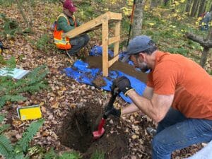
We hear a lot about carbon stored in oceans, trees, and of course the atmosphere. But there’s about three billion tons of carbon stored in soils around the world, according to Jonathan Sanderman. He’s a senior scientist and vice president of science at Woodwell Climate Research Center, in Falmouth.
Sometimes it only takes a small push to start gathering momentum. That’s the idea behind the Fund for Climate Solutions (FCS) at Woodwell Climate. Launched in 2018, FCS is a competitive internal grant program that funds Woodwell Climate scientists to explore research projects that test out innovative ideas for climate solutions. Though each individual project starts small, nearly all FCS projects lead to new lines of inquiry, and a few have grown from their initial seed funding into some of our biggest research projects. From carbon monitoring to wildfire management to thawing permafrost, these three projects exemplify the surprising power of starting small.
1. Monitoring Rangeland Carbon
Rangelands represent a massive untapped natural climate solution, making up more than 30% of the land in the United States and holding 30% of the global soil carbon stock. Conservation practices, including adaptive livestock management, have the potential to enhance that carbon storage— but data was limited on just how grazing systems would respond to different techniques. Senior scientist Dr. Jon Sanderman and Associate Scientist Dr. Jennifer Watts applied for an FCS grant in 2019 to expand scientific understanding in a way that would prove useful for making management decisions.
That first project was successful, and today, Woodwell’s studies of rangeland carbon and other ecological co-benefits have expanded into a multifaceted research project that has received several subsequent grants. Watts and Sanderman are building tools that map and model carbon storage and the overall ecological health of rangelands across the U.S. and show how that storage could change under different management practices. Those tools have been adopted by both conservation groups and corporate partners to better understand the climate benefits of improved range management. They have continued engagement with ranchers and conservation communities across the American West, hosting workshops that bring land managers together to discuss the benefits—both environmental and economic—of improving carbon storage on rangelands.
2. Planning for Intensifying Wildfires
In Summer of 2018, Senior Scientist Dr. Brendan Rogers received an FCS grant to explore the possibility of fire management to mitigate carbon emissions from boreal wildfire. Though fires are a natural part of the northern landscape, wildfires in Alaska and Canada have been growing more frequent and intense as the Arctic rapidly warms. Left unchecked, these northern fires represent a large and broadly unaccounted for threat to emissions reduction goals.
Bringing fires under control as a climate mitigation tactic is now one of the Center’s core scientific goals. Collaborations with the US Fish and Wildlife Service and the Alaska Fire Service are underway to pilot fire suppression as a cost-effective method to keep carbon from entering the atmosphere. Senior Arctic Lead, Edward Alexander, has joined the Center to elevate Indigenous mitigation practices as practical policy solutions to address accelerating northern fires, and strategies are being shared across geographies to inform fire management in temperate and tropical forests as well. Woodwell Climate has also now joined Google’s AI Collaborative on Wildfires and has become an early adopter for the FireSat program led by EarthFire Alliance.
3. Permafrost Pathways
In the summer of 2018 Senior scientists, Drs. Sue Natali, Rogers, Linda Deegan, and Sanderman received an FCS grant to start work on an Arctic change and carbon observatory. Natali observed that while the Arctic was warming at a rapid pace, causing typically-frozen permafrost soils to thaw and erode, actual measurements of carbon emissions from thawing permafrost were sparse. She proposed constructing new carbon-monitoring towers to fill data gaps, starting with a field site in the Yukon-Kuskokwim Delta.
From there, the project gained momentum, and in 2022, Natali was awarded a $41 million grant from the TED Audacious Project to launch Permafrost Pathways. The expanded project not only continued and enhanced carbon monitoring across the Arctic, but also partnered with 10 Alaska Native Tribes and policy experts to advocate for change. Permafrost Pathways supports community-led environmental monitoring of permafrost thaw to help tribes develop a long-term adaptation plan, including relocation. In addition, project experts have been working to influence international policy and get permafrost emissions factored into global emissions models.
In a new study released this week in Nature Communications Earth & Environment, researchers assess the impact of a warming Arctic on global carbon emissions and find that carbon emissions from abrupt permafrost thaw and wildfire will substantially limit our ability to keep global temperature increase below 1.5° or 2° Celsius. When accounting for carbon emissions from abrupt permafrost thaw and intensifying wildfire regimes, the remaining carbon budgets to keep global temperatures below 1.5°C were reduced by about one quarter and by nearly one fifth for 2°C.
Abrupt thaw mainly occurs in ice-rich permafrost landscapes, where rapid thawing can cause the ground to collapse. This exposes deep carbon-rich soils to warmer temperatures, allowing large amounts of previously frozen carbon to be released over a short period of time and amplifying climate warming. At the same time, intensifying wildfires are emitting carbon to the atmosphere at the time of burning and further accelerating permafrost thaw by removing the insulating organic layer at the soil surface.
While existing research has recently led to the critical inclusion of projected carbon emissions from gradual permafrost thawing in global carbon budgets, the impact of abrupt thaw processes and wildfires are both largely missing from Earth System Models, hindering our ability to set sufficiently ambitious and accurate mitigation solutions. The study, which was led by Permafrost Pathways researchers at the Woodwell Climate Research Center and co-authored with the University of Colorado, Boulder and the International Institute for Applied Systems Analysis (IIASA) in Austria, calculates that these total permafrost thaw and wildfire carbon emissions could reach 63 Pg C for every degree Celsius of further global temperature increase. This is over double what is currently included in the Intergovernmental Panel on Climate Change (IPCC) projects. To put it another way, by the end of this century, these projected annual permafrost emissions could reach or exceed the current total annual emissions of a high-emitting nation such as the United States.
“Accurately accounting for land-based emissions directly affects whether remaining carbon budgets, as established by the Paris Agreement, are effective in restricting the planet’s temperature increase to below the 1.5°C and 2°C thresholds,” said Dr. Christina Schädel, lead author of the paper and Senior Research Scientist at Woodwell Climate Research Center. “As the Arctic continues to warm more rapidly than anywhere else on the planet, we must continue to research and support science-based solutions in the Arctic in order to mitigate the impacts of climate change on communities across the globe.”
“Estimates of remaining carbon budgets will continue to underestimate emissions unless the impacts of permafrost thaw and wildfire are fully included,” said Dr. Susan Natali, Senior Scientist and lead of Permafrost Pathways at Woodwell Climate Research Center. “Given the urgency of the climate crisis, and our rapidly shrinking window to limit its impacts and to respond to accelerating climate hazards, the global community must move quickly towards fully informed climate policy and accurate temperature goals.”
This study was funded by One Earth Philanthropy, the Gordon and Betty Moore Foundation, the Quadrature Climate Fund, and with funding catalyzed through the Audacious Project. The full study can be found here.
Our salmon are vanishing — and the State of Alaska is letting it happen
I live along the Yukon River, where my family has harvested salmon for countless generations. Every summer used to bring the same reassuring sight: Busy fish camps. Full smokehouses. Families coming together to pass down traditions that have thrived for thousands of years. Happy kids, curious babies, loving grandparents, moms, dads, aunties, uncles and cousins. Each is an intrinsic part of a beautiful summer day at the smokehouse.
Today, summers mean less time on the river, empty smokehouses and fish camps, and no intergenerational learning. The State of Alaska tells my community and over 50 other Indigenous communities in Alaska and Canada that we are the ones who must stop fishing, we are the ones who must sacrifice, we are the ones who must somehow bear the burden of a crisis we did not create.
Continue reading on Alaska Beacon.
A message from President & CEO Dr. Max Holmes
As the calendar flips from one year to the next, I find myself reflecting not only on the many challenges faced in 2025, but also on lessons learned during difficult moments further in the past. One such time was more than a decade ago, deep in the Siberian Arctic, when weather threatened to delay the conclusion of a weeks-long research expedition. As I wrote on July 23, 2012:
“I’m sitting on the barge, drinking a cup of coffee, watching snow whip across the Panteleikha River. More than 24 hours of rain and snow have turned the dirt runway in Cherskiy to mud, threatening to delay our trip home (which is supposed to begin later today as we fly from Cherskiy to Yakutsk, and then to Moscow). A delayed flight out of Cherskiy would have many ripple effects (lots of rebooking of flights, hotels, buses, etc.; lots of disappointment as our reunions with family and friends are postponed; and lots of additional expenses).
There are many easier things to do in life than to lead a group of 33 people to the Siberian Arctic, so why do I do this? I’ve been asking myself that question this morning, intertwined with thoughts about missing my 6-year-old son and 3-year-old daughter, and facing the prospect of missing my wife’s 40th birthday.
Fortunately, there is an easy answer: This is the most important thing I can imagine doing. I’ll keep hoping that our flight departs as scheduled this afternoon, but if not, I–and the larger group–will rally and use our extra time here to pry a few more secrets from this remarkable, challenging, critical, and beautiful environment.”
As it turned out, our flight out of Cherskiy was canceled, we had to spend an additional $30,000 on plane tickets, and I missed my wife’s 40th birthday. Experiences like this are not unusual when working in challenging environments such as the Arctic, and Woodwell scientists have long been tested by such obstacles.
Fast forward to 2025 and all of the challenges it brought. And yes, as in 2012, there have been moments when I’ve asked myself that same question:
“Why do I do this?”
My answer remains exactly what it was then:
“This is the most important thing I can imagine doing.”
I know that most Woodwell staff feel the same way. This is hard work, and at times, there are more losses than wins. But it is essential work, and we will continue to forge ahead.
I’m certain that 2026 will bring new challenges, but I am confident that Woodwell Climate Research Center will continue to stand tall, doing our science, using our voice, and staying focused on charting a course toward a positive future, no matter the obstacles in our way.
In fact, we are doing much more than simply holding our own; we are forging ahead. In the coming months, you’ll hear about Woodwell’s new office in Washington, DC; our new scientific impact strategy; and how we are continuing to pursue our highest priorities without being beholden to federal government agendas.
Thank you to all our friends, supporters, collaborators, and partners. This is a true team effort. We wouldn’t be able to continue to stand tall without you.
Onward.

Are stratospheric polar vortex disruptions what they seem?
A weak or distorted stratospheric polar vortex (SPV) is often associated with severe winter weather in Northern Hemisphere continents. Traditional metrics of the SPV state, however, may conflate influences from both the stratosphere and the troposphere below, obfuscating attribution of weather extremes. In a new paper, published this month by Climate Dynamics, researchers present a new method that more clearly separates variations in the two atmospheric layers and their contributions to severe winter weather.
Depending on your feelings toward cold and snow, the headline “The Polar Vortex is Coming!” may instill dread or delight. The Polar Vortex first entered dinner-table conversations during the extreme winter of 2013/14, the coldest North American winter of the 21st century, and has since been used—often incorrectly—as shorthand for any cold or snowy spell. The polar vortex is a pool of frigid air encircled by strong westerly winds that sits high above the polar regions during winter only, and normally it has little influence on weather at the surface. But when it becomes disrupted from its typically circular shape—either stretched to an oblong, split into separate swirls, or greatly weakened—extreme winter weather can ensue, including severe cold, snow, and even winter heat waves.
One of the ways scientists track the behavior of the stratospheric polar vortex is to monitor the height of a constant pressure surface that exists within the stratosphere. Pressure decreases at higher altitudes because there are few air molecules above that level. The height of a pressure surface bulges and shrinks depending mainly on the temperature of the air below it: warmer air expands and cooler air contracts. Height fluctuations of a level in the stratosphere, then, are caused by temperature changes in the whole column of atmosphere below that level, not only in the stratosphere. Disruptions to the SPV detected using pressure heights, therefore, may be misleading as to their cause.
“As I explored the role of stratospheric disruptions on extreme winter weather, it occurred to me that there might be a better way to measure those disruptions,” said Dr. Jennifer Francis, Senior Scientist at Woodwell Climate Research Center and lead author. “Focusing on the stratosphere itself rather than the whole atmospheric column helps separate the influences from the two layers, which often behave independently.”
The authors analyzed the thickness of a layer in the stratosphere using an AI-based approach to identify representative patterns in the SPV, including various types of disruptions.
“The new metric revealed an increased occurrence of strong and abnormally cold SPV patterns,” added co-author Natasa Skific, Researcher at the Woodwell Climate Research Center. “This is different from findings in earlier studies based on pressure heights. Our findings make sense because higher concentrations of greenhouse gases cool the stratosphere, causing a stronger SPV.”
Paper co-author Dr. Judah Cohen, Research Scientist at MIT Parsons Lab and Director of Seasonal Forecasting at Atmospheric and Environmental Research, noted the previously underappreciated common occurrence of vortex stretching, which often contributes to cold spells in the U.S. and central Eurasia.
“The results of our study fit with other work highlighting the importance of stretched-vortex states on severe winter weather. Our new metric helps isolate the stratosphere so we can better understand its dynamics and connections with weather extremes, atmospheric blocking, and amplified Arctic warming.”
Fire on ice: The Arctic’s changing fire regime
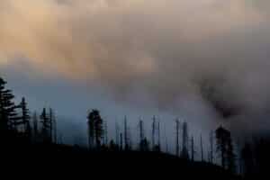
The number of wildland fires burning in the Arctic is on the rise, according to NASA researchers. Moreover, these blazes are burning larger, hotter, and longer than they did in previous decades.
These trends are closely tied to the region’s rapidly changing climate. The Arctic is warming nearly four times faster than the global average, a shift that directly impacts rain and snow in the region and decreases soil moisture, both of which make the landscape more flammable. Lightning, the primary ignition source of Arctic fires, is also occurring farther north. These findings are detailed in a report published in 2025 by the Arctic Monitoring and Assessment Programme (AMAP), a working group of the Arctic Council.


