Why burning biomass is not zero-carbon
Short animation explaining why burning biomass produces more carbon dioxide per unit of energy generated than almost all fossil fuels.
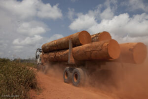
The climate emergency requires countries to transition away from fossil fuels, but it is important to be careful about the alternative energy sources chosen.
In particular, concern is growing over the use of biomass for energy, which is generated when wood or other plant material is burnt to generate heat and electricity. Many governments treat biomass energy as zero-carbon at the point of combustion, and subsidize it in the same way as renewables such as solar or wind, resulting in a large increase in the use of biomass for energy in the UK and the European Union (EU) over the past 15 years.
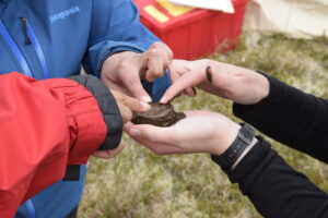
Permafrost slumps spew carbon into streams, study shows
Streams affected by permafrost slumps carry substantially more carbon than typically found in other streams flowing through permafrost landscapes, according to a new study.
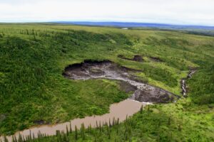
The research highlights freshwater’s growing role in the carbon balance of permafrost landscapes, like much of the Northwest Territories, as the world warms.
The work may help researchers refine their estimates of how much carbon is absorbed versus released in northern regions.
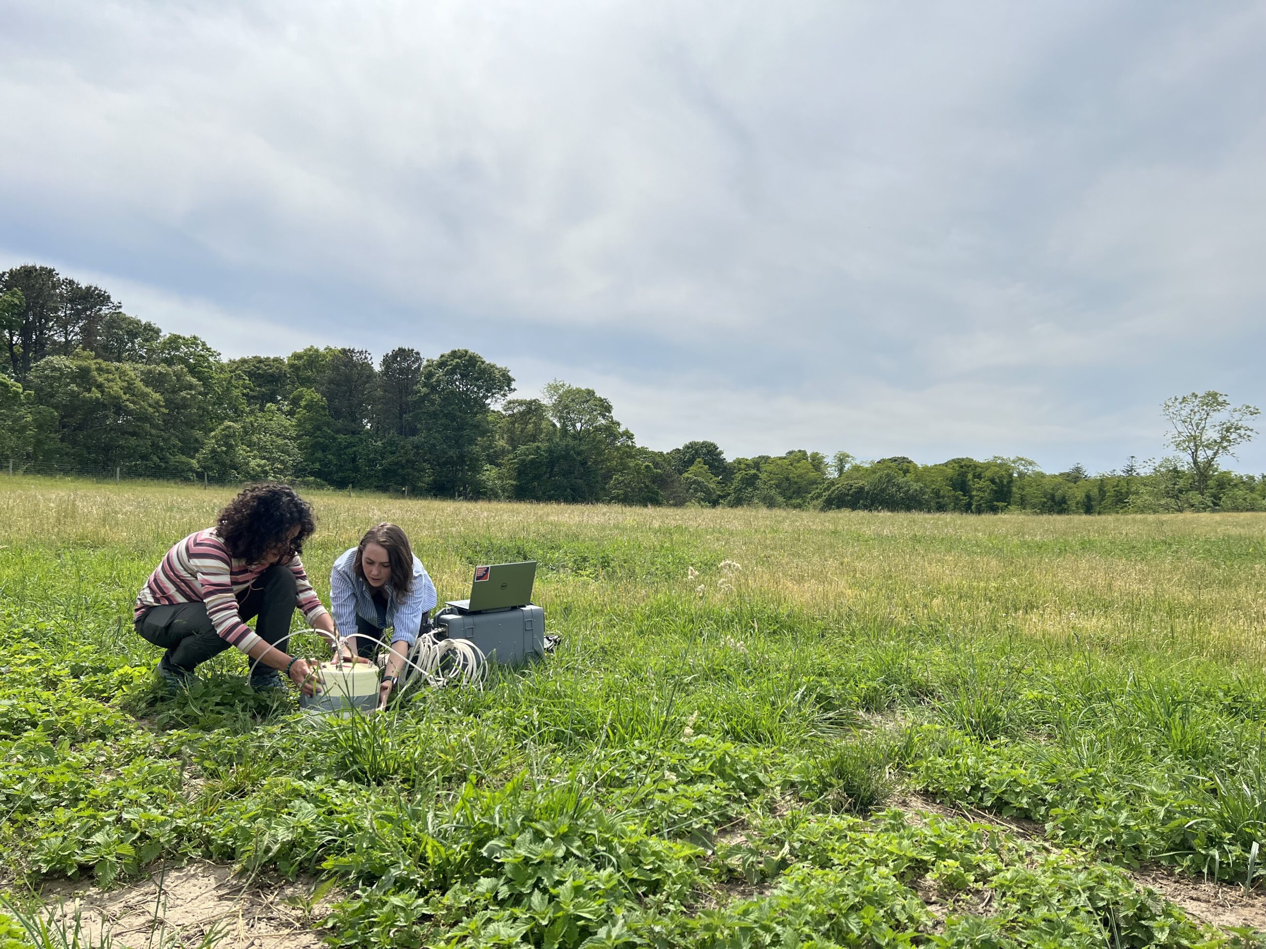
Peterson Farm soil carbon ‘fieldwork’ for Opalite Media filming
June 2022
To confront that uncertainty and put nature-based climate solutions on a sound scientific footing, several dozen scientists and policy experts gathered in Washington D.C. in June of this year for a workshop sponsored by Indiana University, the U.S. Department of Energy, and the U.S. Carbon Cycle Science Program. The resulting white paper report reviews the current state of knowledge in this field, and describes the necessary research and technology investments to support effective mitigation policy.
According to the report’s lead author, Dr. Kim Novick from the Paul H. O’Neill School of Public and Environmental Affairs at Indiana University, “Nature-based climate solutions can play an important role in slowing the pace of climate change, but only if they are pursued alongside economy-wide decarbonization and guided by the best-available science.”
The white paper authors identify critical gaps in the science needed to support large-scale implementation of nature-based climate solutions and lay out a research agenda to fill these gaps. They also outline a set of principles that should guide future assessments of the effectiveness and viability of nature-based climate solutions. The result is a road map for producing information that will foster successful programs and policies—while avoiding energy wasted on those that do not.
Woodwell Senior Scientist, Dr. Jonathan Sanderman attended the gathering in June and contributed to the development of the paper.
“We’re at a unique moment in U.S. climate policy where the hard work of the research science community can be directly and immediately leveraged to help the U.S. fight climate change and become a world leader in implementing nature-based climate solutions.”
The report calls for a ~$1 billion (USD) coordinated investment in a national nature-based climate solution “Information Network” organized around coordinated ground-based experiments and monitoring that can inform rigorously benchmarked maps, model predictions, and protocol evaluations.
According to Dr. Benjamin Runkle, another report co-author and associate professor in the College of Engineering at the University of Arkansas: “Although the investment necessary to generate this information is not small, it is a fraction of the amount already allocated to implementation of nature-based solutions. Investing in sound science to predict, monitor, and verify the benefits of these strategies is fundamental to ensuring their success.”
In addition to their potential to stave off climate change, nature-based solutions also have a range of other benefits, including improving air and water quality, promoting biodiversity, and providing economic opportunities. Many can also help communities adapt to a changing climate and improve resilience of agricultural and food systems.
“There is broad-scale agreement that many nature-based climate solutions benefit people and the environment through co-benefits,” said Dr. Emily Oldfield, a report co-author and agricultural soil carbon scientist with the Environmental Defense Fund. “We should push to incentivize those practices using a wide range of policy tools, while acknowledging there is no one-size-fits-all approach to ecosystem-based climate solutions.”
New study identifies mature forests on U.S. federal lands ripe for protection
In a major new study, a team of scientists has published what it calls the first-ever, map-based assessment of existing mature and old-growth forests in the continental United States. Such forests are critical to fighting climate change and data like this is deemed vital to President Biden’s climate action agenda.
But the new research also shows how much mature forests on both federal and private lands in the U.S. are seriously at risk — offering a conservation opportunity to the Biden administration.
Online permafrost course launches new Woodwell partnership
Woodwell Climate Research Center has released its first course in partnership with FutureLearn, a UK-based global social education platform that delivers learning through online courses, partnering with more than 260 universities and brands. FutureLearn aims to transform access to education for their diverse network of over 17 million learners with courses that empower them to solve the world’s biggest challenges, and Woodwell will be developing additional future courses through the partnership that address other areas of our scientists’ expertise, such as forest carbon and risk assessment.
The newly released course, Thawing Permafrost: Science, Policy, and Environmental Justice in the Arctic, represents years of Woodwell scientists’ research and experience in permafrost regions. It features Arctic Program Director Dr. Sue Natali and Associate Scientist Dr. Brendan Rogers, who also lead Woodwell’s Permafrost Pathways project, as well as Woodwell’s Chief Communications Officer Dr. Heather Goldstone. Over the 4 weeks of the course, learners are introduced to advanced geology and climate science concepts relating to permafrost, translated into an accessible, go-at-your-own-pace experience.
“Permafrost thaw is an underappreciated problem, which unfortunately means that its impacts continue to be underestimated,” said Dr. Brendan Rogers. “While I’m excited for people to learn more about it through the course, my biggest hope is that all of those people will then share what they learned with someone else, and help expand the conversation.”
Offered free of charge on FutureLearn’s online platform, the course is designed for a broad audience, from policy influencers to business leaders, teachers, activists, and anyone interested in climate change.
“Unfortunately, climate change may not be a significant part of people’s formal education. But we all need to understand what’s going on,” said Woodwell Chief Communications Officer, Dr. Heather Goldstone. “With FutureLearn, we can share our insights and expertise with a large, diverse audience, delve into content more deeply than we ever could in a webinar, and provide a more interactive and flexible experience for learners.”
The course is open now for enrollment and on-demand learning, and Woodwell will be offering a facilitated session immediately after COP, with moderators available to answer learner questions.
What can be done about permafrost thaw?
Monitor, model, and make sure Arctic communities have the support they need
With the Arctic warming 3 to 4 times faster than the rest of the world, permafrost thaw has become a significant climate threat. Scientists estimate that permafrost contains 1.4 trillion tonnes of carbon, an amount more than double what is currently in the Earth’s atmosphere. That carbon sink is stable as long as it stays frozen, but with recent and projected thaw, the organic matter in permafrost is breaking down and releasing carbon dioxide and methane into the atmosphere, increasing the rate of climate change.
What we’re doing
Addressing this issue requires extensive data collection on permafrost emissions, as well as equitable strategies for adaptation by Arctic communities. To tackle this issue, Woodwell has partnered with the Arctic Initiative at Harvard Kennedy School, the Alaska Institute for Justice, and the Alaska Native Science Commission to connect experts in climate science, human rights, and public policy with frontline communities and high-level decision makers. The partnership is pioneering a six-year research program called Permafrost Pathways that will develop action plans to address the compounding impacts of permafrost thaw.
With the understanding that this needs to be a sustainable process with long-term impact, Permafrost Pathways’ scientists are expanding and coordinating a pan-Arctic carbon monitoring network to improve the accuracy of permafrost thaw emissions estimates. More precise measurements will fill critical data gaps and reduce uncertainties, so that permafrost emissions can be factored into global carbon budgets, climate models, targets, and measures for mitigation and adaptation. That, combined with high-resolution satellite and aircraft-based observations and advanced computer modeling, will allow for tracking the changing landscape in near real-time and more accurately projecting future emissions.
Permafrost Pathways is also collaborating with local communities to co-create Indigenous-led adaptation strategies. For many, relocation or infrastructure upgrades are needed urgently, but there is currently no process or resources to enable communities to move forward. With Arctic residents already feeling the brunt of climate change, the involvement of frontline communities is crucial in developing successful adaptation plans and effective policies.
What’s left to be done
Despite its big strides, Permafrost Pathways is still in its infancy and there is a long road ahead when it comes to tackling the complexity of permafrost thaw. Today, at least 192 countries, plus the European Union, have signed on to the Paris Agreement’s promise of reducing emissions to keep warming below 2 degrees C. But many emissions reduction goals do not include carbon released by permafrost thaw. The international community needs to take strong action to change this or else permafrost thaw could undermine climate goals.
In the Intergovernmental Panel on Climate Change’s 2021 report, permafrost thaw was named as an issue that should be included in carbon budgets and global reduction schedules, but often isn’t because there is not enough data on its climate impact. Continued support of data gathering programs like Permafrost Pathways will provide the international community, top country-level climate negotiators, and environmental ministers the knowledge needed to fix that oversight and start filling gaps.
In Arctic communities, permafrost thaw is already causing disasters like flooding, coastal erosion, and infrastructure damage. To combat this, national and international policy makers need to act now to integrate permafrost thaw into disaster policies and community-led adaptation frameworks. This will create clear planning and response procedures for future permafrost-related issues.
What you can do
Permafrost thaw is an issue that affects everyone. Understanding the local and global implications and sharing that information within immediate social circles as well as on social media platforms can help start conversations that spur action. The public also has the power to influence the development of climate policies by pressuring elected officials to tackle this serious issue.>
For more information about the issues surrounding permafrost thaw, read part one and part two in our Permafrost series. To stay informed and get involved, visit the Permafrost Pathways site.
The critical missing expense in global climate budgets
A major emitter is being left out of the global climate budget, and Arctic communities are already feeling the impacts
A 2022 Intergovernmental Panel on Climate Change (IPCC) report confirms that the Earth is on track to warm 1.5 degrees celsius by 2040. Warming beyond this will cause global issues like struggling coral reefs, catastrophic storms, and extreme heat waves. The international community has developed a global carbon budget that tracks how much carbon can be added to the atmosphere by human-caused emissions before we push warming past 1.5 and even 2 degrees. It functions much like a household budget— where spending more than you earn can jeopardize your stability and comfort.
With the carbon budget, that means balancing how much carbon is released into the atmosphere with how much is being stored by natural sinks. According to the IPCC, the world needs to wean itself off of “spending” down that budget as we rapidly approach 2 degrees of warming.
Permafrost is missing from the budget
But IPCC’s budget calculations aren’t factoring in a major source of emissions—permafrost thaw. Massive amounts of carbon are stored in frozen Arctic soils known as permafrost. As permafrost thaws, that carbon is released into the atmosphere in the form of carbon dioxide and methane. Scientists estimate that emissions from permafrost thaw will range from 30 to 150 billion tons this century.
Despite being on par with top-emitting countries like India or the United States, permafrost thaw is not included in the global carbon budget. It has historically been excluded because of gaps in data that make existing estimates of emissions less precise. Dr. Max Holmes, President of Woodwell Climate Research Center, says it’s “especially alarming… that permafrost carbon is largely ignored in current climate change models.” That’s because permafrost thaw emissions could take up 25-40% of our remaining emissions budgeted to cap warming at 2°C. Imagine leaving the cost of rent out of your household budget. It doesn’t mean you don’t have to pay it, it just means you won’t be prepared when that bill arrives.
Excluding permafrost thaw also means that projections of the rate of warming will be off. The unaccounted carbon will speed up warming, reducing the amount of time we have to avoid the worst impacts of climate change.
Permafrost thaw is already negatively impacting Arctic residents, especially Indigenous communities. In 2019, a Yup’ik community that has lived in Newtok, Alaska for hundreds of years had to begin moving to higher, volcanic ground because the thawing permafrost under their town was causing disastrous floods and sinking infrastructure. Woodwell Arctic program director and senior scientist, Dr. Sue Natali, who studies permafrost thaw in Yup’ik territory, says “it’s a place where permafrost is on the brink of thawing, and will be thawed by the end of the century, if not much sooner.”
Since permafrost spans multiple countries, it has been difficult to determine who should take responsibility for it. Consequently, there is currently little government framework for adaptation. The Yup’ik people had to reach out to a variety of government agencies and lived without plumbing for decades before the federal government finally awarded them support for relocation. The community paid a heavy price for it, though. Without proper policy in place to manage climate relocation, they had to bargain for government assistance, and in the end, turned ownership of the land they were leaving over to the U.S. government.
It took sixteen years from when Congress agreed to assist the Yup’ik community to when their promises were put into action. While scientists, like the ones spearheading Woodwell’s Permafrost Pathways program, are monitoring and modeling thaw to better prepare people for the damage it can cause, vulnerable communities do not have sixteen years to wait for assistance and relocation.
If permafrost thaw continues to be overlooked by government agencies, then it will remain difficult to prevent the Earth from warming beyond 2ºC and to support frontline communities most affected by it. Tackling permafrost thaw for both Arctic communities and the planet will require a coordinated international effort.
Looking for some background on Permafrost? Read the first piece in our permafrost series: “What is Permafrost?” To learn about what must be done to combat this issue, read part three: “What can be done about permafrost thaw?”
What is permafrost?
Centuries-old frozen soil is under threat from rapid warming
Thinking about climate change usually brings to mind dramatically melting ice caps and rising sea levels, but there’s another threat that’s caught the attention of climate scientists for its potential to be equally as disastrous—thawing permafrost.
Located anywhere between a few centimeters to 4,900ft below the Earth’s surface, permafrost is soil composed of sand, gravel, organic matter, and ice that has been frozen for at least two consecutive years. Some has been frozen for centuries or even millenia, and it’s this ancient permafrost in the Arctic that holds the greatest significance for climate change.
Arctic permafrost stretches across Alaska, Scandinavia, Russia, Iceland, and Canada, and can be found beneath the Arctic Ocean, the Arctic tundra, alpine forests, and boreal forests. It covers 15% of the land in the Northern Hemisphere and 3.6 million people live atop it. Scientists estimate that Arctic permafrost contains 1.4 trillion tonnes of carbon, an amount more than double what is currently in the Earth’s atmosphere. That carbon sink is stable as long as it stays frozen, but when it thaws, soil microbes break down the organic matter in permafrost and release carbon dioxide and methane into the atmosphere, increasing the rate of climate change.
In many places, forests, plants, and peat act as protective insulation for Arctic permafrost. This insulation helps keep carbon-storing organic matter, like plants and animals, as well as bacteria and archaea, frozen in the permafrost. However, climate change is already causing the Arctic to warm three to four times faster than the rest of the planet.
In addition to rapid warming speeding decay, it also strips back permafrost’s protective layers with increasing fires and heavy summer rains that burn and erode away top soil layers, further accelerating thaw. In some places, permafrost thaws so abruptly that the ground can collapse. Developing infrastructure that requires deforestation and underground pipes further exposes permafrost to warming. Additionally, as sea ice melts, coastal Arctic permafrost is exposed to warmer waters. The combined result is extensive permafrost thaw across the region.
Researchers have been studying permafrost thaw to determine the size of the threat it poses. Methods such as placing soil moisture sensors in strategic locations and examining soil cores collected by drilling holes into the soil to document the different layers of permafrost help gauge the rate and extent of thaw.
In a recent TEDTalk, Dr. Sue Natali, Woodwell’s Arctic program director and senior scientist, cautioned that, “By the end of this century, greenhouse gas emissions from thawing permafrost may be on par with some of the world’s leading greenhouse-gas-emitting nations.”
There are already visible signs of vast permafrost thaw in the Arctic. Since ice is an essential part of the ground’s structural integrity, the soil becomes unstable when it thaws. This leads to dangerous situations like landslides, sinkholes, and destabilized infrastructure that threaten millions of people. Remote communities are particularly impacted, losing access to roads and sources of freshwater.
For both the carbon it threatens to release, and the destabilizing impacts it has on Arctic residents, permafrost thaw is a serious threat. One that, as the Arctic continues to warm, demands urgent attention and remediation.
Until now, that attention has been slow in coming. Read about why combatting permafrost thaw is such a complex issue in part two of our Permafrost series: “The critical missing expense in global climate budgets.”
