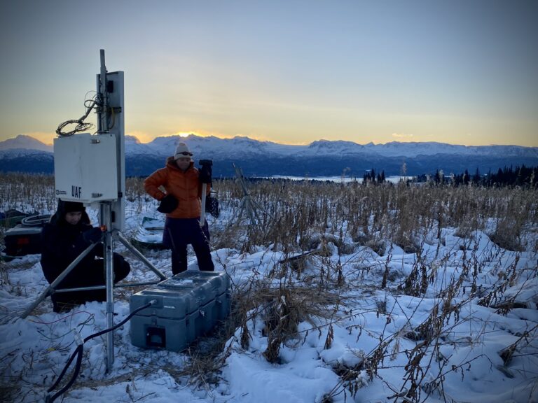
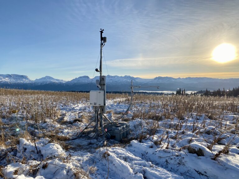
Caribou Hills South meteorological station installation.
photo by Anna Liljedahl
Site location: 59.85 N; -151.06 W (WGS1984)
Site name: Caribou Hills South
Research area
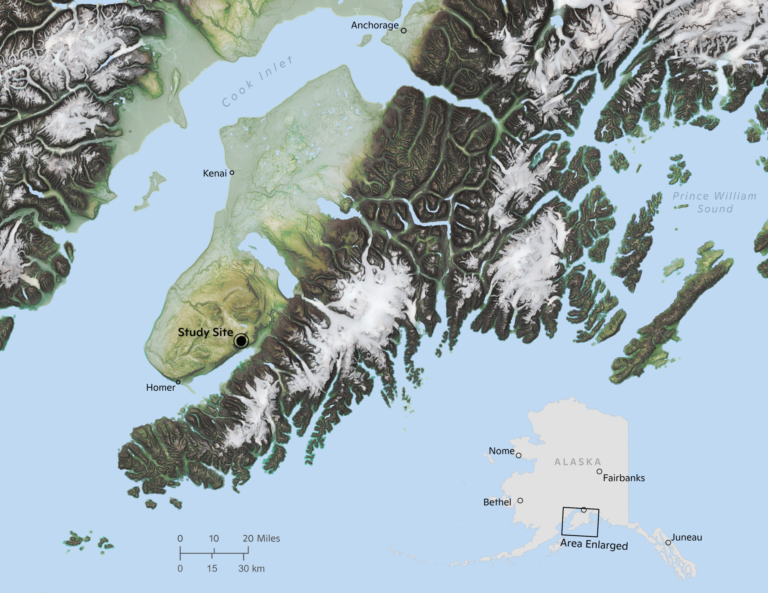
map by Greg Fiske
Description: This site is located on private land, 32 km (20 miles) NE of Homer, southern Kenai Peninsula, Alaska, on a natural grassland at ~1400 ft elevation (~425 m). The boreal forest in the Kenai Peninsula is transitioning to a grassland ecosystem due to changes in climate (drier and warmer) and bark spruce beetle attacks. This location has likely been a grassland since the last glaciation (~10,000 years ago). The Kenai Mountains in the background (south) reach up to 2000 m (~6000 ft) and when the weather is good you can see the Dixon and Portlock Glaciers.
The meteorological station was installed in late November 2022 to allow for the collection of baseline meteorological and soil data representing an ecosystem type that has not received much attention in Alaska. Further, the region around Homer experiences large temperature, wind, and precipitation gradients that are not well quantified. The data is updated every hour. The plots represent raw data, i.e. it is not quality controlled.
This data collection is made possible through a collaboration between the Water and Environmental Research Center at the University of Alaska Fairbanks and Woodwell Climate Research Center. If you would like to learn more, please contact Anna Liljedahl (aliljedahl@woodwellclimate.
Data graphs: ine.uaf.edu/werc/projects/woodwell/caribouhillssouth.aspx
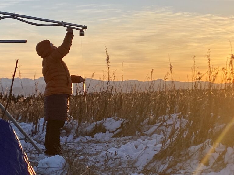
Caribou Hills South meteorological station installation, with assistance from Joel Bailey and Emily Youcha from University of Alaska Fairbanks. photo by Anna Liljedahl
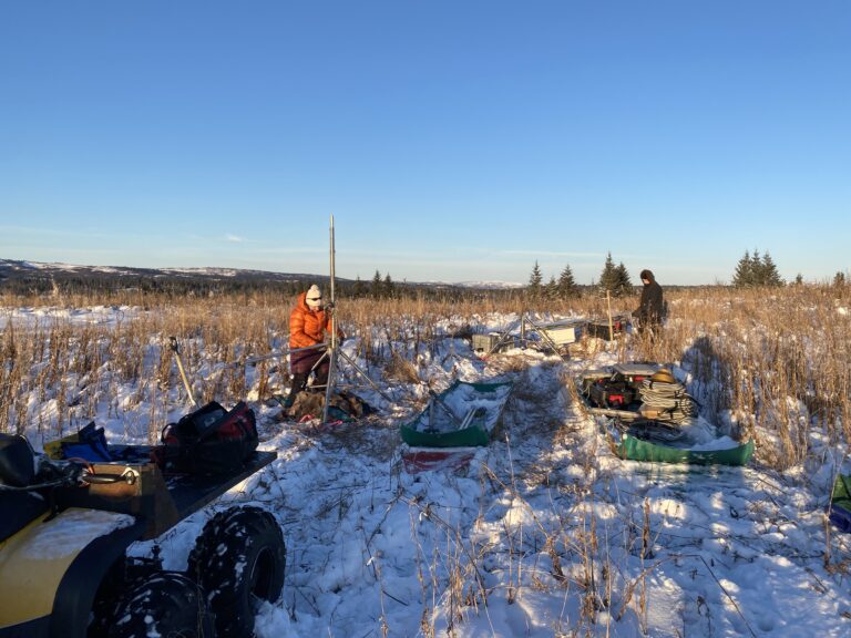
Caribou Hills South meteorological station installation, with assistance from Joel Bailey and Emily Youcha from University of Alaska Fairbanks. photo by Anna Liljedahl
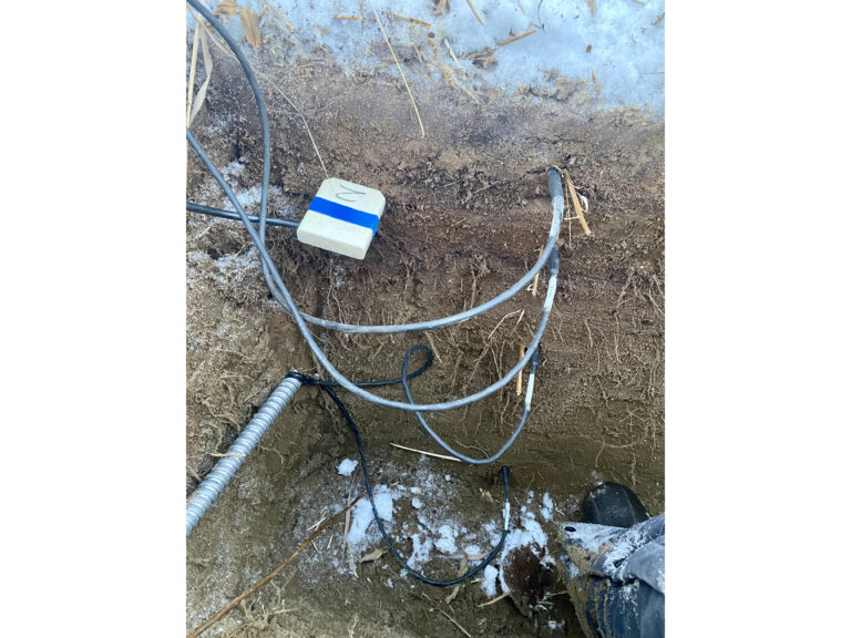
Caribou Hills South meteorological station installation, below groundlevel photo by Anna Liljedahl
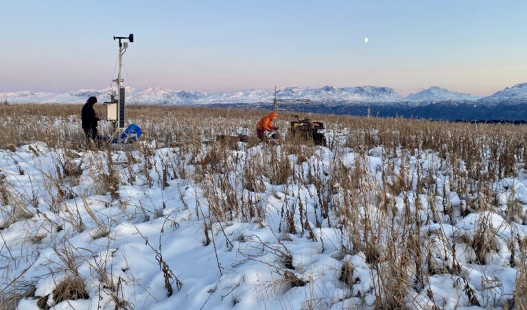
Emily Youcha, University of Alaska Fairbanks, measures the height of the sonic snow depth sensor on the Caribou Hills South meteorological station. photo by Anna Liljedahl
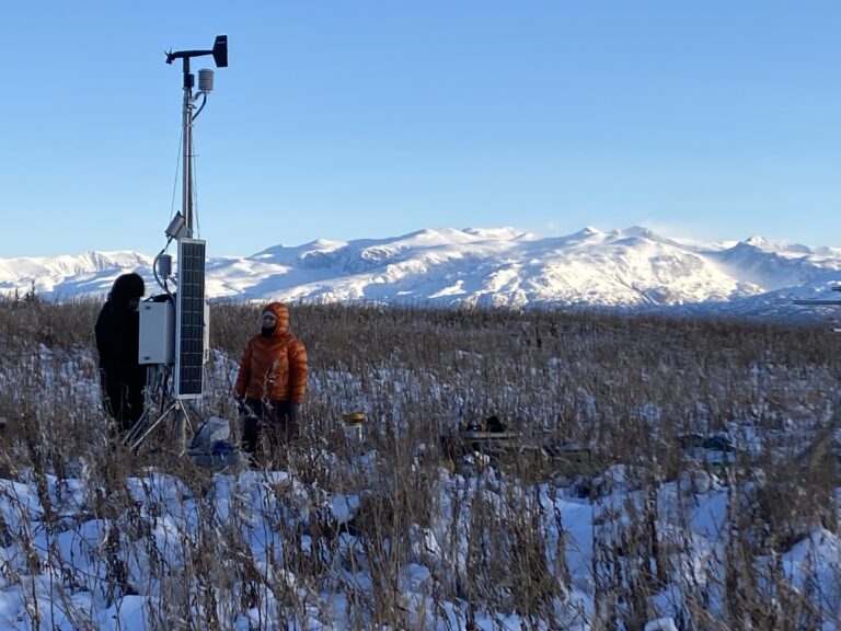
Caribou Hills South meteorological station installation, with assistance from Joel Bailey and Emily Youcha from University of Alaska Fairbanks. photo by Anna Liljedahl
Caribou Hills South meteorological station installation, with assistance from Joel Bailey and Emily Youcha from University of Alaska Fairbanks. photo by Anna Liljedahl
Caribou Hills South meteorological station installation, with assistance from Joel Bailey and Emily Youcha from University of Alaska Fairbanks. photo by Anna Liljedahl
Partners & Collaborators
