Climate change intersects with global security in multiple ways, including threatening infrastructure and exacerbating existing societal stressors and regional instabilities.
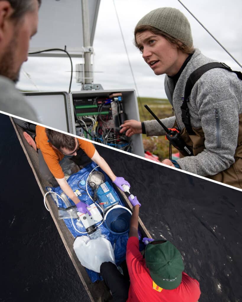
While climate change has been identified by policymakers as a critical national security issue, granular climate impacts are rarely included in security strategy. In 2020, Woodwell Climate’s Government Relations and Risk teams began to address this gap through a series of case studies that combined cutting edge climate risk assessments and security analysis.
Our Work and Impact
We quantify and map key climate risks that have the potential to aggravate existing instabilities and tensions in the future. Our team has also provided analysis of climate risk to military installations for Defense Department decision makers.
Our case studies focused on the China-India border region (storymap), the Arctic (storymap), and North Korea (storymap). Our team also produced storymaps (no case study) related to water security issues in Iran and Türkiye.
That work has developed into a broader climate security expertise and our experts continue to provide this analysis to senior policymakers in the U.S. Congress and at federal agencies.
If you would like to connect with us about this work, please contact External Affairs Manager Andrew Condia at acondia@woodwellclimate.org.
The research team uses Self-Organizing Maps (SOMs), an AI-based pattern recognition tool, to analyze the behavior of the stratospheric polar vortex. This research has two goals:
- Develop a more comprehensive way to identify different disruptions to the stratospheric polar vortex. Current research methods only identify disruptions that lead to a reversal of wind direction from westerly to easterly in a specific latitude, missing other types of disruptions. The team’s approach provides a new, more complete listing of disruptions to the stratospheric polar vortex.
- Assess the potential for using SOMs to further analyze triggers and impacts of disruptions in the stratospheric polar vortex.SOMs may be able to help researchers isolate what triggers disruptions to the stratospheric polar vortex, relate extreme winter weather events to those disruptions, and even evaluate how well global climate models simulate linkages between the troposphere and stratosphere.
This work is supported by Woodwell Climate’s Fund for Climate Solutions.
A growing body of research is examining disruptive and abrupt shifts in weather extremes. Contributing to this work, the research team has developed a novel method to identify so-called weather whiplash events.
The team defines a weather whiplash event as a long-lived (4 or more consecutive days), continental-scale pattern in the upper-level circulation of the atmosphere that shifts abruptly (over 1-3 days) to a substantially different pattern, bringing a stark end to persistent weather conditions throughout the region.
This definition eliminates the possibility of misidentifying sharp, localized weather changes caused by features like fronts, discrete disturbances like tropical storms, and changes in low-level winds (e.g., shifting from onshore to offshore or from downslope to upslope).
To identify weather whiplash events, the team is using an AI pattern recognition tool called Self-Organizing Maps (SOMs). Unlike methods used in previous studies, this new approach does not rely on measurements or simulations of precipitation or temperature, so it avoids uncertainties introduced by instrument error, local influences, and deficiencies in models.
This tool allows us to analyze real-world data to identify weather whiplash events in the past. Then, the team applies the same approach to modeled simulations of past weather to see how well those models capture whiplash events, and to future modeled projections to investigate how the frequency of weather whiplash events changes under different emissions scenarios.
The research team is currently applying this method to three large (120° longitude) sections of the northern hemisphere—the northeast Pacific Ocean/North America, the North Atlantic Ocean/Europe, and Asia.
This work is supported by Woodwell Climate’s Fund for Climate Solutions.
Vicious cycles—known as positive feedback loops—are amplifying global warming and causing high northern latitudes to warm four times faster than the globe as a whole. This rapid Arctic warming has decisively altered the speed and shape of the jet stream and with it, the behavior of weather patterns around the Northern Hemisphere.
In previous work, the research team established a link between episodes of Arctic warm anomalies and severe winter weather at locations in eastern North America using observational weather station data. Now, we are expanding this same methodology to examine both historical data and modeled future projections for all northern hemisphere areas, in both winter and summer.
This research will greatly expand our understanding of how amplified Arctic warming is statistically associated with extreme summer and winter weather conditions, and inform ongoing studies exploring these linkages.
This research is supported by the National Science Foundation.
From disruptive winter cold spells to hotter, drier summers, heavier downpours, and more damaging hurricanes—it’s clear climate change is driving extreme weather events, but how?
Weather patterns are becoming increasingly “stuck,” which can lead to extreme events such as prolonged heatwaves, drought, heavy rains, and even winter cold spells. The increasing occurrence of these extremes is just what scientists have expected to occur as humans continue to emit heat-trapping greenhouse gases faster than natural processes can remove them.
Our Work
Led by Dr. Jennifer Francis, this work centers a few key questions whose answers could help us better understand the connections between climate change and global weather, and how to take action:
- The Arctic has warmed 3 to 4 times faster than the globe as a whole. The resulting decrease in the temperature difference between the Arctic and temperate latitudes is weakening the west-to-east winds of the jet stream—the fast river of wind encircling the Northern Hemisphere at altitudes where jets fly and that creates and steers weather systems. How will this affect weather patterns, and especially extreme weather events in different places and seasons?
- How do natural oscillations (such as El Niño/La Niña) and climate-change-fueled oceanic heat waves affect the jet stream and the Arctic’s influence on weather patterns?
- Can the complex computer programs used to simulate the climate system (climate models) capture the Arctic/mid-latitude connections we observe in the real world?
- How does rapid Arctic warming affect the Stratospheric Polar Vortex and severe winter weather events?
Impact
Understanding how weather patterns are and may be affected by climate change is critical to analyzing climate risk. This research examines the hypothesis that rapid Arctic warming will cause weather regimes to become more persistent, which can lead to extreme events. Dr. Francis and other team members’ previous studies have also documented an increase in “whiplash” events—when one persistent weather regime is suddenly replaced by a different one, such as a drought being replaced by days of rain.
Solaris Education Program
The Solaris education program was created to develop the next generation of climate change scientists, journalists, and decision makers well versed in the challenges of the Tropics. These are the future leaders in tropical forest conservation and landscape resilience.
The Solaris Project provides training and support for individuals from a wide range of backgrounds to develop research expertise and/or policy-relevant skills they need to address the many significant conservation challenges in Brazil’s Amazon and Cerrado (savanna) regions. The project immerses Brazilian, US, and other international students in field research at Tanguro Research Station. It also exposes them to public policy through intensive policy development in Brasilia in direct collaboration with relevant governmental agencies. Approximately 200 students have taken part in this program during the last 15 years.
The Solaris program trains four distinct groups through tailored programs: Solaris Scholars, Solaris Fellows, Solaris Field Courses, and Solaris Communicators.
- Solaris Scholars are graduate students from American or Brazilian universities who pursue individual, academic projects. These students may complete a thesis, a dissertation, or research project.
- Solaris Fellows seek an education in policymaking pertaining to Brazil. They could be graduate students, post-docs, or professionals further along in their career who seek policy-related training.
- Solaris Field Courses are hands-on field experiences for undergraduates that introduce students to conservation-related issues with an emphasis on endangered Amazon forest and Cerrado.
- Solaris Communicators are reporters, writers, or members of the press who want to gain first-hand experience in deforestation and climate change impacts in the Amazon and Cerrado.
Watch the video below and keep scrolling to hear Solaris participants describing their experiences at Tanguro.