Winter oil & gas surveys in Arctic Refuge leave lasting scars
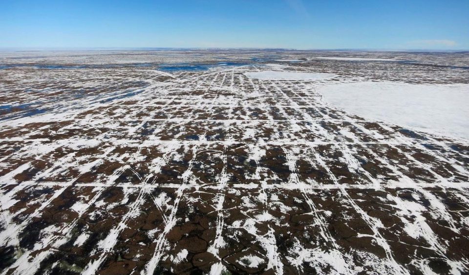
Tracks from oil & gas seismic survey vehices in the Arctic National Wildlife Refuge. Photo by Heather Buelow
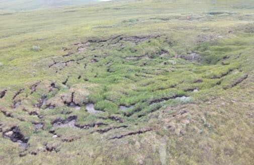
Vehicles and equipment used in winter-time seismic surveys for oil and gas drilling can leave long-lasting scars in the Arctic National Wildlife Refuge, raising questions about whether existing regulations are sufficient to protect the Refuge and the indigenous communities that rely on its wildlife, according to new research published in the journal Ecological Applications. Despite requirements that surveys only be made during times when the tundra has a protective minimum snow cover and freeze depth, harm continues to occur, with miles-long vehicle tracks, some dating back decades, remaining on the region’s landscape and vegetation.
“We need to understand how oil and gas development could permanently change the landscape of the Arctic National Wildlife Refuge, especially as the Arctic warms faster than anywhere else on Earth,” said Dr. Anna Liljedahl, Woodwell Climate Research Center (formerly Woods Hole Research Center) scientist and a co-author of the study.
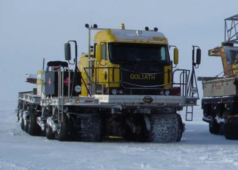
Seismic survey vehicle Photo courtesy of the Alaska Department of Natural Resources
The northern part of the refuge, 1.5 million acres known as the 1002 Area, is believed to contain oil and gas and has recently been opened to leasing. In preparation for leasing, BLM is considering a proposal for a wintertime 3D seismic survey that would create a grid of vehicle trails spaced 200 meters apart and totaling 63,000 kilometers in length.
One reason there hasn’t been sufficient scientific study of potential harms is that the U.S. Bureau of Land Management (BLM) hasn’t required it. When Congress passed legislation opening the Arctic National Wildlife Refuge to oil and gas drilling in 2017, BLM only required an environmental assessment–not a full environmental impact statement (EIS) under the National Environmental Policy Act (NEPA)–to evaluate and permit seismic exploration activities.
“Winter tundra travel hasn’t changed much since the ’80s,” said Dr. Martha Raynolds, lead author of the study and a researcher at the University of Alaska Fairbanks’ Institute of Arctic Biology. “The impacts are going to be as bad or worse, and there are proposing many, many more miles of trails.”
As a consequence of manmade climate change, the Arctic National Wildlife Refuge has already warmed by up to 3°C (5.4°F) since 1985, which could exacerbate impacts caused by seismic vehicles. Researchers found mechanical disturbances by seismic vehicles often disturb soil and plant cover, allowing solar radiation to thaw permafrost the following summer. Some impacts led to thermokarst, with thawing permafrost causing pits and troughs above degrading ice wedges. The Arctic National Wildlife Refuge’s terrain is hillier than areas to its west with long-time oil exploration such as Prudhoe Bay and the National Petroleum Reserve-Alaska. Extreme winds, low snow cover, the hilly terrain, and extreme ice-rich sediments leave the area vulnerable to damage by vehicle tracks. The area also has little surface water, a concern as oil and gas drilling requires a great deal of it.
Damage to the Arctic National Wildlife Refuge could threaten the habitat of local wildlife and the native communities that depend on them, as well as the scenic qualities of this area, which is considered one of the most biologically diverse areas in the Arctic, and one of the few remaining large intact ecosystems in the world. Caribou use the region for calving and are an important subsistence and cultural resource for Gwich’in, Iñupiaq, and Inuvialuit, but caribou shy away from any oil infrastructure. Polar bears use the coastal zone for fall feeding and for maternal denning and as sea ice has become thinner and more prone to fragmentation, there has been a landward shift in the distribution of polar bear dens. Denning density is particularly high in this region, partly due to the hilly terrain, which provides deep snow drifts for denning sites. Most birds in the area are migratory, with 157 species recorded in the area.
Among the data scientists say is needed:
- Studies of the impacts of 3D‐seismic exploration
- Better climate records for the Arctic National Wildlife Refuge, especially for wind and snow
- High‐resolution maps of topography, ground ice, hydrology, and vegetation
Support for this research was provided by the National Science Foundation, NASA Terrestrial Hydrology Program for snow research, and the U.S. Fish and Wildlife Service, which has supported 30 years of continued studies of the seismic trails in the Arctic National Wildlife Refuge.