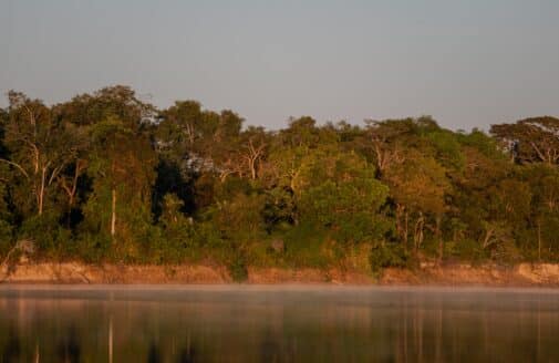
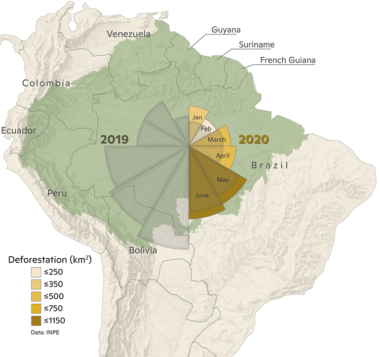
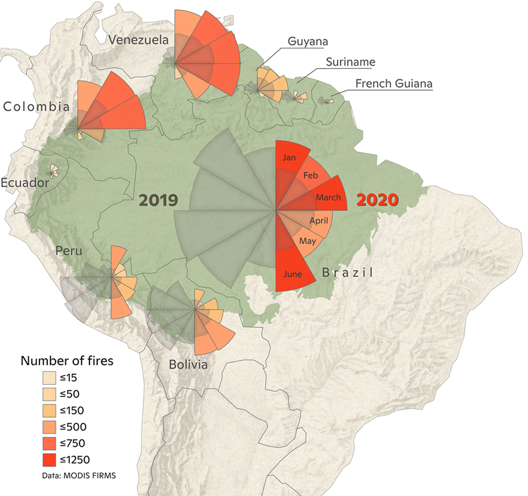
Analysis: 2020 Amazon deforestation up 20 percent over 2019
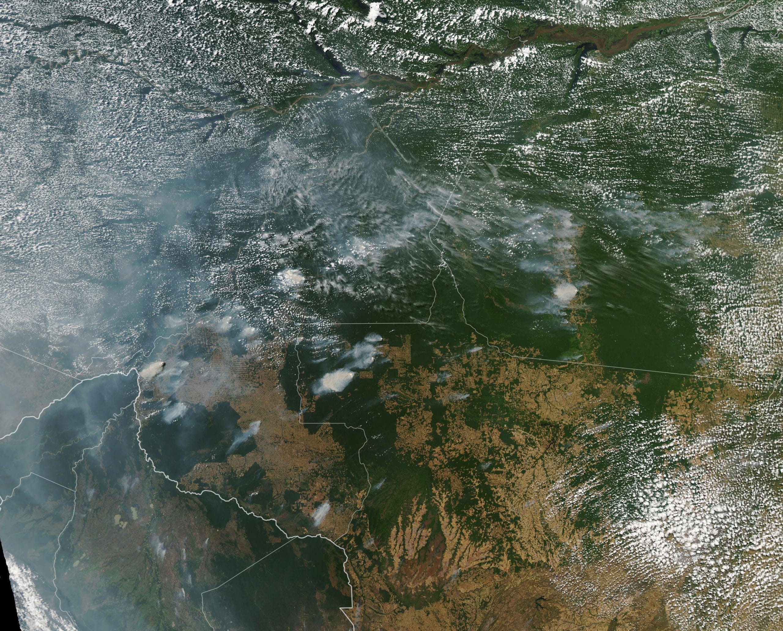
Deforestation in the Brazilian Amazon has risen 20% over the same point last year and is up significantly over the decade average, warns a new 2020 Amazon Deforestation and Fire Outlook from scientists at Woodwell Climate Research Center (formerly Woods Hole Research Center) and IPAM Amazônia. The loss of more than 3,300 square kilometers (nearly 1,300 square miles) of forest from January through June this year represents an area the size of Rhode Island. That means deforestation has committed at least 115 million metric tons of carbon to the atmosphere, equivalent to the annual emissions of 25 million vehicles, or the annual carbon emissions of the entire state of North Carolina. With parts of the Amazon now experiencing drought conditions, the data is an ominous sign for the fires, intentionally set to clear land for farming and ranching, that plague the region in August and September.
“Especially with drought numbers looking worse than in recent years, our concern is that fires could escape into neighboring forests, greatly compounding the harm of deforestation. Furthermore, when the Amazon burns it will not only create carbon emissions, but also intense air pollution that will exacerbate the public health crisis at a time when Brazil is seeing some of the worst rates of COVID-19 infection in the world,” said Dr. Ane Alencar, Director of Science at IPAM Amazônia.
Land clearing happens in two waves–first the trees are cut and left to dry, and then later they’re set on fire to remove the debris. Virtually all fires this year will be human-caused, as naturally-occurring Amazon fires are rare. This year, as in previous years, almost all of the deforestation is taking place on unprotected lands, including private properties and federal lands without a protected status. Protected natural areas and indigenous territories have seen little deforestation.
Maps by g_fiske
“This data points to a second consecutive year of rising deforestation and fires in the Brazilian Amazon, reversing what had been a decade-long trend of relatively low deforestation. We can look at this data and see where the deforestation is happening and the majority of it is illegal, people deforesting without permits on their land or stealing land from unprotected areas,” said Dr. Michael Coe, Tropics Program Director at Woodwell Climate Research Center.
“The Amazon is central to the future of mankind, helping to stabilize climate, maintain biodiversity, and provide home for indigenous people and food for a growing global population. All human beings and their interests should be focused on keeping this forest standing for future generations,” said André Guimarães, Executive Director of IPAM Amazônia.
IPAM Amazônia and Woodwell Climate have worked together closely for 25 years studying the Amazon, working with Indigenous communities, large farmers, and family farms to help sustain it, and examining the climatological and ecological benefits of avoiding deforestation and promoting sustainable agriculture. The Amazon has lost 800,000 square kilometers of forest over the past 60 years, an area equivalent to one-tenth of the contiguous United States, much of it to intentional burning to clear land for agriculture.