From New Zealand to New York, people and communities are moving to avoid climate disasters
In the face of floods, wildfires and other natural disasters, when should a community relocate to avoid potential harm?
This month’s Nature Quest is about that very question. Listener Molly Magid in New Zealand wanted to know if and how other communities have chosen the path of “managed retreat.” That’s the purposeful and coordinated movement of people and assets out of harm’s way.
Behind the levee: The forgotten communities at risk in Massachusetts
Catherine Gonzalez knows the water always wins.
She remembers being 5, riding on her father’s shoulders as he trudged through chest-high water to escape to higher ground in Santa Isabel, Puerto Rico. As Hurricane Hortense barreled through in September 1996, the river overflowed its banks, taking her home and belongings, but thankfully not her family. Others weren’t as fortunate. After 20 inches of rain, flash flooding, and mudslides, at least 18 people were dead.
In the wake of the devastation, Gonzalez and her family followed relatives to Chicopee, a town defined by its relationship to two rivers – the Chicopee and the Connecticut. A place less prone to hurricanes. A place that was supposed to be safe. But Gonzalez worries it brings dangers of its own.
Read more on The Boston Globe.
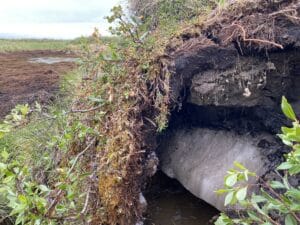
Permafrost thawed by climate change threatens remote villages in Alaska
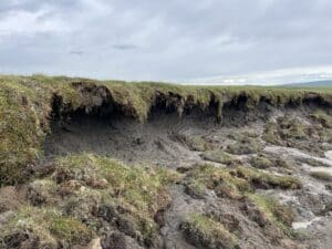
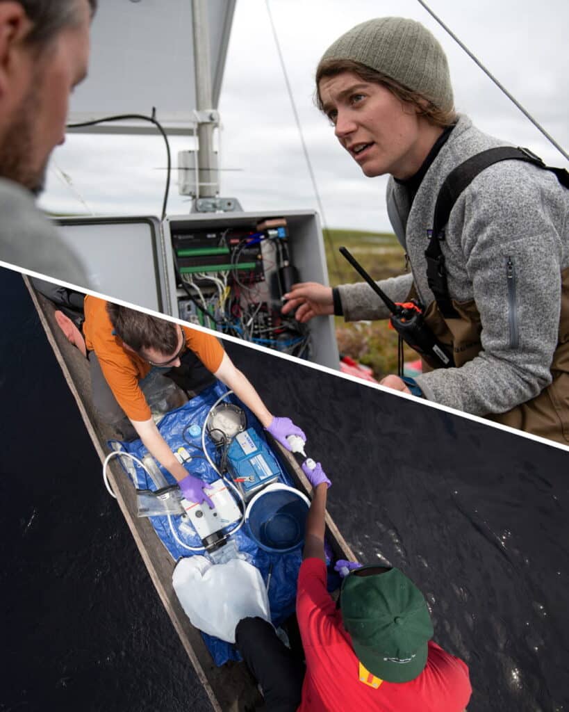
In the Arctic tundra of Alaska, climate change is forcing an Alaska Native village to relocate. Rising temperatures are melting the underground permafrost. The melted ice then mixes with the soil, creating unstable land the Yupʼik people call Alaskan quicksand. Amalia Huot-Marchand and a team from the Medill School of Journalism report.
To meet pledges to save forests spending must triple, U.N. report says
Four years after a global pledge to end deforestation, the amount of money going toward conserving and restoring forests is not enough, the analysis found.
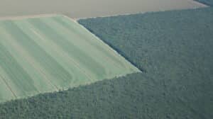
Nations are not spending enough to ensure that the forests that cover nearly a third of the planet remain healthy, according to a new United Nations report. To meet various international climate, biodiversity and land restoration goals, annual global spending needs to triple to $300 billion by 2030, the report found.
Forests are the “quintessential definition of a public good,” because of the benefits they provide, said Gabriel Labbate, who leads the climate mitigation unit at the U.N. Environmental Program and is one of the lead authors of the analysis.
Read more on The New York Times.
How can we help scientists tell their stories?
Science has a communication problem. This week on Possibly we’re taking a look at an audio-storytelling organization, called Transom, that’s trying to help fix it.
Welcome to Possibly. Where we take on huge problems, like the future of our planet, and break them down into small questions with unexpected answers. I’m Megan Hall.
Science has a communication problem. It can be hard for everyday people to understand what scientists are saying about their research..
Juliana Merullo and Nat Hardy are here to tell us about a science storytelling workshop trying to help solve this problem.
Read more or listen on Possibly.
Feeding Resilience: Ethiopia
Compound security, hunger, and climate risks
A Crossroads for Conflict, Food, and Climate
Ethiopia sits at the intersection of climate change, food security, and conflict risks that will shape the country’s internal stability, influence on East African security, and geopolitical role for years to come.
Huge danger from permafrost loss
With the Arctic warming four times as fast as the rest of the globe, and fires now routinely burning large swaths of northern forests, carbon stored in permafrost is rapidly escaping into the atmosphere where it can warm the planet even faster. Edward Alexander, Senior Arctic Lead at the Woodwell Climate Research Center and a Co-Chair of the Gwich’in Council International, speaks with Host Jenni Doering about the enormous climate risks of permafrost loss and how Indigenous cultural practices can help protect this vital resource.
It is now peak hurricane season: What to expect for storms in the Atlantic
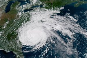
Don’t be fooled by the lack of tropical cyclones in the Atlantic Basin.
The peak of hurricane season is here, and activity could soon ramp up, despite the relative quiet currently occurring in the tropics, according to meteorologists.