Climate change likely to slow plant growth in northern hemisphere
While the higher temperatures and CO2 levels associated with climate change currently fuel plant productivity, a study finds that changing conditions could take a toll on photosynthesis rates in regions outside the Arctic within a decade.
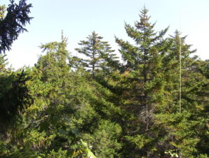
Plants are a highly effective carbon sink. Globally, forests absorb about 7.6 billion metric tons of carbon dioxide per year, about 1.5 times the annual emissions of the United States.
Since the 1980s, climate warming, prompted by rising levels of carbon dioxide and other greenhouse gasses in the atmosphere, has caused an increase in plant productivity in the Northern Hemisphere outside the tropics.
But new research published May 30 in Nature Climate Change estimates that summer warming in this region will begin to have the opposite effect within the next half-century, causing photosynthesis—or plant productivity—to decline. The global land carbon sink will likely take a hit as a result, the authors write.
Continue reading on The Scientist.
Climate risk assessment: New Orleans, Louisiana
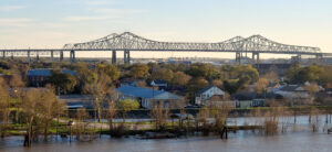
The impacts of climate change on the frequency and severity of physical hazards will put many communities
at risk. As the threat of climate change grows, so too does the need for accessible information, tools, and expertise to support climate-resilient decision making for municipalities. In the newly released report Recognizing Risk—Raising Climate Ambition, Woodwell Climate Research Center (“Woodwell”) highlights the need to localize and customize climate risk assessments. However, given that the private sector is meeting the majority of the need for climate data and analyses, communities without sufficient financial resources often do not have access to this information. To address this gap, Woodwell works with communities across the world, including New Orleans, LA, to provide municipal climate assessments, free of charge.
Results Summary
As a result of climate change, temperatures are set to increase in New Orleans. Extreme rainfall events will also become more frequent and sea levels will continue to rise, increasing future flood risk. The impacts associated with this increasing heat and precipitation will be felt differently across the city. Factors such as income, race, age, and availability of nearby greenspaces impact one’s capacity for resiliency during extreme heat and flooding events. Here we present findings on expected changes in maximum temperature, heat danger days, and extreme precipitation events paired with citywide income, race, and tree canopy data to help New Orleans create a more resilient future.
Government negotiates with Musk to monitor the Amazon (Governo negocia com Musk monitoramento da Amazônia)
Bolsonaro announces contract with Musk to monitor the region and says satellites will debunk “lies” about devastation (Bolsonaro anuncia contrato com Musk para monitoramento da região e diz que satélites derrubarão “mentiras” sobre devastação)
President Jair Bolsonaro (PL) and billionaire Elon Musk—owner of the companies SpaceX, Tesla and Starlink—announced yesterday in São Paulo the launch of a satellite internet program that aims to connect 19,000 schools in rural areas and promote “more technological” environmental monitoring in the Amazon. However, details of the agreement were not disclosed.
O presidente Jair Bolsonaro (PL) e o bilionário Elon Musk—dono das empresas SpaceX, Tesla e Starlink — anunciaram, ontem, em São Paulo, o lançamento de um programa de internet via satélite que pretende conectar 19 mil escolas em áreas rurais e promover um monitoramento ambiental “mais tecnológico” na Amazônia. Não foram divulgados, porém, detalhes do acordo.
Read more on Correio Braziliense.
New global study identifies opportunities for increasing carbon storage on land to mitigate climate change

A new study, “The Global Potential for Increased Storage of Carbon on Land,” published today in Proceedings of the National Academy of Sciences (PNAS), provides a series of geospatial maps that improve our understanding of the global gap between current and potential carbon storage on land, and offers a framework for action to realize the full potential of land-based carbon storage as a natural climate solution. The study is timely, coming on the heels of the Intergovernmental Panel on Climate Change (IPCC)’s Working Group III’s latest report, which focuses on the urgent need to reduce carbon emissions in order to limit future warming, and highlights the significant mitigation potential of natural and managed ecosystems given the opportunity they offer to remove additional carbon from the atmosphere.
India’s record-setting heat wave in pictures

India has been suffering under record-breaking heat for the last couple months.
Last month was the third-hottest April the country has seen over the past 122 years, from 1901 to 2022, according to government officials.
See more of the story on CNBC.
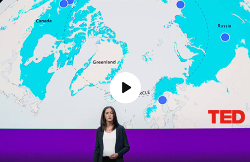
Sue Natali: How ancient Arctic carbon threatens everyone on the planet
What will happen to the planet if climate change melts what’s left of Arctic permafrost? Shedding light on this overlooked threat, Arctic geologist Sue Natali reveals the true danger of heating up the iciest place on the planet: the release of ancient carbon that will dramatically worsen our climate problems. In this urgent talk, she introduces a new initiative, Permafrost Pathways, and their work to measure permafrost carbon emissions, fuse Indigenous solutions with modern technologies and protect the rights of Arctic residents. (This ambitious plan is a part of the Audacious Project, TED’s initiative to inspire and fund global change.)
