Despite thorough preparations, flying the drone is still nervewracking.
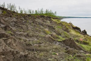
Dr. Manoela Machado, a Research Scientist at Woodwell Climate, has double- and triple- checked her calculated flight path over a study plot in the Cerrado, Brazil’s natural savanna. The drone can essentially fly itself, and she’ll be monitoring its speed, altitude, and battery life from her handheld controller on the ground, but many things could still go wrong. High winds, an unforeseen obstruction, loss of connectivity— all could jeopardize the mission, potentially dropping the expensive equipment 40 meters into the woodland canopy below.
Aboard Machado’s drone sits a powerful piece of technology – a LiDAR sensor. Developed originally for use in meteorology, this remote sensing technique now has widespread applications across scientific fields, from archaeology, to urban planning, to climate science. At Woodwell Climate, Machado and others employ LiDAR to create detailed three dimensional models of landscapes, which provide valuable insight into the structure of ecosystems and the amount of carbon stored in them— all with just a few (million) pulses of light.
What is LiDAR?
LiDAR stands for Light Detection and Ranging. Put simply, it is a sensor that uses laser light to measure distance.
Similar to other technologies like sonar and radar, which use sound and radio waves, respectively, LiDAR is an example of an “active” sensor. “Passive” sensors like cameras collect ambient light, while LiDAR actively pings the environment with beams of laser light and records the time those beams take to bounce back. The longer the return time, the further away an object is. That distance measurement is then used to calculate the precise location in three-dimensional space for each reflection.
This process is repeated millions of times during a single scan, resulting in a dense cloud of point locations. With some advanced computing, the data can be assembled into a 3D picture of the landscape.
“It’s effectively three dimensional pointillism,” says Woodwell Climate Chief Scientific Officer, Dr. Wayne Walker, who has been using LiDAR in his studies for 25 years.
Far more detailed than an oil painting however, a LiDAR model can reconstruct nearly every leaf, twig, and anthill on a landscape.
“Once you construct that cloud of millions of points, you get to walk inside the forest again,” says Machado. “When you finish processing the data and see the cloud you go, ‘I remember that tree! I remember standing there!’ It’s mesmerizing.”
For a project like Machado’s, scanning a few dozen hectares, the sensor is usually placed on a drone. Larger study areas require sensors mounted on low-flying airplanes or even satellites, but for small ground-based applications there are sensors one can carry, mount on a tripod, or attach to a backpack. Some newer phone models even have LIDAR apps built in. Regardless of how LIDAR is deployed, it remains a straightforward method of data collection. Just point the sensor at what you want to scan and within minutes, you’ve captured the data for a detailed three-dimensional model of your area of interest.
Estimating the weight of a forest
What Machado and Walker are often after from a LiDAR scan is a measurement of biomass, or the total weight of the organic matter present in an ecosystem. Plants store carbon in the form of organic matter, so biomass measurements are an easy way to estimate an area’s carbon storage.
However, measuring a forest’s biomass directly would require cutting down all the trees, drying them out, and weighing what’s left — impractical and needlessly destructive— so scientists use proxy measurements. Walker likens the process to trying to estimate the weight of a human without access to a scale.
“What are the measurements you might use if you couldn’t actually physically measure weight? You might record height, waist size, inseam, and if you obtain enough of these measurements you can start to build a model that relates them to weight,” says Walker. “That’s what we’re trying to do when we estimate the biomass of an entire forest.”
Raw LiDAR data is only a measurement of distance, but by classifying each point based on its location relative to the cloud, researchers are able to extract the proxy measurements needed to model biomass across the ecosystem. Before LiDAR, these proxy measurements— things like trunk diameter, height, and tree species— had to be recorded entirely by hand, which limits data collection based on human time and resources. The time-saving addition of LiDAR has vastly expanded the possible scale of study plots. While field measurements are still essential to calibrate models, LiDAR is one of the only technologies that can give scientists enough detail and scope to assess carbon stocks over entire ecosystems.
“There is no other kind of sensor that even comes close to LiDAR,” says Walker.
The power and potential of LiDAR
At Woodwell Climate, researchers have employed the power of LiDAR to map biomass and carbon from Brazilian forests, to the Arctic tundra. Outside of the Center, the technology has found applications in archaeological surveys, lane detection for self-driving cars, and topographical mapping down to a resolution of half a meter.
But the detail that makes LiDAR so powerful can also make the data a challenge to work with. A single scan produces millions of data points. According to Geospatial Analyst and Research Associate, Emily Sturdivant, who analyzed LiDAR data for Woodwell’s Climate Smart Martha’s Vineyard project, that wealth of data often overwhelms our ability to extract the full potential of information available in one point cloud.
“LiDAR creates so much data that when you look at it, it’s hard not to be blown away imagining all the different things you could do with it. But then reality kicks in,” says Sturdivant. “It’s challenging to take full advantage of all those points with our current processing power. It’s a matter of the analysis technology catching up with the data.”
Processing LiDAR data requires large amounts of computing time and storage space, especially when performing more complex analyses like segmenting the data on the scale of individual trees. As machine learning and cloud computing technologies advance however, this becomes less of an obstacle, and the potential insights from LiDAR datasets will advance along with them.
LiDAR can be an expensive endeavor, too. Drones with the right equipment can cost tens of thousands of dollars, as can hiring a plane and pilot and paying for jet fuel, so data sharing has been important in making the method more cost effective. U.S. government agencies like NASA and the USGS have facilitated the collection of LiDAR data through satellites and plane flights, making the data available for public use. Woodwell Climate research has benefitted from these public datasets, using them to inform landscape studies and carbon flux models.
According to Sturdivant, the reliable production of public data has been greatly beneficial to advancing LiDAR-based studies, though it now faces risks from federal cuts to science agency funding.
“One of the greatest advantages of having publicly supported data is the consistency, but that’s exactly what’s now at risk,” says Sturdivant. “Public accessibility has been so important in allowing new scientists to learn and experiment and then help everyone else learn.”
Each new LiDAR scan represents a trove of information that could be used to better understand our changing planet, making it critical to continue supporting and collecting LiDAR data. Its intensely visual and highly detailed nature has made it one of the most powerful tools we have for understanding something as complex as a forest.
“And on top of that,” says Machado “It’s just visually beautiful.”
Update: How’s U.S. winter weather changing in a warming world?
Cold extremes are indeed waning over most of the midlatitude Northern Hemisphere, but a decade-plus debate on the Arctic’s role continues.
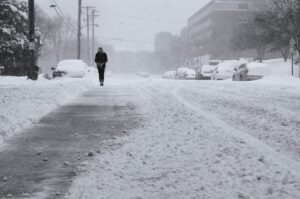
When a full-fledged snowstorm descended on the U.S. Gulf Coast in mid-January 2025, followed by a night of unprecedented cold across some bayous and beaches (see Part I of this two-part post), it did more than turn New Orleans and Mobile into winter wonderlands. It reignited a topic that’s cropped up again and again across science and media landscapes since the early 2010s: Is a warming Arctic affecting winter extremes over North America and Eurasia? And if so, how?
Read more on Yale Climate Connections.
The current state of the Arctic carbon cycle
New study on the Arctic carbon cycle provides important insights and highlights research needs
The Arctic plays a central role in the global climate system, particularly through its function as a carbon sink. However, climate change could disrupt its balance. An international research team headed by the Alfred Wegener Institute and the Vrije Universiteit Amsterdam has presented a comprehensive analysis of the current state of the Arctic carbon cycle. The results, which have been published in the scientific journal Nature Reviews Earth & Environment, provide new and updated numbers and highlight existing uncertainties.
Read more on The Max Planck Institute for Biogeochemistry website.
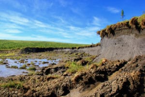
Scientists look to keep NWT’s huge carbon stores out of the air
Cutting human-driven greenhouse gas emissions is already proving tough in the North. Now, attention is turning to carbon within the land itself – an emissions problem that also needs solving and which could be hugely damaging.
Governments across Canada and the world have spent years trying to bring down the emissions we put out through our use of fossil fuels.
Yet targets are being missed and our world is still warming. As it does that, the likelihood increases that massive stores of carbon contained within our landscape will start to emerge into the air, making the overall problem worse.
Next week, scientists will gather in the Northwest Territories to talk about that.
Continue reading on Cabin Radio.
January 2025 was warmest on record as climate change ‘overwhelms’ La Niña’s cooling

January 2025 was the warmest January on record, surpassing the previous record set by January 2024, according to satellite data from the EU’s Copernicus program. The findings were unexpected as ongoing La Niña conditions in the Pacific typically cool down global temperatures.
The global average surface air temperature for the month reached 1.75° Celsius (3.15° F) above pre-industrial levels. The most dramatic variation, up to 6°C (10.8°F), was concentrated in northern Canada, Russia and the Scandinavian countries.
Warmth is weakening the polar vortex. Here’s what it means for extreme cold.
Research has found that rising temperatures in the Arctic are weakening weather systems that normally trap the cold around the poles, making winter weather more chaotic.
The blast of cold that fueled record snowfall across Gulf Coast beaches last week was just the latest to transport frigid air that normally swirls above the North Pole to places much farther south — a phenomenon that researchers connect to a warming climate.
While scientists say that there is not evidence that extreme cold is becoming more frequent or intense, a growing body of research is finding that rising temperatures in the Arctic are weakening weather systems that normally trap the cold around the poles, making winter weather more chaotic. This shift is encouraging the erratic weather patterns high in the atmosphere that can cast chills even on regions with typically balmy climates, some research suggests, threatening to overwhelm communities not prepared for such frigid conditions.
Continue reading on The Washington Post.
Sobering news for the North
Science columnist Torah Kachur says new research indicates the Canadian North is not as effective a carbon sink as once thought.
