Alaska firefighters experiment with targeting blazes to save carbon
The Bureau of Land Management pilot program represents a shift designed to help curb climate change
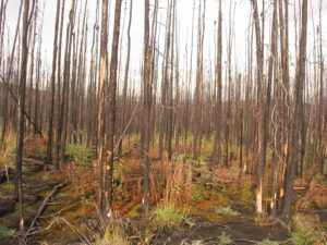
Firefighters are embarking on an ambitious experiment to stamp out blazes deep in the Alaskan wilderness as a way to avert carbon emissions in what experts say is a seismic shift in thinking in modern wildfire management that has traditionally focused only on fires that threaten human life, property or commercial interests.
Read more on The Washington Post.
It didn’t matter that she didn’t speak any English at the time, or that the American researchers who had chartered her father’s boat that summer didn’t speak any Russian, 14 year-old Anya Suslova was a quick learner. She watched them dip sample bottles into the Lena River, filter the water, and mark information down on the side of the bottle. By the end of the two week research expedition, Suslova had mastered the protocol and was helping Dr. Max Holmes and his fellow scientists collect water samples.
When the scientists returned to the United States, they left behind some equipment, in case Suslova and her father were interested in sampling throughout the winter. After a year without contact with Suslova, the researchers were delighted to return to the Lena the following summer to find months of samples and a neatly organized logbook she made.
Twenty years later, Suslova is a Research Assistant at Woodwell Climate Research Center who continues to bring her expertise and unique perspective to the Arctic Great Rivers Observatory (ArcticGRO). Since 2003, participants of ArcticGRO—scientists and Arctic community members alike—have been sampling water from the six largest rivers in the Arctic: the Ob’, Yenisey, Lena, and Kolyma in Siberia, and the Yukon and Mackenzie in North America. It’s a rare example of a long-term research project, designed to span decades, deepening our understanding of change across the years.
We need to establish baselines
The Arctic is warming, on average, at least two times faster than the rest of the planet. We need to know the implications of this, but it can be difficult to study ecosystem change across such a vast area. Rivers can offer insights. The chemistry of a river connects environmental processes across its watershed, and the dissolved and particulate materials that are carried to the ocean can influence marine chemistry and biology. Measuring the concentrations of these materials, and how they are transported by rivers, provides vital information about changes in the linkages between terrestrial and aquatic ecosystems.
“Global climate change is rapidly and disproportionately affecting northern high latitude environments,” says Dr. Scott Zolkos, a Research Scientist at Woodwell Climate and one of ArcticGRO’s lead scientists. “Monitoring Arctic river chemistry is critical for detecting trends and understanding the effects of environmental change on northern ecosystems.”
In order to uncover those trends and effects, need to establish baselines on the key chemical constituents within rivers — organic matter, inorganic nutrients like nitrogen, sediments— to compare against future measurements. The more data gathered, the easier it is to sift out annual variability from longer term trends.
So, using Arctic rivers as sentinels of ecosystem health and environmental change was the idea behind the project’s creation, but it was the international collaboration that started with Suslova that gave ArcticGRO its longevity. The project leaders realized that enlisting the help of trained local residents could allow for sample collection in places, and during times of the year, that the researchers themselves couldn’t access. It also helped build enthusiasm for the project among Arctic communities.
“I believe that ArcticGRO has been able to go for so long because it is built on trust and a shared goal between scientists and local people who collect water samples,” says Suslova. “Amazingly the team of ArcticGRO hasn’t changed much over the last two decades, many of the original members are still involved. It feels like a family.”
Now, 20 years after its inception, the ArcticGRO team has published a paper in Nature Geoscience on long-term trends in pan-Arctic river chemistry. The team found strong signals of environmental change for some chemical constituents, but not in others. Alkalinity, which reflects rock weathering, increased in all rivers, while nitrate, an important nutrient for terrestrial and aquatic organisms, decreased. The authors hope the data and insights from this work will be invaluable to scientists refining models of the Arctic system.
“There’s nothing quite like ArcticGRO,” says Dr. Zolkos. “It’s unique in that it measures a comprehensive suite of chemical parameters across the Arctic’s largest rivers, uses consistent sampling and analytical methods across the rivers, and sampling occurs at the same times and locations. The consistency of ArcticGRO is increasingly valuable, because it is building a dataset which allows scientists around the world to detect, monitor, and understand northern environmental change in ways that no other scientific program does.”
We never would have known
A few thousand miles south of the Arctic circle, on the marshy coastline of Massachusetts, another long-term ecological research project has entered its third decade as well. The brainchild of Senior Scientist Dr. Linda Deegan, the TIDE project is unique even among long-term studies. Rather than simply monitoring the nutrient flows in the salt marshes of Plum Island Estuary, the TIDE project has been altering nutrients in carefully controlled amounts to understand the long term impacts of human development in coastal ecosystems.
TIDE focuses on nitrogen, an element of most fertilizers and a common pollutant from developed areas in the uplands. Previous studies of nitrogen impacts indicated coastal marsh plants could absorb a lot of nitrogen with no ill effects. But that dynamic was only examined on short time scales, and in small plots of marsh. Whether there were changes that might require many years or many acres to be detected, was unknown.
Thus TIDE was designed to increase nitrogen concentrations in the water to mimic coastal eutrophication across three marshes in the Plum Island estuary and document which effects might cascade through the system. The initial grant was for five years, but Dr. Deegan and her collaborators wanted to keep the project running for at least a decade, if not more, expecting the changes might be slow to reveal themselves.
After years of observations, Dr. Deegan says she remembers the exact moment they discovered a significant change.
“Several of the senior scientists—myself included—came back at the end of a long field day each of them saying, ‘I don’t remember it being this hard to walk through the nutrient enriched marsh when we started this project. Am I just getting older or has something changed?’ And then one of the new students said, ‘I thought that marsh was always like that—well, it’s not like that in the other sites where we haven’t added nitrogen.’”
So they followed the hunch, made some new measurements, and found the structure of the marsh had changed significantly with the added nitrogen. The plants, suddenly awash in a necessary component for growth, no longer needed to dedicate their energy to making roots to seek out nutrients; their root systems were shallower and less dense, thus less capable of holding the marsh together. At the same time, nitrogen-consuming microbes were breaking down organic matter in search of carbon to fuel the chemical processes that allow them to take up nitrogen. This combination made the marsh creek edges more susceptible to erosion by tides and storms.
It took more years than most experiments are run for, but increased susceptibility to erosion steadily altered the shape of stream channels. The ground along the edges of the streams, previously held in place by a deep network of roots, now collapsed underfoot. Chunks of marsh fell off the edges as the roots no longer held the marsh together. As the years went on, fish and other organisms that travel along stream floors to seek out food began to suffer from difficult terrain, resulting in slower growth and fewer fish.
These findings, published in Nature, upended the way people thought about the effects of eutrophication on marshes. “And we never would have known any of that,” says Dr. Deegan. “If we hadn’t done the project at an ecosystem scale and over such a long time.”
A pipe you can turn off
Over the decades, the TIDE project not only faced the challenges of running a consistent project for so long, but also of justifying making intentional changes to an otherwise healthy ecosystem. The question lingered: If the goal is to protect ecosystems from human disruption, what do we gain from knowingly tinkering with them?
Humans have already accidentally conducted thousands of ecological change experiments across the globe. Casually inflicted pollution, deforestation, or extinction with no control group, no careful observations, no time limits or safeguards—by scientific standards these are reckless and poorly designed experiments.
In Dr. Deegan’s mind, this makes controlled studies like TIDE even more significant.
“We need to know the true impact of the changes that we are already imposing on the environment. And once we do, we need to be able to halt those changes that threaten the integrity of an ecosystem.” Says Dr. Deegan. “This is a pipe I can easily turn off. Not like when you build a housing development and then you’re stuck with all those houses and their impacts forever.”
Climate change is perhaps the most all-encompassing of these involuntary experiments. As ArcticGRO’s and TIDEs results indicate, ecosystem responses to human disturbance, whether it is climate warming or nutrient over enrichment, are complex. Understanding and adapting to these responses will depend on continued monitoring, observation and experimentation.
A testament to the people
In the world of research, rife with limited grants and time-bound fellowships, ArcticGRO and TIDE have been uniquely successful. Research Associate, Hillary Sullivan, who has been part of the TIDE project since 2012, attributes this to the dedication of the researchers, who showed up year after year to get the research done even when funding wasn’t certain or while enduring a global pandemic.
“These large scale projects are a testament to the people that are involved in the effort, and the work that goes in behind the scenes to keep it running,” says Sullivan.
Both ArcticGRO and TIDE plan to continue. ArcticGRO is seeking additional funding to analyze new chemical constituents and continue providing invaluable data for scientists and educators to understand how rivers are responding to a warming climate. “ArcticGRO has improved our understanding of the Arctic, and our work is just getting started,” says Dr. Zolkos. “Continuing will be essential for generating new insights on climate change, northern ecosystems, and societal implications.”
TIDE has now shifted to a new phase of study — observing the legacy of the added nitrogen on marsh recovery in the face of climate change induced sea level rise. Nitrogen additions were halted 6 years ago and researchers hope to gain insights into marsh restoration and ways to improve their resilience to sea level rise.
Thinking in the long-term is not something humans have historically excelled at, Dr. Deegan admits. But the more we try to expand our curiosity past immediate cause and effect, the better we get at understanding nature. If you want to understand an ecosystem, you have to think like an ecosystem—which means longer time scales and larger areas that encompass every aspect of the system.
“Nature tends to take the long view and people tend to take the short,” says Dr. Deegan. “So if you can stick with it for the long view, I think you see things in a very different way.”
Putting the emphasis on the local level to address climate change

Jobs Neck, Martha’s Vineyard, MA
With effects of climate change becoming more apparent in recent years, an ever-growing body of research has emerged to quantify, understand, model and predict the risks associated with the phenomenon.
But within that field, said Woodwell Climate Research Center climate risk director Christopher Schwalm, the focus has always been on global climatic trends.
Continue reading on The Vineyard Gazette.
As climate warming drives more extreme weather, ‘everything we care about is on the line’
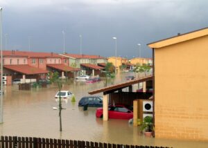
The extreme weather this year has been relentless. Currently, a heat dome over the southeastern United States is sending temperatures well above 100°F, more than 1,000 fires are actively burning across Canada, and some 100,000 people in Pakistan have been evacuated after a river overflowed and sent up to six feet of water across roadways.
Meanwhile, hurricane season is just ramping up, ocean temperatures are at record highs, and parts of Greenland’s ice sheet are melting at a record pace.
This is life on planet Earth that is roughly 2°F warmer than preindustrial times. Even for climate scientists who have long warned this was coming, the onslaught of crises has been nothing short of shocking.
Read more on The Boston Globe.
Arctic wetlands are known emitters of the strong greenhouse gas methane. Well-drained soils, on the other hand, remove methane from the atmosphere. In the Arctic and boreal biomes, well-drained upland soils cover more than 80% of the land area, but their potential importance for drawing methane from the atmosphere—the underlying mechanisms, environmental controls and even the magnitude of methane uptake—have not been well understood.
A recent study led by researchers from the University of Eastern Finland and University of Montreal, in collaboration with Woodwell Climate Research Scientist, Dr. Anna Virkkala, has expanded our understanding of these dynamics, finding that Arctic soil methane uptake may be larger than previously thought. The results show uptake increasing under dry conditions and with availability of a type of soil organic carbon that can be used in microbial uptake processes.
The study was primarily conducted at Trail Valley Creek, a tundra site in the Western Canadian Arctic. The authors used a unique experimental set-up consisting of 18 automated chambers for continuous measurements of methane fluxes. No other automated chamber system exists this far North in the Canadian Arctic, and only few exist above the Arctic circle globally, most of which are installed at methane-emitting sites.
The high-resolution measurements of methane uptake (more than 40,000 flux measurements) revealed previously unknown daily and seasonal dynamics: while methane uptake in early and peak summer was largest during the afternoons, coinciding with maximum soil temperature, uptake during late summer peaked during the night. The study shows that the strongest methane uptake coincided with peaks of ecosystem carbon dioxide respiration—meaning that as methane is removed from the atmosphere, carbon dioxide production in the soil is high. Complementing flux measurements at Trail Valley Creek with measurements at other sites spread across the Canadian and Finnish Arctic showed that the availability of soil organic carbon and other nutrients may promote methane consumption in Arctic soils.
“The methane cycle has previously been primarily studied in wetlands because of their high methane emissions, but this study shows that drier ecosystems are also very important in the methane cycle,” says Dr. Virkkala.
These findings are highly relevant for estimating the current Arctic carbon budget, and for predicting the future response of Arctic soil methane uptake to a changing climate. According to the study, high-latitude warming itself, occurring up to four times faster in the Arctic than the rest of the world, will promote atmospheric methane uptake to a lesser extent than the associated large-scale drying.
“The Arctic methane budget has remained highly uncertain,” remarks the paper’s lead author, Dr. Carolina Voigt. “Our research provides one potential mechanism that might explain those uncertainties, and highlights the importance of methane measurements in drier ecosystems to calculate more accurate methane budgets.”
Climate change is having profound effects on the chemical composition of large Arctic rivers, signaling changes both on land and in the coastal ocean, according to new international research examining chemical signatures in rivers across Canada, Alaska and Russia.
The study, the result of a two-decade effort by the Arctic Great Rivers Observatory, analyzed nearly twenty years of water chemistry and discharge data collected from six rivers that comprise 60 percent of the Arctic Ocean watershed.
The researchers tracked river water ions, key nutrients, and dissolved organic carbon, among other indicators. They found that chemical concentrations changed substantially over the past two decades, but trends across chemical groups were different, with some increasing, some decreasing, and others showing little change.
The international scientific collaboration tracked river water ions, key nutrients and dissolved organic carbon among other metrics. Chemical concentrations changed substantially over the past two decades, but trends across chemical groups were different with some increasing, some decreasing, and some showing little change.
“The only way that this divergence in trends is possible is if multiple factors of change are being brought to bear on the Arctic system at the same time,” says Woodwell Research Assistant, Anya Suslova and co-author on the paper. “We know that permafrost is thawing, vegetation is changing and moving northward, and processing of nutrients and organic matter may be happening more quickly. Global climate change appears to be causing many systems that are critical for ecosystem function to change at the same time—and that change is showing up in the chemical composition of river water.”
Key nutrients observed in river water are declining, according to the study. This trend suggests warming temperatures are increasing biological uptake of nutrients on land or in aquatic ecosystems, leading to an overall decrease despite factors like wildfire and permafrost thaw releasing more nutrients into the waterways.
ArcticGRO represents a partnership between researchers at Woodwell Climate Research Center, University of Alberta, the Marine Biological Laboratory, Florida State University, and the University of New Hampshire, as well as scientific and community collaborators in Siberia and the North American Arctic.
“The success of this study is largely due to its collaborative nature,” says Dr. Max Holmes, Woodwell Climate President and CEO, and founder of the ArcticGRO project. “Without the dedication of scientists and community members across the Arctic, we never would have been able to generate the comprehensive dataset that allowed us to uncover these insights.”
Because trends in river water chemistry are not always acting in the same direction, Dr. Holmes and Suslova say the study will help give scientists a blueprint for thinking about how Arctic change will play out.
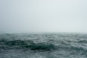
Is Earth’s largest heat transfer really shutting down?
With unprecedented heat waves and record-breaking global temperatures, it’s hard to believe that there might be a place on earth that has actually COOLED since the industrial revolution. But, it turns out, there is such a spot. The COLD BLOB off of Greenland mystified scientists for years, but new studies have uncovered a scary reality – this cool patch might be a warning of the impending collapse of a vital earth circulation system. And the consequences would be dire. In this episode of Weathered, we travel to the Gulf Stream with the new PBS Terra show Sharks Unknown to experience the AMOC first hand. And we ask, what is the likelihood that the AMOC will collapse, and what would the consequences be?
