photo by Heather Goldstone
To date, our team has completed five climate security case study reports. Short summaries are provided below, with links to the full reports and storymaps.
Click the links below to jump to:
China-India border region / the Arctic / North Korea / Iran / Türkiye / Ethiopia
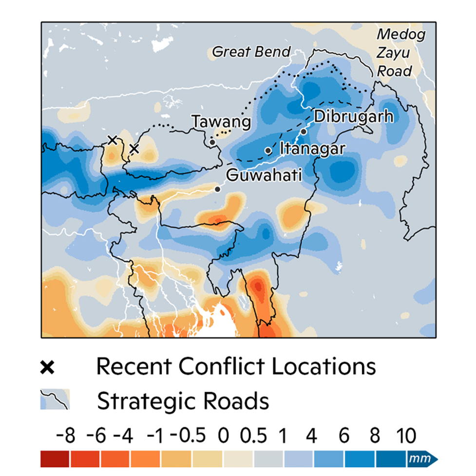 Maps of the difference in daily 99th percentile precipitation from 2010 to 2040 due to climate change. Darker blue areas indicate locations more likely to experience extreme rainfall. Map by Carl Churchill.
China-India border region
The first case study investigates climate impacts on the longstanding India-China rivalry: both countries are major nuclear weapons powers and are highly vulnerable to climate change.
The study found that climate change, driven by extreme warming, will enhance material as well as perceptual risks between the rivals by 2040. In particular, warming will increase the likelihood of glacial lake outburst floods and landslides, threatening troops in the Western Border Region, and will increase the likelihood of flooding in India’s Brahmaputra River Basin.
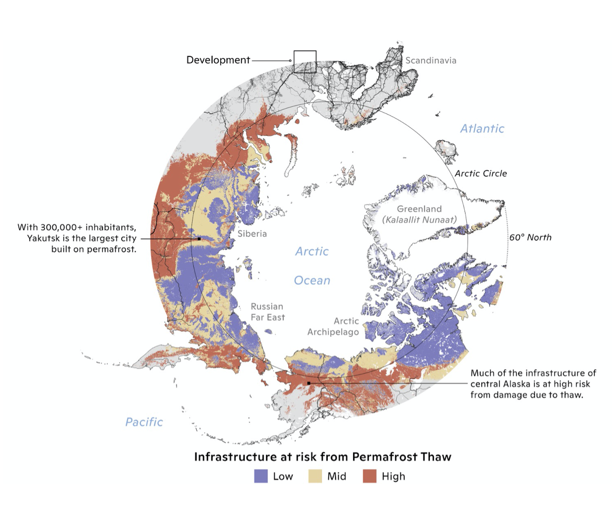 Thawing permafrost threatens to destabilize Arctic infrastructure in the coming decades. Index represents risk for 2040-2060 using RCP 8.5. Map by Carl Churchill.
The Arctic
The Arctic is set to experience intense change in the coming decades along two converging trendlines.
First, the region will face major environmental shifts that accompany our current warming trajectory, including sea ice loss and permafrost thaw. Second, the Arctic will continue to see an influx of new human activity (including resource extraction), the development and use of new shipping lanes, and commercial and military traffic. These trends take place across a region witnessing increasing defense force activities by many Arctic nations.
 The current (light blue) vs 2050 (dark blue) extent for the 1-in-100 year flood for Pyongyang. Developed areas (yellow) indicate land covered predominantly by buildings and other man-made structures. The lighter red color indicates current flood risk in developed areas, while the darker red color indicates flood risk in 2050. Map by Carl Churchill.
North Korea
In North Korea, climate extremes like heat, drought, and flooding will constrain the nation’s already precarious ability to provide public goods for its population, compounding persistent security concerns.
In addition to threatening city infrastructure and nuclear facility safety, climate change will make crop failures (particularly rice) more likely in the growing region along the Western coastline, impacting local livelihoods and jeopardizing national food security.
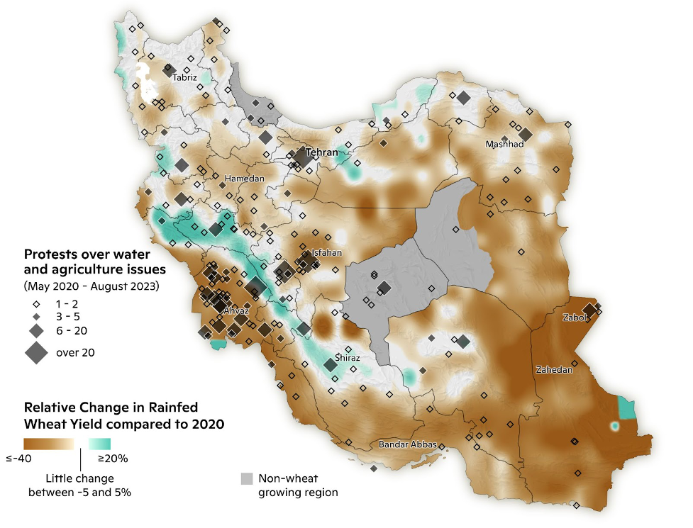 Rainfed wheat will face declines across the country, including in southeast Sistan and Baluchistan province, already the site of some water protests and a hotbed of broader anti-regime activity. Map by Christina Shintani.
Iran
In Iran, climate impacts, resource mismanagement, and international isolation are coming to a head—fueling repression internally and generating tensions with Türkiye, Iraq, Afghanistan, and the Gulf States. Decades of corruption and nationalism have led the Iranian government to prioritize food self-sufficiency, entrenching a reliance on water-intensive agriculture.
High water demand and a diminishing water supply will further jeopardize Iran’s food and water security. Reductions in country-wide average wheat yields of up to 10% by 2040 will increase the potential for political instability, repression, and militancy, particularly in rural and ethnic minority communities.
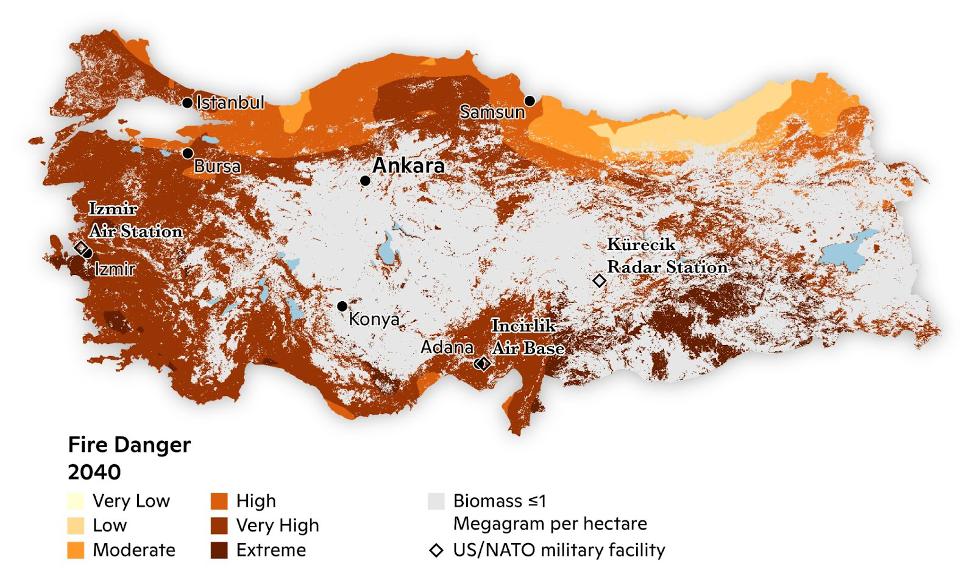 In the coming decades, in all but its rainiest region along the Black Sea coast, Türkiye will face high wildfire risk. This includes areas near major population centers and military facilities that the United States and NATO use for functions including nuclear weapons storage, NATO land forces headquarters, ballistic missile defense, humanitarian relief, and counterterrorism operations. Map by Christina Shintani.
Türkiye
Türkiye sits in a geographic hot spot where extreme weather and natural disasters are already intersecting with unsustainable development, geopolitical tensions, and both geologic and domestic fault lines—with climate change projected to exacerbate these challenges.
Our analysis highlights widespread wildfire risk and diminishing water resources, including rainfall and streamflow, threatening major hydropower projects like the Southern Anatolia Project. These climate impacts will amplify domestic political grievances, exacerbate ethnic tensions, and fuel disputes with downstream countries over the shared Tigris and Euphrates rivers.
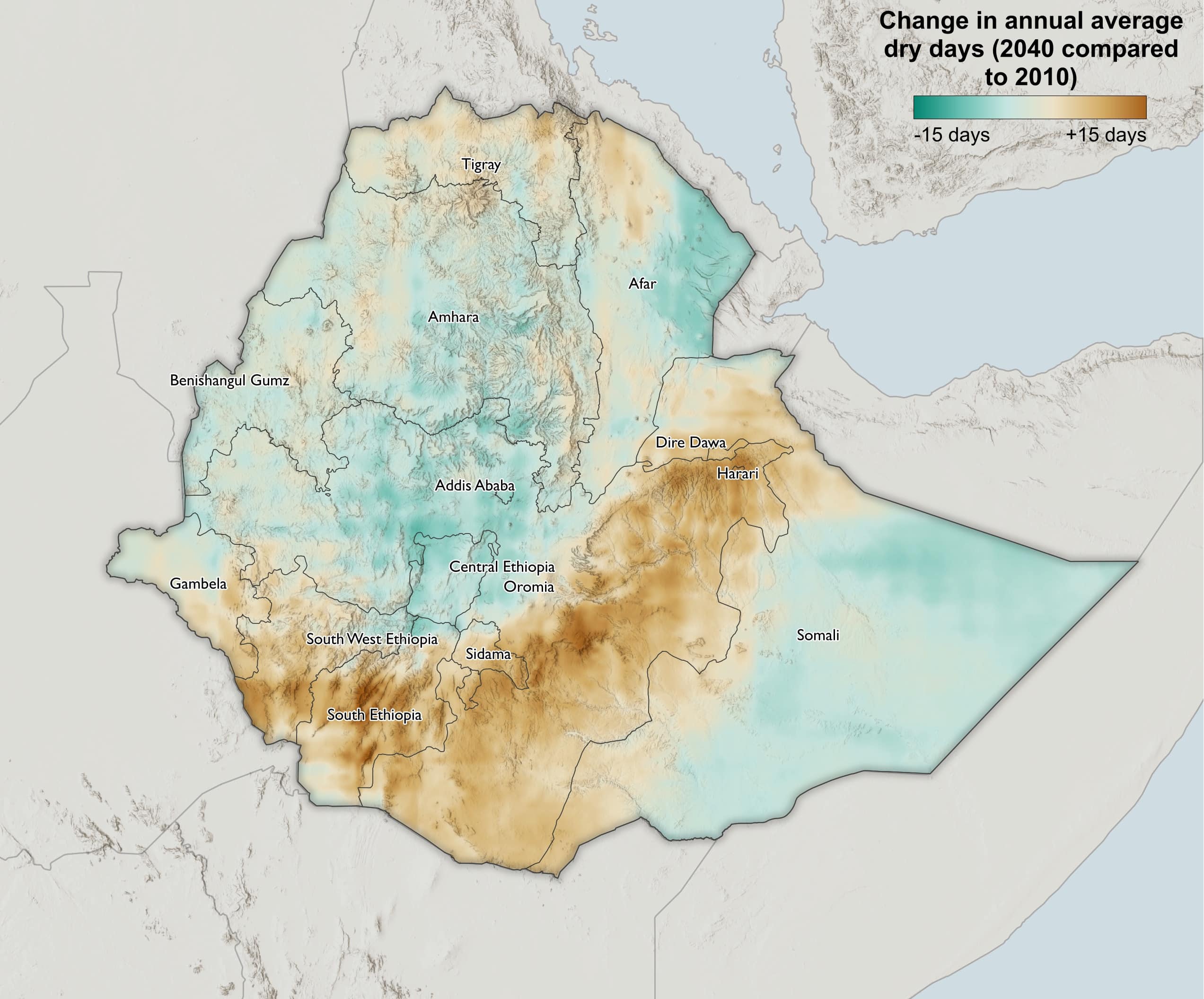 The change in annual dry days (precipitation < 1mm/day) in 2040 relative to 2010.
Ethiopia
Ethiopia is uniquely positioned at the intersection of climate change, food security, and conflict risks that will shape the country’s internal stability, influence on East African security, and geopolitical role for years to come.
Changes in precipitation accumulation and distribution will compound pre-existing vulnerabilities and impact agriculture and livelihoods in conflict-afflicted central and eastern Oromia and eastern Amhara, and traditionally food-insecure southern Ethiopia, with some crop yields projected to fall by up to 15% in the future.