Flooding is a hallmark of the climate-changed world. Rising sea levels, extreme rainfall, and aging infrastructure systems have left communities across the U.S. facing increasing damages from flooding, making flood insurance an expensive necessity for more and more Americans.
But U.S. flood insurance policy was created on the assumption of a more stable and predictable climate and has struggled to keep up with the rapid pace of change. Two new papers led by Research Associate, Dominick Dusseau shine a light on vulnerabilities within the American flood insurance system that will only be exacerbated as climate change advances.
You may be paying for your neighbor’s discount
The National Flood Insurance Program (NFIP), a program of the Federal Emergency Management Agency (FEMA), was created to help property owners secure affordable flood insurance and encourage communities to manage their flood risk.
One of the ways the NFIP encourages floodplain management is through the Community Rating System. The system rewards communities with discounts on their premiums for implementing certain actions. These actions range from building up the elevation of ground within a floodplain to making local flood maps publicly accessible. Actions are assigned points and the number of points determines how much of a discount the community will receive.
This reduction in price is not a true discount however, because the NFIP adjusts state-wide premiums to make up the difference. The NFIP calculates the average percentage discount for the entire state and increases all premiums by that amount. This means policyholders in towns that are not even participating in the Community Rating System may be paying more than their risk level requires to subsidize their neighbor’s discounts.
“It’s basically a way for the NFIP to actuarially pay for the Community Rating System,” says Dusseau. “Because otherwise they’d be foregoing that revenue from the discounts. To recoup the lost income they do this cross-subsidization by putting it back into each policy by state. ”
Climate change will exacerbate inequalities
A study from Dusseau, published in the journal One Earth, shows that through the Community Rating System, roughly half of NFIP policy holders subsidize the discounts of the other half. In theory, subsidization ensures the NFIP is collecting enough revenue to pay out all their future obligations. But in reality, this framework presents two flaws. First, not all Community Rating System actions— publishing flood maps, for example— reduce damages. While the action may be beneficial to community awareness, it doesn’t translate directly to dollars saved.
Additionally, existing disparities between communities result in unequal distribution of the burden of subsidization.
“One of the big takeaways that we found was that it’s largely under-resourced rural counties that are subsidizing the more affluent, well-resourced urban counties,” says Dusseau.
Even though many rural communities would be eligible for discounts themselves, they may not have the capacity available to take advantage of them.
“There’s a bureaucracy involved here. There’s paperwork. You have to document all of these things that you’re doing. You have to submit the application. You need someone that’s a certified floodplain manager,” says Dusseau. “Not every town has that capacity, so it just falls through the cracks.”
This means that already resource-strapped communities may be paying more than required for their true risk level.
Dusseau’s study points out that these inequalities will be exacerbated by climate change. The NFIP has long underpriced policies. The rising sea levels and more extreme precipitation caused by climate change has only widened the gap between the program’s revenue and obligated pay-outs. In 2021, FEMA implemented a new framework, called Risk Rating 2.0, that takes the impacts of climate change to date into account, gradually raising premiums year over year to more closely align with the actual risk of damages.
“And what we see is that states with the greatest level of inequality now will experience even worse disparities in the future,” says Dusseau.
How accurate are flood models?
In addition to inequity, flood insurance suffers from a frustrating lack of transparency, with each company and the NFIP employing a proprietary combination of models to decide premium prices. A second paper led by Dusseau, published in the Journal of Catastrophe Risk and Resilience in February, generates some much needed transparency around the data underlying the insurance industries assumptions.
One type of model employed by insurers is called a catastrophe model. These models can estimate the likely damages from both natural and man-made hazard events like wildfires, terror attacks, and hurricanes. Dusseau’s study evaluated the accuracy of seven flood-specific catastrophe models, including three commonly used by the NFIP.
“Insurers rely heavily on these models that have historically been very ‘black-box’—nearly impossible to evaluate their methods,” says Assistant Scientist Zach Zobel, a co-author on the paper. “Without proper independent review of these models, insurers will continue to misrepresent the risk catastrophes pose on local communities.”
The study found that model accuracy varied widely. Some models overestimated flood losses, while others underestimated losses— by up to 13 times in the most extreme case. This has major implications for the ultimate cost of flood insurance.
“There is a non-trivial difference in the premiums that would be passed on to consumers based on these assumptions,” says Dusseau.
Catastrophe models are also still based upon historical data. Many have not been updated to account for the impacts of climate change, let alone cast forward to how flood risk may change in the future.
“The insurance industry drives using only the rearview mirror. Yesterday’s data to price tomorrow’s risks doesn’t work in a world of more extremes, says Vice President of Science, Dr. Christopher Schwalm who also contributed to the paper. “The past is no longer a reliable guide for the future. To stay ahead, we have to stop guessing based on what happened years ago and start modeling the ‘new extremes’ we are seeing right now.”
Informing policies that protect people
Dusseau along with Woodwell’s risk and policy experts have made science-backed contributions to conversations about improving flood insurance. Dusseau and Senior Policy Analyst Jamie Cummings authored a policy brief last April that advocates for NFIP reforms that help property owners access affordable flood protection, including the creation of a standard national catastrophe model. Dusseau has also briefed congressional staff, highlighting areas where Congress could play a role in bolstering the long-term resilience and insurability of communities.
However, aligning pricing more closely with the realities of climate change is much more complicated—and for many property owners, emotional—than simply incorporating the right data. The increases brought on by Risk Rating 2.0 have already pushed flood insurance out of the range of affordability for many policy holders, forcing them to drop their coverage. The pricing framework is a sticking point in lawmakers’ debates over reauthorizing the NFIP in the long term. The program is currently funded through September 30, 2026.
“How do you balance updating policies to reflect true climate risk with affordability, in a political context? Yes, you want people to know that they’re in a flood zone, but if you price them out of the market, are you really helping them?” says Woodwell Climate Vice President of Policy and Government Relations, Laura Uttley. “That’s why the work Woodwell’s risk team does is so vital. The science and modeling they provide adds context for the development and implementation of new policies. We are very pragmatic about the ways we recommend change.”
Additionally, federal policy changes happen much slower than climate ones, making it a challenge to build policy that is both durable and versatile.
“Policy change at the federal level can be incredibly slow. We need to consider policy proposals that build durable systems that enable adaptability, recognizing the urgency posed by rapidly changing conditions,” says Uttley.
Woodwell Climate has been involved in advocacy around the inclusion of flooding from extreme rainfall— called pluvial flooding— in FEMA’s regulatory maps. These maps identify “flood hazard zones” in which property owners are required to have flood insurance. Currently they only represent coastal and riverine flooding hazards. This has led many property owners to mistakenly believe their homes are not at risk.
Though improved data and transparency might ultimately translate to higher costs for some, Dusseau says the alternative, not knowing, hurts people in the long run.
“If people don’t know that they’re at high risk, they won’t know what to do about it so they won’t do anything about it,” says Dusseau.
The decision to repeal the 2009 Endangerment Finding is a dangerous attack on the United States’ ability to reduce air pollution harmful to human health. The Environmental Protection Agency’s (EPA) final rule rejects decades of rigorous science and inhibits urgently-needed action to mitigate and adapt to the climate crisis. Now is the time to double down on science-based solutions that will protect the health and wellbeing of our communities and our environment–the intended mission of the EPA–not roll them back.
As we experience increasingly violent storms, destructive flooding, catastrophic wildfires, and record-breaking temperatures, it is clear that climate change is already creating dangerous conditions across the country. Deregulating greenhouse gas emissions will exacerbate these impacts and lead to increased costs for resilience and public health.
The Endangerment Finding is the foundation of U.S. efforts to fight climate change, and, as a Woodwell-led scientific review in 2018 found, ‘the case for endangerment, which was already overwhelming in 2009, is even more strongly justified.’ Woodwell remains deeply committed to advancing rigorous science and conducting the highest quality research to enable solutions at the nexus of climate, people, and nature, across the United States as well as globally.
Sometimes it only takes a small push to start gathering momentum. That’s the idea behind the Fund for Climate Solutions (FCS) at Woodwell Climate. Launched in 2018, FCS is a competitive internal grant program that funds Woodwell Climate scientists to explore research projects that test out innovative ideas for climate solutions. Though each individual project starts small, nearly all FCS projects lead to new lines of inquiry, and a few have grown from their initial seed funding into some of our biggest research projects. From carbon monitoring to wildfire management to thawing permafrost, these three projects exemplify the surprising power of starting small.
1. Monitoring Rangeland Carbon
Rangelands represent a massive untapped natural climate solution, making up more than 30% of the land in the United States and holding 30% of the global soil carbon stock. Conservation practices, including adaptive livestock management, have the potential to enhance that carbon storage— but data was limited on just how grazing systems would respond to different techniques. Senior scientist Dr. Jon Sanderman and Associate Scientist Dr. Jennifer Watts applied for an FCS grant in 2019 to expand scientific understanding in a way that would prove useful for making management decisions.
That first project was successful, and today, Woodwell’s studies of rangeland carbon and other ecological co-benefits have expanded into a multifaceted research project that has received several subsequent grants. Watts and Sanderman are building tools that map and model carbon storage and the overall ecological health of rangelands across the U.S. and show how that storage could change under different management practices. Those tools have been adopted by both conservation groups and corporate partners to better understand the climate benefits of improved range management. They have continued engagement with ranchers and conservation communities across the American West, hosting workshops that bring land managers together to discuss the benefits—both environmental and economic—of improving carbon storage on rangelands.
2. Planning for Intensifying Wildfires
In Summer of 2018, Senior Scientist Dr. Brendan Rogers received an FCS grant to explore the possibility of fire management to mitigate carbon emissions from boreal wildfire. Though fires are a natural part of the northern landscape, wildfires in Alaska and Canada have been growing more frequent and intense as the Arctic rapidly warms. Left unchecked, these northern fires represent a large and broadly unaccounted for threat to emissions reduction goals.
Bringing fires under control as a climate mitigation tactic is now one of the Center’s core scientific goals. Collaborations with the US Fish and Wildlife Service and the Alaska Fire Service are underway to pilot fire suppression as a cost-effective method to keep carbon from entering the atmosphere. Senior Arctic Lead, Edward Alexander, has joined the Center to elevate Indigenous mitigation practices as practical policy solutions to address accelerating northern fires, and strategies are being shared across geographies to inform fire management in temperate and tropical forests as well. Woodwell Climate has also now joined Google’s AI Collaborative on Wildfires and has become an early adopter for the FireSat program led by EarthFire Alliance.
3. Permafrost Pathways
In the summer of 2018 Senior scientists, Drs. Sue Natali, Rogers, Linda Deegan, and Sanderman received an FCS grant to start work on an Arctic change and carbon observatory. Natali observed that while the Arctic was warming at a rapid pace, causing typically-frozen permafrost soils to thaw and erode, actual measurements of carbon emissions from thawing permafrost were sparse. She proposed constructing new carbon-monitoring towers to fill data gaps, starting with a field site in the Yukon-Kuskokwim Delta.
From there, the project gained momentum, and in 2022, Natali was awarded a $41 million grant from the TED Audacious Project to launch Permafrost Pathways. The expanded project not only continued and enhanced carbon monitoring across the Arctic, but also partnered with 10 Alaska Native Tribes and policy experts to advocate for change. Permafrost Pathways supports community-led environmental monitoring of permafrost thaw to help tribes develop a long-term adaptation plan, including relocation. In addition, project experts have been working to influence international policy and get permafrost emissions factored into global emissions models.
In a new study released this week in Nature Communications Earth & Environment, researchers assess the impact of a warming Arctic on global carbon emissions and find that carbon emissions from abrupt permafrost thaw and wildfire will substantially limit our ability to keep global temperature increase below 1.5° or 2° Celsius. When accounting for carbon emissions from abrupt permafrost thaw and intensifying wildfire regimes, the remaining carbon budgets to keep global temperatures below 1.5°C were reduced by about one quarter and by nearly one fifth for 2°C.
Abrupt thaw mainly occurs in ice-rich permafrost landscapes, where rapid thawing can cause the ground to collapse. This exposes deep carbon-rich soils to warmer temperatures, allowing large amounts of previously frozen carbon to be released over a short period of time and amplifying climate warming. At the same time, intensifying wildfires are emitting carbon to the atmosphere at the time of burning and further accelerating permafrost thaw by removing the insulating organic layer at the soil surface.
While existing research has recently led to the critical inclusion of projected carbon emissions from gradual permafrost thawing in global carbon budgets, the impact of abrupt thaw processes and wildfires are both largely missing from Earth System Models, hindering our ability to set sufficiently ambitious and accurate mitigation solutions. The study, which was led by Permafrost Pathways researchers at the Woodwell Climate Research Center and co-authored with the University of Colorado, Boulder and the International Institute for Applied Systems Analysis (IIASA) in Austria, calculates that these total permafrost thaw and wildfire carbon emissions could reach 63 Pg C for every degree Celsius of further global temperature increase. This is over double what is currently included in the Intergovernmental Panel on Climate Change (IPCC) projects. To put it another way, by the end of this century, these projected annual permafrost emissions could reach or exceed the current total annual emissions of a high-emitting nation such as the United States.
“Accurately accounting for land-based emissions directly affects whether remaining carbon budgets, as established by the Paris Agreement, are effective in restricting the planet’s temperature increase to below the 1.5°C and 2°C thresholds,” said Dr. Christina Schädel, lead author of the paper and Senior Research Scientist at Woodwell Climate Research Center. “As the Arctic continues to warm more rapidly than anywhere else on the planet, we must continue to research and support science-based solutions in the Arctic in order to mitigate the impacts of climate change on communities across the globe.”
“Estimates of remaining carbon budgets will continue to underestimate emissions unless the impacts of permafrost thaw and wildfire are fully included,” said Dr. Susan Natali, Senior Scientist and lead of Permafrost Pathways at Woodwell Climate Research Center. “Given the urgency of the climate crisis, and our rapidly shrinking window to limit its impacts and to respond to accelerating climate hazards, the global community must move quickly towards fully informed climate policy and accurate temperature goals.”
This study was funded by One Earth Philanthropy, the Gordon and Betty Moore Foundation, the Quadrature Climate Fund, and with funding catalyzed through the Audacious Project. The full study can be found here.
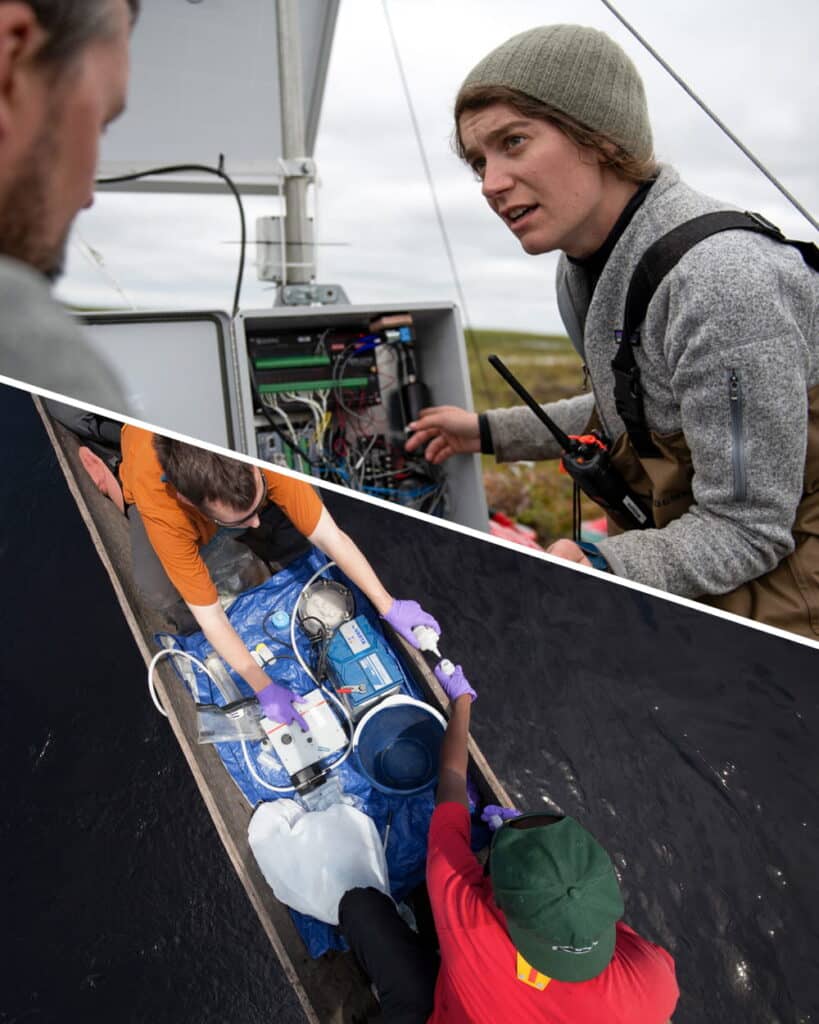
2025 marked the first year I went out in the field as a member of Woodwell Climate’s Permafrost Pathways monitoring team. I travelled around Alaska to our carbon monitoring sites, maintaining and installing equipment and taking static measurements of greenhouse gases — namely carbon dioxide, methane and nitrous oxide — in various degraded and disturbed permafrost landscapes around Fairbanks and west of Prudhoe Bay by the Arctic Ocean.
In late April this year, I returned to Toolik together with Dr. Jennifer Watts, Dr. Kyle Arndt, Christina Minions, Dr. Kelly Gleason (snow scientist from Portland State University) and photographer Jayme Dittmar to install an eddy covariance tower by a retrogressive thaw slump (here). Eddy covariance towers monitor and capture fluxes, or the exchange between land and atmosphere, of energy and greenhouse gases. Thaw slumps are areas of tundra that have collapsed due to thawing ice-rich permafrost. When the ice melts, the ground collapses, revealing old, buried carbon rich soils that begin releasing their carbon back to the atmosphere. The towers help us better understand how much carbon these features contribute to calibrate models of Arctic carbon emissions.
Spring is one of the best times to be in northern latitudes. Near endless days, the bright snow, the monochromatic stretches of landscapes, the binary experience of both intensity and complete stillness. Now suddenly, the interruption of a small group of people gathering, pulling around equipment, cords, cables, instruments, and then suddenly there is a new structure in the landscape and the people disappear. Off to a great start, we packed and organized our tools and equipment and headed from the wintery landscape of the north towards the onset of green-up to the south.
Back in Fairbanks, the bloom of birches in early June is one of my favorite sights. The dense stretches of light, delicate greenness and resinous fragrance from the new sprung leaves that are drowning in summer sunlight makes me almost feel all the carbon dioxide being sucked out of the air by the trees. This, again, makes me really appreciate the northern latitudes. The vastness that cradles your existence grounds you and at the same time lifts you with the intensity of the surrounding life. It is an energy that can only be felt at these latitudes. A form of mania that propels you onward without pause.
In late June the trip headed to Nome and Council where I, together with colleagues Dani Trangmoe and Dr.Kelcy Kent, maintain the tower there. With each site visit, not only do I get an improved grasp of the equipment, but also a better understanding of the surrounding landscapes, now even more chlorophyll-saturated peak green. I shuttled to Anchorage and then back up to Bethel with Trangmoe to join Dr. Jackie Hung and Christina Minions at the two towers located a 40 minute flight northeast of the town. Here, we upgraded solar structures, maintained and swapped equipment and hauled out old and damaged power supplies and misc. materials. I really appreciated the time being out there and the sense of community that comes with remote camps, although we only stayed out for about a week.
Afterwards we circled through Anchorage again on our way to the very top— the Arctic Ocean. I assisted Hung and fellow researchers from Woods Hole Oceanographic Institute and the Marine Biological Laboratory to collect greenhouse gas measurements from coastal tundra. The contrast of the flora and fauna against the infrastructures from the oil and gas fields makes for a surreal sight. From here I am going southward again, stopping at Toolik to check on the new tower and enjoy the buzzing environment that Toolik is offering during this time of year. The intensity of the arctic summers is reflected in the frantic work of scientists that all gather here to conduct a wide range of work.
At what other place in the world than Toolik would one be able to hike out on the tundra and do maintenance work on an eddy covariance tower in the morning, come back for a snack, go out in a helicopter to search for new areas of permafrost degradation, get a panoramic sight of thousands of caribou, come back to a hearty meal, and finish off the day catching some grayling at the river inlet by the Toolik lake. The beautiful clear light, the humming of mosquitoes, and the rippling sounds of the water give me a sense of belonging, a sense of home.
I spent my last weeks in Alaska in Fairbanks again, making boreholes in permafrost together with a magnificent team gathered from across the U.S. We can learn a lot from these seven-meter-deep boreholes. Not only studying the samples that we retrieve, but also how these permafrost soils evolve and change with climate change with sensors that monitor variables such as temperature, oxygen and soil moisture. The drilling was challenging and physically demanding, but at the same time something of a treasure hunt as each of the soil samples we were able to retrieve has the potential to unlock a wealth of information that can help us expand our understanding of the changing permafrost soils in the region. In the end it felt well worth the effort, especially being privileged to work with such a dedicated and knowledgeable group.
2025 also marked my tenth year of working in the Arctic. As a junior scientist, I remember reading and hearing about Woodwell Climate’s work in the Yukon-Kuskokwim Delta long before I joined the team. I remember spending a full summer on the Delta by the coast, learning about and experiencing firsthand the effects of both permafrost thaw and coastal erosion. Knowing that Woodwell’s first eddy covariance tower was installed in this region around the same time, and that it has been collecting data ever since, has given me a sense of perspective not only on my career, or the Permafrost Pathways project for which this tower was the springboard, but also the future of the Arctic landscapes that I have come to love.
I am grateful to have been given this perspective, and to work in and celebrate all these unique and beautiful places. If it wasn’t for the people and the relationships built through this work, we would know much less about these complex and fascinating landscapes. It is through these encounters with people and the environment that we can not only deepen our understanding but also gain connection. These encounters and interactions give a sense of belonging as a part of something bigger.
November 2025 marked the 30th convening of the United Nations climate conference (COP). Woodwell Climate has been a pivotal player in the annual COP since our founder, Dr. George Woodwell and early staff members, played an instrumental role in the creation of the United Nations Framework Convention on Climate Change (UNFCCC) which enacts the annual conferences. This year was an important milestone for Woodwell due to its focus on tropical forests and nature-based solutions. Woodwell Climate sent 17 staff and scientists to Belem, Brazil, where they spoke at 52 events, and continued the Center’s legacy of advancing science-informed climate policy. Here are 4 takeaways from this year’s conference.
What is COP? Learn more about what goes on at climate’s biggest event of the year in this explainer.
1. COP30 was Brazil’s time to shine
As host country, Brazil used COP 30 to vault themselves into global leadership, to press the importance of international cooperation, and to build bridges between the global north and south. COP30 served as the launchpad for several forest-centered initiatives spearheaded by Brazil, including the Tropical Forests Forever Facility, a new financial solution that would pay tropical countries to keep their forests standing. Woodwell Senior Policy Advisor Frances Seymour and Associate Scientist Dr. Glenn Bush provided input and technical assistance to help launch the TFFF. In addition, Brazil launched a global initiative on wildfire resilience and a global coalition to harmonize carbon markets. Brazil also announced that they will publish two roadmaps in 2026: one to chart the course towards ending halting and reversing deforestation, and another for transitioning away from fossil fuels.
2. NDCs were one of the trickiest issues at COP30
Nationally Determined Contributions (NDCs) are the promises each party country to the UNFCCC makes every five years, to reduce their emissions. Ahead of COP30, countries were supposed to submit their third round of NDCs to raise their ambition. However, many NDCs were missing by the start of the conference, and those presented would reduce emissions only by 10-12% from 2019 levels by 2035, a far cry from the 60% the IPCC says is needed to limit global warming to 1.5 degrees Celsius. The European Union, Latin America, and small island nations attempted to advance this conversation but this was opposed by major emerging economies, who view the NDCs as a commitment to be worked out at the national level.
During several speaking events, Woodwell Senior Research Scientist Dr. Christina Schaedel emphasized the importance of including growing emissions from Arctic permafrost thaw in NDCs and estimates of the global carbon budget. Schaedel’s research has focused on modeling the contributions of permafrost-thaw emissions to sea level rise, temperature increases, and damage costs.
Given strong opposing interests, the issue of NDCs was not resolved by the end of the conference. The UNFCCC instead set up two workstreams to discuss NDC ambition: the Global Implementation Accelerator and the Belem Mission to 1.5. Details about what shape these discussions will take is still forthcoming.
3. Climate finance took center stage
During COP29 in Baku, Azerbaijan, countries agreed to mobilize $1.3 trillion per year by 2035 for climate adaptation and mitigation. Many hoped COP30 negotiations would identify funding sources to reach that goal: developing countries wanted public finance from industrialized countries, while industrialized countries insisted that finance must also come from major emerging economies and non-governmental sources. Again, the official outcome was to launch work programs to address the issue outside of conference. The programs created will tackle questions of finance obligations and climate-friendly investments.
Woodwell experts provided important contributions to the complex climate finance debate: Seymour played a lead role in the Forest Finance Roadmap for Action highlighted by a coalition of 34 countries, and Vice President of Science, Dr. Wayne Walker introduced a roadmap for carbon and biodiversity credits that takes a community-based and Indigenous-led approach for generating climate finance.
4. Measurements of progress towards resilience
Countries did reach an agreement on indicators to help measure progress on adaptation and resilience goals in sectors like water, agriculture, health, ecosystems, infrastructure, poverty eradication, and cultural heritage, as well as on resilience efforts, including risk assessments, adaptation planning, and early warning systems. 59 indicators were identified for countries to use in their future progress reports. Woodwell Climate has been supporting adaptation efforts through the Just Access program, which provides cost-free risk assessments to local, state, and national governments around the world.
Next year’s COP will be hosted jointly by Türkiye and Australia in Antalya, Türkiye, and while the agendas are not fixed, the outcomes of this year’s conference have indicated that NDCs and climate finance will continue to be high priority issues. In addition, a new global stocktake, a required moment under the Paris Agreement to re-evaluate the state of the planet and progress towards goals, is on the horizon.
When I was young, there were always a few horses and ponies on our family farm. I was a pretty good rider. I even showed ponies in the 4-H children’s show at the local county fair.
My previous horse experience, however, proved little help for the day-long horse riding treks I found myself on this summer during a spontaneous trip to Northwestern Mongolia with friend and colleague, Marina Tonkopeeva of the International Center for Reindeer Husbandry (ICR). We were there to visit indigenous Dukha reindeer herders in the Taiga regions near Tsagaannuur, not far from the Russian border. The only access to these remote communities, I quickly discovered, was by riding many hours on horseback. Our journey included two separate horse treks, one to the East Taiga camp, home to about a dozen herder families and a second to the more rugged West Taiga region, higher up in the mountains where we met with two families on a much smaller camp in their autumn location. I was forced to relearn horsemanship on the fly across the Mongolian wilderness and was wishing I still had the resilience and physical toughness of my youth.
The goal of this trip was exploratory. I hoped to connect with herders and introduce cartography as a powerful tool, and importantly to gain first-hand knowledge about the lands I would be mapping. From many other field trips in the past, I’ve learned that there is true inspiration in taking the time to travel to a field site. It allows me, as a cartographer, to build relationships and make connections between my virtual world of geospatial data and reality. Experiencing things like natural colors and landscape dynamics all help with making maps, post-trip. My goal was also to co-produce maps with the Dukha herders. Co-production of maps essentially means combining Indigenous knowledge with western science and cartography to communicate a story, based on mutual understanding and trust. Through the process of co-production, I can learn about the intended audience of our proposed maps, about how the maps will be used, and what story we will tell with the maps we make together.
With the help of our host and colleague, Khongorzul Mungunshagai, we met with many reindeer herding families and shared detailed satellite images inside their teepees. Over reindeer milk tea and cheese, we discussed migratory paths, seasonal camp locations, and shared stories about regional changes.
Indigenous communities across the planet have adapted to climate variability for millennia; however, the combined impacts of rapid warming and resource development are having an unprecedented impact on Indigenous peoples and their lands. Reindeer husbandry, which has been practiced for thousands of years, constitutes the modern-day livelihood of tens of thousands of Indigenous people who tend millions of domesticated reindeer on lands that span the Eurasian permafrost region. Traditional reindeer husbandry practices are now being challenged by loss of land due to development, conservation, and climate change.
The Dukha people of Mongolia, like other indigenous peoples, have lived respectfully and in harmony with the land since time immemorial; however, their lifeways are being challenged by land use decisions that have been implemented without proper consultation and consent. Impacts of these land use changes on traditional grazing lands are being further exacerbated by landscape and landcover changes associated with climate change including increased fire, permafrost thaw, and shrubification. This is of particular concern in Mongolia, where the rate of summertime warming is three times faster than the average for Northern Hemisphere lands, resulting in land degradation from permafrost thaw and changes in vegetation cover due to desertification.
Additionally, the Mongolian government’s new national parks have created unmarked boundaries and land-use restrictions that are essentially invisible lines of attack on the Dukha’s traditional lifestyle. They are being forced to alter ancient migration routes or grazing sites, and they often unknowingly cross park borders because the government hasn’t provided any clear, useful maps.
Woodwell Climate has recently awarded a Fund for Climate Solutions grant to continue this work. We plan to work closely with Dukha reindeer herders using GIS tools to map land use and land cover changes in Mongolia and their impacts on grazing lands. We will co-produce maps to support climate change research and advocacy for environmentally and culturally-just land management practices. This work would build on past co-production successes working with ICR and Sámi reindeer herders in Norway and with Indigenous communities in Alaska.
It’s clear that maps are a powerful medium for clearly communicating information and important stories. Whether I’m visiting politicians, working with scientists, or gathering in a teepee on the taiga, I’ve found that maps are always a welcome addition to the conversation and they help grease the wheels of communication. Leaving the Taiga and enduring the long trip home, I was physically worn out, but the vision of the Mongolian landscapes and the clarity in the work that lies ahead gave the long trip back purpose. I took home not just memories of making new friends (both two legged and four) and of a stunning ecosystem, but a commitment to help map a path forward with our partners at ICR and the Dukha.
In 2018, a group of Inuit youth stood before a scientific crowd at the annual ArcticNet conference in Ottawa, Canada. They spoke in Inuktitut—and observed the faces of the largely Western scientific crowd quickly turn to confusion.
For Indigenous communities in the North, the feeling of exclusion in a Western scientific space is commonplace. Researchers arriving in the Arctic often approach communities with very little consideration of linguistic barriers, historical context, or cultural differences. By flipping the script on the researchers, the Inuit youth delivered a clear message: Arctic research has an equity problem.
Read more on Permafrost Pathways.