We have to study fire up close in order to model and predict it
Postdoctoral researcher Dr. Joshua Rady observed a prescribed burning experiment that will help inform wildfire research
The ignition helicopter comes in for a landing during the April 2025 NASA FireSense-led research campaign at Fort Stewart-Hunter Army Airfield in Georgia.
photo by Milan Loiacono
At Fort Stewart-Hunter Army Airfield in Georgia, dozens of people in uniform position themselves along the edge of a pine stand as multiple aircraft approach overhead and a helicopter starts dropping incendiary devices into the forest in front of them. This may sound like a military training exercise but it is not. It is the NASA FireSense campaign, co-led in partnership with the Department of Defense and the U.S. Forest Service, a carefully planned and coordinated set of scientific experiments being used to better understand wildfires.

Firefighting personnel observe a prescribed burn.
photo by Milan Loiacono
As wildfires get more frequent, intense, and destructive due to human activity, scientists are coming up with new and creative ways to study them. This is what brought me to this collaborative project at Fort Stewart in March 2025 for a week of prescribed burns and intensive wildfire research.
I’m an ecologist at Woodwell Climate Research Center working to understand how climate change is altering wildfires in boreal forests and the Arctic. I improve ecosystem models— computer software programs that simulate how ecosystems work— to better predict wildfire under a changing climate. This requires a holistic understanding of wildfires: from the way plants grow and produce fuels, to the weather that leads to fires, to how fires spread and grow. For me, getting out in the field is an important way to confirm that my computer simulations are behaving like real fires.

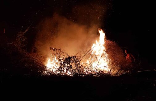
Fire consumes low-level brush.
photo by Milan Loiacono
Wildfires can be a difficult and dangerous environment in which to do research. For this reason, wildfire research is sometimes done during prescribed fires. Prescribed or controlled burns are lit by trained professionals to reduce the buildup of natural fuels and to benefit plants and wildlife, especially in ecosystems that historically had regular wildfires. Fort Stewart has one of the largest prescribed fire programs in the United States, burning around 115 thousand acres every year. Burns are performed both to protect soldiers from wildfires that can easily start during military training exercises, as well as to manage the base’s pine forests for the recovery of several threatened and endangered species including the red-cockaded woodpecker and the smooth coneflower. This makes it a great location to do research. Unlike wildfires, controlled burns allow researchers to know exactly when and where a fire will occur, giving them time to plan safe research projects.


left: Joseph O’Brien from the U.S. Forest Service installs a meteorological station ahead of the prescribed burn.
right: A timber rattlesnake, native to Georgia’s pine forests.
photos by Joshua Rady
This most recent experimental burn campaign represents a new level of cooperative effort to study wildland fire at all stages. While the Environment and Natural Resources Division Forestry Branch at Fort Stewart conducted the prescribed burns, researchers from NASA and seven DoD Strategic Environmental Research and Development (SERDP) funded research projects deployed weather stations, fire sensors, cameras, and emberometers on the ground. NASA flew three aircraft overhead with advanced sensors aimed at the fire below and a radar truck monitored the smoke plume. Fuels were measured with LIDAR scanners before and after the fires to detect what burned. During the fire, fuel moisture was measured. The ability to study conditions before, during, and after a fire gives a more complete picture of fire behavior compared to a wildfire where researchers are often limited to data gathered after the threat of the fire has passed.

Katherine Mistick, Geospatial Research Associate at the University of Utah, receives near real-time data from the NASA JPL AVIRIS-3 instrument as it flies over a prescribed burn at Fort Stewart-Hunter Army Airfield in Georgia.
photo by Milan Loiacono/ NASA
Working together like this makes for more than just good science, it also builds community. Like all scientists, wildfire researchers tend to be specialized, with some studying fuels, while others study smoke, or the energy produced by the flames. Bringing these people together allows them to share ideas, discuss problems, and learn new experimental techniques. These connections and conversations are what spark new ideas and collaborations that push science forward. For me this was a valuable opportunity to meet other researchers, discuss ideas, and to learn how to perform experiments safely in a fire, something that could help me improve my wildfire models in the future.
The FireSense campaign at Fort Stewart went off without a hitch. The data collected during the campaign will take many months to analyze, but the hope is that this campaign will act as a model for a new era of cooperative wildfire research. Planning for another campaign next year in Florida is already under way and in the meantime I’ve returned to my lab to refine my code and apply what I’ve learned in preparation for the next fire.
Latest Stories
- In The News