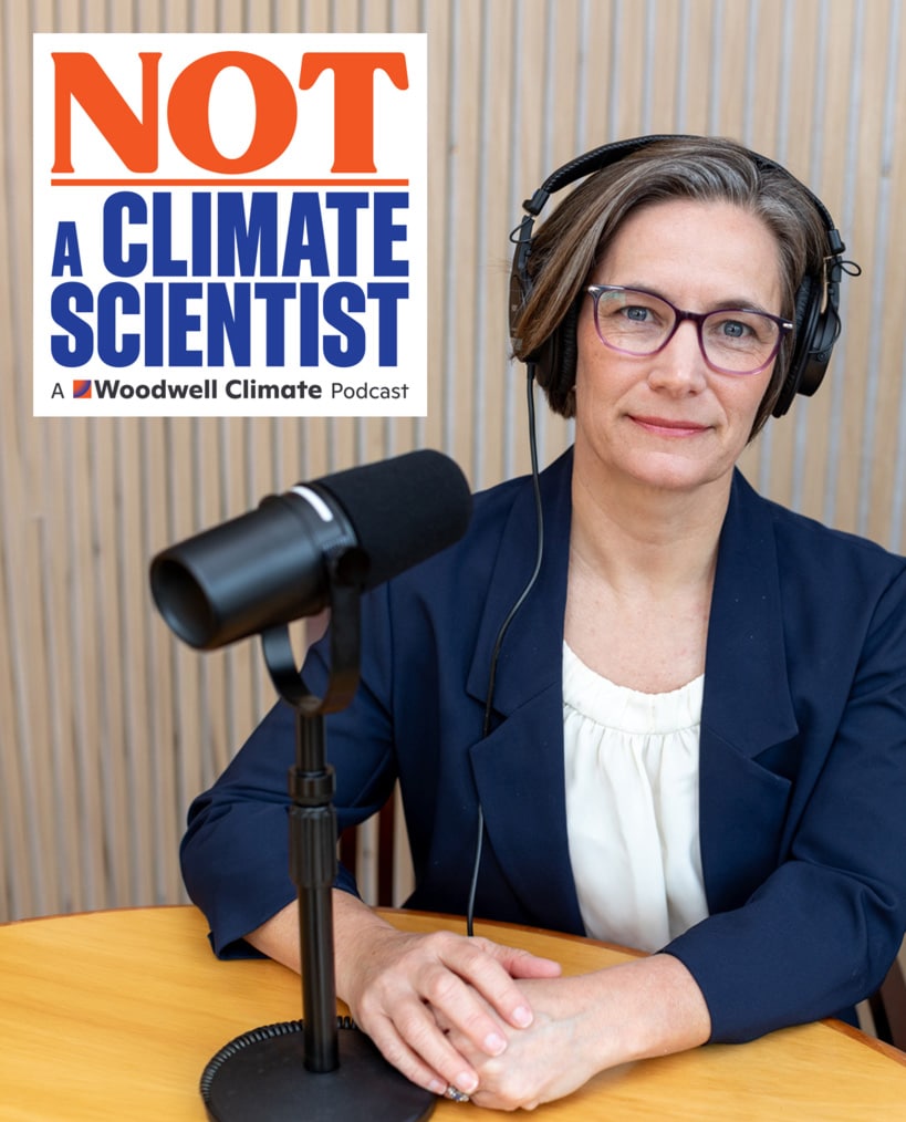
Today on Earth Day, Woodwell Climate Research Center is launching a podcast for everyone who is not a scientist, but is worried about the effects of climate change and wants to understand how others are taking action in their daily work and lives. As the consequences of the climate crisis increasingly impact our economy, infrastructure, public health, and communities, Not a Climate Scientist will provide listeners with a window into how industry leaders and everyday individuals are working to adapt and plan for the future.
“Science provides critical information about how fast our climate is changing, what’s driving that, and how we can change course. But scientists alone can’t solve this problem,” said Dr. R. Max Holmes, President and CEO of Woodwell Climate Research Center. “Climate action is for everyone, whatever your passion or profession. Not a Climate Scientist provides examples of people who have figured that out, and can help others find their first step.”
New episodes will be released every other week on YouTube, Spotify, Apple, Amazon, and iHeartRadio. The first three episodes are available now and feature:
- Fire Chief John Butler of Fairfax County, Virginia Fire Rescue Department, who says climate change is an unavoidable part of daily conversations for those who respond to natural disasters;
- Therapist Leslie Davenport, author of Grist’s “Ask a Climate Therapist” column, who used her own personal climate crisis to develop an approach that can help others cope with climate anxiety and grief;
- Rancher Jim Howell, CEO of Grasslands, LLC, who pushes back on blaming cows for climate change and says ranches can be climate solutions.
The podcast is hosted by Dr. Heather Goldstone, Senior Fellow at Woodwell Climate. Goldstone joined Woodwell Climate in 2020 after nearly a decade at GBH, where she founded and hosted a weekly science-focused radio show, Living Lab Radio. Her science and environmental reporting has appeared in a range of outlets, including the Cape Cod Times, Commercial Fishery News, NPR’s Morning Edition, The Takeaway, and PBS NewsHour.
“Climate change is not just a distant threat or political flash point, it’s a reality that is showing up in people’s lives and jobs across the U.S. on a daily basis,” said Goldstone, executive producer and host of Not a Climate Scientist. “The vast majority of Americans are worried about climate change, but relatively few are talking about it. This podcast brings this looming issue down to earth and opens up conversations that are personal, relatable, and actionable — an antidote to the doom and gloom so many people are trying to avoid.”
For 40 years, Woodwell Climate Research Center has led groundbreaking scientific research and solutions to help leaders, communities, and policymakers across the world respond to the climate crisis. Not a Climate Scientist will notably talk to everyone except climate scientists, highlighting the ways in which we all, regardless of profession, geography, or socioeconomic status, can be part of shaping a more positive climate future.
Follow Not a Climate Scientist on TikTok and Instagram @NotAClimateScientist.
September 2025— On the shores of Lago Caracaranã, deep in the Brazilian State of Roraima, a group of Indigenous brigadistas gather around printed paper maps. They have come to this lakeside meeting place from their territories across the state and beyond to learn about maps from Dr. Ray Pinheiro Alves, a research analyst at the Amazon Environmental Research Institute (IPAM). Alves directs each woman to a map of their own territory, completely unlabeled. He hands them drawing supplies, and within moments the brigadistas have oriented perfectly to the map, tracing familiar rivers, home sites, and landmarks from memory.
Roraima is Brazil’s northernmost state. It straddles the equator, and contains both native sweeping grasslands like those around Caracaranã and misty, mountainous stretches of the Amazon rainforest. It is remote, and sometimes disconnected from the rest of the country, yet experiencing the same encroachment from agriculture and illegal mining, and the same increase in destructive fires that often follow in the wake of deforestation. Which is why the Indigenous fire-fighting brigades here are eager to pick up new tools that could help them manage and protect their forests and homes.
Alves believes maps should be one of those tools. He, along with Woodwell Climate research scientist, Dr. Manoela Machado, has been spearheading a series of workshops designed to help Indigenous fire brigades build the skills of cartography and geographic information systems (GIS). Strong GIS knowledge allows fire crews to make use of data to guide decisions about both on- and off-season fire management activities— both of which will become more critical as the climate warms and fire becomes more prevalent and difficult to control.
Brazil’s fiery landscape
It is supposed to be raining in Roraima right now, but the winter has been dry this year. Climate change has been elongating dry seasons in many regions of the country, increasing the time that ecosystems are prone to burning.
In the Amazon, fires are set intentionally as a part of the deforestation process. Land grabbers use fire to clear the piled vegetation that was cut to make way for cattle ranching, which later will be converted to cropland. With climate shifts, these fires are now more likely to escape into drier and weakened surrounding forests. In Central Brazil, the savana and seasonal wetland ecosystems of the Cerrado and Pantanal have co-evolved with varying levels of frequency and intensity of fire. But prolonged drought and rising temperatures have turned fire seasons into crisis seasons.
Indigenous communities across Brazil have used fire for millennia, working with the ecosystem to promote culturally important species. With climate change extending fire seasons, traditional calendars are also shifting, as the time available for safe burning shrinks. Communities are also facing incursions into their territories from runaway fires ignited on nearby farms.
The world got a taste of the scope of the crisis in 2019 when, during an already record-breaking summer of fire, land grabbers in the Amazon intentionally set so many fires in a single day that the smoke traveled to the City of São Paulo hundreds of miles away.
“The sky in São Paulo became dark at 3pm. And then the world started paying attention to fires in the Amazon,” says Machado. Protecting Brazil’s forests from fire, especially the carbon-rich Amazon rainforest, became a much higher priority for the international community.
Brazil has an extensive wildland fire fighting system, composed of both official and voluntary brigades, supported by various government agencies to operate across private lands, protected public lands, and Indigenous territories. Amidst the increased urgency to quell fires, Machado was interested in understanding what brigades at different jurisdiction levels might need to be more effective during crisis months. She herself has extensive expertise in geospatial software and analysis and wondered whether organizations like Woodwell Climate and IPAM could help by providing data on terrain, weather patterns, vegetation type, and other field-relevant information.
So Machado and Senior Scientist Dr. Marcia Macedo, conducted a needs assessment of the firefighting system to identify what analyses might be most useful.
“The answer was a little bit different, depending on who we were talking to,” says Macedo. “But when we spoke to the Indigenous fire brigades, one of the things that came out right away was not just a desire for spatial data, but for training in spatial analysis. They wanted to be able to work with the data the same way we did.”
Two ways of knowing the land
For the Indigenous communities of Brazil, maps aren’t needed for navigating their territory the way Google Maps might be for someone walking in unfamiliar lands.
“The Indigenous peoples of Brazil have a great understanding of their territory,” says Alves. “We show them an image and they recognize some river or some landmark. They can see it immediately in the satellite view.”
Instead, geospatial data offers another way of communicating their innate knowledge of the land. For the Indigenous fire brigades Machado and Macedo spoke with, the ability to use the same GIS tools that scientists use, and make maps the way a government agency like Brazil’s Institute of the Environment and Renewable Natural Resources (IBAMA) might, is invaluable to advocating for themselves in non-Indigenous spaces.
“To be able to make their own maps can strengthen their autonomy to make decisions, and [aid in] dialogs with people about public policies,” says Alves.
Machado worked with Alves to develop the curriculum for a series of workshops that would help teach the foundations of GIS to fire brigade members from Indigenous territories across Brazil. The first was held in Brasília in 2022, and three more have followed since, the class in Roraima most recently.
Each workshop begins with the basics—latitude and longitude, hemispheres, projections. Alves is a natural teacher, and makes use of props, metaphors, and activities like drawing on the printed maps to make the concepts feel more tangible.
On later days of the workshop, as participants get familiar with QGIS, a free map-making software, Alves sometimes adapts the suggested curriculum to the needs of the communities in attendance.
“For example, in one class we were presenting topographic maps, and they said ‘this is really, really, useful for us,’” says Alves. “So we changed that part of the course to solve for the question they were dealing with.”
By the end of the course, participants have successfully created maps relevant to their own territories. Seeing their own homes represented in map form, Machado says, connects them more strongly to the material.
“You could see the pride on their face,” Machado says. “They recognize every element of that map because they built it. They made each decision of what to show on the map.”
The women’s brigade
Ana Shelley Xerente of the Xerente people had watched her husband work on their territory’s official fire brigade for 13 years before she decided she’d like to try her hand at it as well. Over the years raising her two children, she observed changes occurring in the native Cerrado ecosystem of the Xerente territory—hotter temperatures, drying streams, more fires.
“Nowadays, right after the rain, it’s basically dry,” says Ana Shelley. “All due to climate change.”
She felt a strong duty to protect the environment, and told her husband she’d like to work at Prevfogo, the firefighting arm of Brazil’s Institute of the Environment and Renewable Natural Resources (IBAMA), like him.
“He kept teasing me. ‘There’s no way you could handle that,’” Ana Shelley says. “But I kept talking about it and he came up with the idea of creating a volunteer brigade.”
Volunteer brigades support official brigades, including with that critical non-crisis season prevention work. In 2021, responding to interest from Ana Shelley and others in the territory, Prevfogo and the National Indian Foundation (FUNAI) provided support to start an all-woman volunteer brigade— the first in Brazil. Ana Shelley drove her team of 29 women from village to village, speaking to elders, educating children, re-planting vegetation around headwater streams, and discussing how climate change has affected their traditional calendar for cultural burning.
“We have our own calendar, made by our elders. It marks the rainy season and the dry season, when burning isn’t allowed. So we went through the whole territory, talking to people about what fire brings, the impact it has on humans and animals, and there was a significant reduction [in fires],” Ana Shelley says.
Ana Shelley began to stand out as a leader among the volunteers. In 2024, when her husband left his role as president of the official territory brigade to pursue work with FUNAI, she was asked to fill in for the remainder of his term. At the start of 2025, she was named president for her own four-year term, and has eagerly assumed the responsibility of organizing the activities of 74 Indigenous firefighters, both men and women.
“Everything is new to me, being a brigade chief. And since in our community it’s mostly men who call the shots, it causes an impact, because now the chief is a woman, so it’s all new to them, too,” Ana Shelley says. “I learn a lot from them, and I also share with them what I know. I’m sure it’s going to be challenging, but I also know it’s going to bring a lot of good results.”
Classroom representation
The second GIS workshop was hosted in Ana Shelley’s own territory in Tocantins, but only her husband participated in the course. In fact, midway through the workshop, Machado looked around and wondered why, in a territory with an established brigade of motivated female fire fighters, she was the only woman in the classroom.
Despite not being in operation for as long as the men’s brigades, the brigadistas were eager to perform at the same level. Perhaps, Machado wondered, the workshops could be an opportunity to level the playing field.
She suggested hosting a women’s-only brigade training to encourage their participation, giving women a chance to learn alongside others with similar experiences. The first one took place in Maranhão in June, followed by the one in Roraima.
Macedo says this kind of peer representation is critical to the success of capacity sharing efforts like this one.
“Peer-to-peer teaching and knowledge sharing among people who are living the same reality is almost always more effective than us scientists standing at the front [of a class],” Macedo says.
The brigadistas of Roraima are the clear result of women’s representation on fire brigades, which started in Tocantins with Ana Shelley and has now unfurled across the country. Roraima was the first Brazilian state to formalize all-female fire brigades with the Brigada Pataxibas— a multi-territory collective of female firefighters. During the closing ceremony for the workshop in Roraima a Tuxaua, or elderly community member honored for their wisdom, named Azila stood to point out the bravery of the women assembled, who had accomplished things she never had the opportunity to do in her youth.
Brigade participation has also begun to open doors for women even beyond their territories.
“Some have become teachers, others are in college. It has broadened their horizons. We’ve inspired many women across Brazil,” says Ana Shelley.
According to Machado, the GIS training offers all participants, men and women, the opportunity to tell their own stories on their own terms.
“Maps tell stories,” says Machado. “So the importance of all community members being able to build their own maps is that it allows them to control the narrative. They control how their story is told, instead of waiting for someone else to build a map and tell the story for them.”
The future of fire management
For now, the workshops are planned and hosted on an ad hoc basis, as funding allows. But Macedo sees a pressing need to scale up. The more brigades participate, the more excitement grows for the material.
“If we offered one of these a month for a while, we still wouldn’t be able to meet the demand for them,” says Macedo.
At some point, Macedo says, the project will have to shift to a “training the trainers” strategy. The team envisions a model where the most engaged workshop participants are taught the skills needed not just to make maps but to teach others, expanding this knowledge further and faster than Alves, Machado, and Macedo could on their own. Technology access is another limiter. Some Indigenous communities have access to laptops at central headquarters but it is not common for each community to have its own laptop and almost no individual brigade members do. More laptops would allow workshop participants to continue practicing their skills on their own time.
Policies in Brazil have also begun to shift to open additional opportunities. In 2024, the country passed a new Integrated Fire Management law that will require greater coordination among different brigade jurisdictions for pre-season and mid-season firefighting activities. The law places a specific emphasis on incorporating traditional knowledge. Macedo says she thinks the GIS workshops could contribute to this greater movement and help position Indigenous communities as central to the country’s fire management policies.
When Ana Shelley reflects on how much her brigades have already been able to accomplish, and the possibilities on the horizon, she is hopeful.
“I see a much better future.”
Setembro de 2025 — Nas margens do Lago Caracaranã, no interior do estado brasileiro de Roraima, um grupo de brigadistas indígenas se reúne em torno de mapas impressos em papel. Elas vieram a este ponto de encontro à beira do lago desde seus territórios em todo o estado, e até de outros estados, para aprender sobre mapas com o Dr. Ray Pinheiro Alves, analista de pesquisa do Instituto de Pesquisa Ambiental da Amazônia (IPAM). Alves direciona cada brigadista para um mapa de seu território, completamente sem rótulos. Ele distribui materiais de desenho e, em poucos instantes, as brigadistas já estão perfeitamente orientadas no mapa, traçando de memória rios conhecidos, locais de moradia e pontos de referência.
Roraima é o estado mais ao norte do Brasil. Ele atravessa o Equador e abriga desde vastos campos como os que cercam o lago Caracaranã até trechos montanhosos e enevoados de floresta Amazônica. É uma região remota e, por vezes, desconectada do restante do país, mas que sofre com as mesmas pressões da expansão da agricultura e do garimpo ilegal, além do mesmo aumento de fogos destrutivos que frequentemente acompanham o processo de desmatamento. É por isso que as brigadas indígenas aqui estão ansiosas para adotar novas ferramentas que possam ajudá-las a manejar e proteger suas florestas e lares.
Alves acredita que os mapas devem ser uma dessas ferramentas. Ele, juntamente com a pesquisadora do Woodwell Climate, Dra. Manoela Machado, tem liderado uma série de workshops desenvolvidos para ajudar brigadistas indígenas a desenvolverem habilidades em cartografia e sistemas de informações geográficas (SIG). O domínio das ferramentas de SIG permite que brigadistas façam uso de dados para orientar decisões sobre o manejo de fogo, tanto durante quanto fora da temporada de queimadas — atividades que se tornarão cada vez mais essenciais à medida que o clima esquenta e os incêndios se tornam mais prevalentes e difíceis de controlar.
A paisagem ardente do Brasil
Deveria estar chovendo em Roraima agora, mas o inverno tem sido seco este ano. As mudanças climáticas têm prolongado as estações secas em muitas regiões do país, aumentando o período em que os ecossistemas ficam propensos ao fogo.
Na Amazônia, o fogo é provocado intencionalmente como parte do processo de desmatamento. Grileiros usam o fogo para limpar a vegetação acumulada após a derrubada, abrindo espaço para as pastagens, que mais tarde serão convertidas em lavouras. Com as mudanças climáticas, esse fogo tem mais chance de escapar para florestas mais secas e enfraquecidas ao redor. Mais ao centro do Brasil, os ecossistemas de savana e áreas úmidas sazonais do Cerrado e do Pantanal coevoluíram com níveis variados de frequência e intensidade de fogo. Mas a seca prolongada e o aumento das temperaturas transformaram as temporadas de fogo em temporadas de crise.
Comunidades indígenas em todo o Brasil usam o fogo há milênios, trabalhando com o ecossistema para promover espécies culturalmente importantes. Com as mudanças climáticas prolongando as temporadas de fogo, os calendários tradicionais também estão mudando, já que o período disponível para queimadas seguras diminui. As comunidades também estão enfrentando invasões em seus territórios por incêndios descontrolados iniciados em fazendas vizinhas.
O mundo teve um vislumbre da dimensão da crise em 2019, quando, durante um verão já recordista em incêndios, grileiros na Amazônia atearam tantos focos em um único dia que a fumaça percorreu centenas de quilômetros e chegou a encobrir a cidade de São Paulo.
“O céu em São Paulo escureceu às 15h. E então o mundo começou a prestar atenção ao fogo na Amazônia”, diz Machado. Proteger as florestas do Brasil dos incêndios, especialmente Amazônia, rica em carbono, tornou-se uma prioridade muito maior para a comunidade internacional.
O Brasil tem um amplo sistema de combate a incêndios florestais, composto por brigadas oficiais e voluntárias, apoiadas por vários órgãos governamentais para operar em terras privadas, áreas públicas protegidas e Territórios Indígenas. Em meio à crescente urgência de conter incêndios, Machado estava interessada em entender o que brigadas de diferentes níveis de jurisdição poderiam precisar para serem mais eficazes durante os meses de crise. Ela própria tem ampla experiência em análise geoespacial e se perguntou se organizações como Woodwell Climate e IPAM poderiam ajudar fornecendo dados sobre terreno, padrões climáticos, tipo de vegetação e outras informações relevantes para o campo.
Então, Machado e a cientista sênior Dra. Marcia Macedo conduziram uma avaliação das necessidades do sistema de combate a incêndios para identificar quais análises poderiam ser mais úteis.
“A resposta variava um pouco, dependendo de com quem estávamos falando”, diz Macedo. “Mas quando falamos com os brigadistas indígenas, uma das coisas que surgiu de imediato não foi apenas um desejo por dados espaciais, mas por treinamento em análise espacial. Eles queriam poder trabalhar com os dados da mesma forma que nós.”
Duas maneiras de conhecer a terra
Para as comunidades indígenas do Brasil, os mapas não são necessários para navegar em seus territórios da mesma forma que o Google Maps pode ser para alguém caminhando em terras desconhecidas.
“Os povos indígenas do Brasil têm um grande conhecimento dos seus territórios”, diz Alves. “Mostramos uma imagem e eles reconhecem algum rio ou algum marco. Eles veem isso imediatamente na visão de satélite.”
Em vez disso, os dados geoespaciais oferecem outra maneira de comunicar esse conhecimento inato da terra. Para as brigadas indígenas com quem Machado e Macedo conversaram, a capacidade de usar as mesmas ferramentas de SIG que os cientistas usam, e de fazer mapas da mesma forma que um órgão governamental, como o Instituto Brasileiro do Meio Ambiente e dos Recursos Naturais Renováveis (IBAMA) faria, é inestimável para que possam se representar e reivindicar seus interesses em espaços não indígenas.
“Poder fazer os próprios mapas pode fortalecer a autonomia para tomar decisões e [ajudar] nos diálogos sobre políticas públicas”, diz Alves.
Machado trabalhou com Alves para desenvolver o conteúdo de uma série de workshops que ajudariam a ensinar os fundamentos de SIG a brigadistas de Territórios Indígenas em todo o Brasil. O primeiro foi realizado em Brasília em 2022, e outros três se seguiram desde então, sendo a turma de Roraima a mais recente.
Cada workshop começa pelo básico: latitude e longitude, hemisférios, projeções. Alves é um professor nato e faz uso de adereços, metáforas e atividades como desenhar em mapas impressos para tornar os conceitos mais tangíveis.
Nos dias seguintes, à medida que os participantes se familiarizam com o QGIS, um software gratuito de elaboração de mapas, Alves adapta as aulas às necessidades das comunidades presentes.
“Por exemplo, em uma aula estávamos apresentando mapas topográficos, e eles disseram ‘isso é muito, muito útil para nós’”, diz Alves. “Então mudamos o curso para resolver a questão com a qual eles estavam lidando.”
Ao final do curso, os participantes haviam criado mapas relevantes para seus territórios. Ver suas próprias casas representadas em forma de mapa, diz Machado, os conecta mais profundamente ao material.
“Dava para ver o orgulho no rosto delas”, diz Machado. “Elas reconhecem cada elemento daquele mapa porque foram elas que construíram. Elas tomaram cada decisão sobre o que mostrar no mapa.”
A brigada feminina
Ana Shelley Xerente, do povo Xerente, viu seu marido trabalhar na brigada oficial de seu território por 13 anos antes de decidir que também gostaria de experimentar. Ao longo dos anos criando seus dois filhos, ela observou mudanças ocorrendo no ecossistema nativo do Cerrado do território Xerente: temperaturas mais altas, córregos secando, mais incêndios.
“Hoje em dia, logo depois da chuva, já está praticamente seco”, diz Ana Shelley. “Tudo por causa das mudanças climáticas.”
Ela sentiu um forte dever de proteger o meio ambiente e disse ao marido que gostaria de trabalhar no Prevfogo, o braço de combate a incêndios do IBAMA, como ele.
“Ele vivia me provocando. “Não tem como você aguentar isso”, diz Ana Shelley. “Mas eu continuei falando sobre isso e ele teve a ideia de criar uma brigada voluntária.”
As brigadas voluntárias apoiam as brigadas oficiais, inclusive no trabalho crítico de prevenção realizado fora do período de crise. Em 2021, atendendo ao interesse de Ana Shelley e de outras pessoas do território, o PREVFOGO e a FUNAI ofereceram apoio para criar uma brigada voluntária composta exclusivamente por mulheres,— a primeira no Brasil. Ana Shelley levava sua equipe de 29 mulheres de aldeia em aldeia, conversando com anciões, educando crianças, reflorestando margens de nascentes e discutindo como as mudanças climáticas têm afetado o calendário tradicional de queimadas culturais.
“Temos nosso próprio calendário, feito pelos nossos anciões. Ele marca a estação chuvosa e a estação seca, quando a queimada não é permitida. Então, percorremos todo o território, conversando com as pessoas sobre o que o fogo traz, o impacto que ele tem sobre humanos e animais, e houve uma redução significativa [nos incêndios]”, diz Ana Shelley.
Ana Shelley começou a se destacar como líder entre as voluntárias. Em 2024, quando seu marido deixou o cargo de presidente da brigada oficial Xerente para trabalhar na FUNAI, ela foi convidada a substituí-lo pelo restante do mandato dele. No início de 2025, ela foi nomeada presidente para seu próprio mandato de quatro anos e assumiu com entusiasmo a responsabilidade de organizar as atividades de 74 brigadistas indígenas, homens e mulheres.
“Tudo é novo para mim, ser chefe de brigada. E como na nossa comunidade são, na maioria, os homens que tomam as decisões, isso causa um impacto, porque agora a chefe é uma mulher, então é tudo novo para eles também”, diz Ana Shelley. “Eu aprendo muito com eles e compartilho com eles o que eu sei. Tenho certeza de que vai ser desafiador, mas também sei que vai trazer muitos bons resultados.”
Representação em sala de aula
O segundo workshop de SIG foi realizado no território de Ana Shelley, no Tocantins, mas apenas seu marido participou do curso. De fato, em certo momento do workshop, Machado olhou ao redor e se perguntou por que, em um território com uma brigada de mulheres motivadas, ela era a única mulher na sala de aula.
Apesar de não estarem em operação há tanto tempo quanto as brigadas masculinas, as brigadistas estavam ansiosas para atuar no mesmo nível. Talvez, pensou Machado, os workshops pudessem ser uma oportunidade para nivelar o campo de atuação.
Ela sugeriu organizar um treinamento exclusivo para mulheres, incentivando sua a participação e dando às elas a oportunidade de aprender ao lado de outras mulheres com experiências semelhantes. A primeira ocorreu no Maranhão, em junho, seguida pela de Roraima.
Macedo afirma que esse tipo de representatividade entre pares é essencial para o sucesso de iniciativas de compartilhamento de capacidade como este.
“O ensino entre pares e a troca de conhecimento entre pessoas que vivem a mesma realidade são quase sempre mais eficazes do que nós, cientistas, em pé na frente [de uma turma]”, diz Macedo.
As brigadistas de Roraima são o resultado claro da representatividade feminina em brigadas, que começou no Tocantins com Ana Shelley e agora se espalhou pelo país. Roraima foi o primeiro estado brasileiro a formalizar brigadas exclusivamente femininas com a Brigada Pataxibas — um coletivo multiterritorial de mulheres combatentes. Durante a cerimônia de encerramento da oficina em Roraima, uma Tuxaua, ou anciã da comunidade reconhecida por sua sabedoria, chamada Azila, destacou a coragem das mulheres ali reunidas, que haviam alcançado coisas que ela mesma nunca tivera a oportunidade de fazer em sua juventude.
A participação nas brigadas também começou a abrir portas para as mulheres para além de seus territórios.
“Algumas se tornaram professoras, outras estão na faculdade. Ampliou seus horizontes delas. “Inspiramos muitas mulheres em todo o Brasil”, diz Ana Shelley.
Segundo Machado, o treinamento em SIG oferece a todos os participantes, homens e mulheres, a oportunidade de contar suas próprias histórias em seus próprios termos.
“Mapas contam histórias”, diz Machado. “Portanto, a importância de todos os membros da comunidade poderem construir seus próprios mapas é que isso lhes permite controlar a narrativa. Eles controlam como sua história é contada, em vez de esperar que alguém faça um mapa e conte a história por eles.”
O futuro da gestão de incêndios
Por enquanto, os workshops são planejados e realizados de forma ad hoc, conforme o financiamento permite. Mas Macedo vê uma necessidade urgente de expansão. Quanto mais brigadas participam, mais cresce o entusiasmo pelo material.
“Se oferecêssemos um desses por mês durante um tempo, ainda não conseguiríamos atender à demanda”, diz Macedo.
Em algum momento, diz Macedo, o projeto terá que mudar para uma estratégia de “formar formadores”. A equipe imagina um modelo em que os participantes mais engajados do workshop sejam capacitados não apenas para fazer mapas, mas também para ensinar outras pessoas, expandindo esse conhecimento de forma mais ampla e rápida do que Alves, Machado e Macedo conseguiriam sozinhos. O acesso à tecnologia é outro limitador. Algumas comunidades indígenas têm computadores em sedes centrais, mas não é comum cada comunidade possuir o seu, e quase nenhum brigadista tem computador próprio. Mais laptops permitiriam que os participantes dos workshops continuassem praticando suas habilidades de forma autônoma.
As políticas no Brasil também começaram a mudar para abrir novas oportunidades. Em 2024, o país aprovou uma nova lei de Manejo Integrado do Fogo que exigirá maior coordenação entre diferentes jurisdições de brigadas para atividades de prevenção e combate, tanto no início quanto no meio da temporada de fogo. A lei dá ênfase à incorporação do conhecimento tradicional. Macedo diz que acredita que os workshops de SIG podem contribuir para esse movimento maior e ajudar a posicionar as comunidades indígenas como centrais nas políticas nacionais de manejo do fogo.
Quando Ana Shelley reflete sobre o quanto suas brigadas já conseguiram realizar e as possibilidades no horizonte, ela se mostra otimista.
“Eu vejo um futuro muito melhor.”
Summers in the Arctic-boreal region are becoming increasingly defined by fire. In 2023, Canada endured its worst wildfire season in history, with nearly 200,000 Canadians displaced. Fast forward to summer 2025, and the country faces its second-worst wildfire season on record, with 470 outbreaks deemed “out of control” by August. Siberia and Alaska are also confronting active fire seasons.
For Arctic communities, the physical impacts of smoke exposure, the toll of evacuations and destruction, and the threats to cultural traditions compound the danger of extreme fires. But Indigenous science and cultural traditions offer a path towards justice and resilience.
Climate change and colonial histories fuel the fire
Climate change has created hotter and drier conditions in the north, increasing the frequency and intensity of Arctic-boreal wildfires. These wildfires amplify global warming, creating a feedback loop by burning deep into permafrost, a carbon-rich soil, and releasing stored carbon dioxide and methane into the atmosphere. A recent study led by Permafrost Pathways researchers found that wildfire has contributed to the Arctic’s shift from a net absorber to a net emitter of carbon. That increase in emissions in turn fuels even more fires. Between 2003 and 2023, the Arctic-boreal region saw a sevenfold increase in extreme wildfires.
“Things have really changed in our traditional territories,” said Woodwell Climate’s Adaptation Specialist, Brooke Woods. Woods is a Tribal member from Rampart, Alaska, and she currently lives in Fairbanks, Alaska. “We had two fires close to Rampart this summer. We’ve had back-to-back fires over the past three summers. Growing up, I don’t ever recall back-to-back wildfires surrounding our communities.”
The increase is also due, in part, to increased lightning strikes, which are occurring more frequently as warming temperatures further destabilize atmospheric conditions, leading to more storms that produce lightning.
“Our summers are drier and we’re having more severe heat events as well as more intense lightning and thunderstorms now, too,” said Woods. “When we had the fire in Rampart, in the midst of this wildfire, one of the storms actually produced 1600 lightning strikes across Alaska.”
The history of colonialism in North America has also played a role in today’s extreme wildfire regimes. For millennia, Indigenous Peoples across the Arctic practiced cultural burning—using small, controlled fires to manage the land, reduce dry fuel buildup, and prevent large, catastrophic wildfires. These practices not only protected ecosystems but also supported biodiversity and were deeply rooted in cultural knowledge and tradition. However, colonization disrupted these systems as Indigenous communities were forcibly removed from their lands, and cultural burning was often banned and criminalized altogether.
“Elders risked jail time for burning,” Dr. Amy Cardinal Christianson told Chatelaine Magazine. Christianson is a Metis wildfire expert and Policy Advisor for the Indigenous Leadership Initiative who co-hosts the podcast Good Fire and serves on the board of the International Association of Wildland Fire. “That’s how badly they knew that the land needed to burn.”
This erasure, combined with colonial fire suppression tactics, has led to the accumulation of flammable undergrowth that makes the land more vulnerable to intense and widespread fires.
Smoke, displacement, and cultural survival
Increasingly active Arctic-boreal wildfires are not just environmental disasters, they’re also cultural and human crises.
Wildfire smoke—which can contain soot and high levels of mercury— threatens the health of Arctic communities and can put vulnerable groups, like elders, young children, and those with pre-existing health conditions, at prolonged risk well after the fires have gone out.
“In my baby’s first year of life in 2023, we had such bad air quality [in Fairbanks]. It impacted his respiratory system, and it was just so hard for him to be able to nurse,” said Woods. “I was even considering driving 300 miles to the next urban area to get him to clean, healthy air because there was also a fire in Rampart. It impacted our safety in both of the places that we call home.”
The mental toll of wildfires can also be just as devastating as the physical impacts, as communities must navigate evacuation logistics, loss, and displacement with very little governmental support.
“Communities are thinking about how the wildfire crisis is real—it’s driven them from their home and maybe destroyed their home—they’re thinking ‘what else am I going to lose’?” said Edward Alexander, Senior Arctic Lead at the Woodwell Climate Research Center, Chair of Gwich’in Council International, and Co-Chair of the Arctic Council’s Expert Group on Wildland Fire. “Then, becoming unhoused… people lose their jobs, their businesses, or their investments. They lose forward momentum in their life.”
In addition, evacuation is far more complicated in the Arctic. Many remote communities and villages in Alaska and Canada either have only one main road or aren’t connected to road systems at all, making them accessible only by plane or boat, which presents a logistical and financial challenge for mass evacuation. The combined impacts of smoke, heat, and economic insecurity can also present impossible choices.
“If you look at not only the health disparities but your income, what can you afford to keep yourself healthy?” said Woods. “Can you afford air filters for your home? Can you afford and have access to air conditioners with filters? Because not only are you battling the smoke, but you’re also battling this heat. So just navigating those at different income levels can be very complex.”
Fire doesn’t just destroy infrastructure and threaten health and well-being, it also disrupts Indigenous ways of life, cultural connections to land, intergenerational knowledge sharing, language revitalization, and cultural history tied to specific places like hunting trails, fish camps, and seasonal migration.
“When we were still able to subsistence fish in Alaska, and had wildfires at the same time, there were community members in Rampart that were not able to meet all of their subsistence needs due to wildfires,” Woods said.
Traditional solutions for modern problems: A return to cultural burning
In Good Fire, Christianson discusses ways to restore the modern world’s broken relationship with fire and the need to integrate systems that not only respond appropriately but are also proactive and predicated on Indigenous Knowledge and expertise. This is where cultural burning offers a way forward—a way to view fire not as a threat, but as a critical tool for keeping land healthy and communities safe.
The First Nations Emergency Services Society (FNESS) and the Indigenous Leadership Initiative (ILI) recently released the “Create a Cultural Burn Pathway” workbook to support Indigenous communities in creating cultural burn programs to reduce wildfire risk and maintain healthy connections to the land.
“Fire doesn’t have to be scary,” said Christianson in a video produced by the Indigenous Leadership Initiative. “It doesn’t have to be something we live in fear of every summer. We can have a better relationship with fire that can have really important benefits.”
Traditional burning is a culturally grounded, community-empowered, and ecologically practical approach to managing and mitigating wildfire risk in the North, born from generations of Traditional Ecological Knowledge. Unlike conventional fire suppression, which often seeks to eliminate fire altogether, cultural burning is a proactive, place-based practice rooted in Indigenous governance, values, and ecological understanding. These approaches aren’t about fighting fire—they’re about embracing it to foster sovereignty, revitalize knowledge, and deepen connection to the land.
Beyond the health of the land and forests, cultural fire also contributes to cultural resilience and maintains Indigenous connections to land and community. Cultural burns ensure practices are guided by traditional protocols and adapted to local ecosystems. Community members, including youth, are involved—passing knowledge between generations and restoring cultural roles that were disrupted by colonization.
Which is why, according to Alexander, placing the emphasis on the health of the forest, ecosystems, and community overall, rather than on controlling fire, should be the real goal.
“We should be thinking a little differently,” Alexander said. “Cultural fire is a tool, but fire is not the emphasis. It’s the health of the forest, it’s the health of the land, it’s the health of the animals and birds, it’s the health of our peoples and communities. That’s the emphasis.”
From ‘wildfire to mildfire,’ Indigenous fire stewardship as a path forward
Cultural burning is just one part of the solution, which will involve moving away from colonial fire suppression methods altogether and supporting Indigenous-led fire stewardship models with meaningful changes in policy and funding. Woods says she’d like to see Indigenous-led fire programs represented as part of a broader recognition of Indigenous sovereignty in the North.
“I’d like to see more local people leading the work rather than just renting out their equipment or hiring them as boat captains,” Woods said. There are more opportunities for Indigenous People to help their own communities. I feel there’s always time to course correct and really acknowledge and honor the 229 Tribes of Alaska and their practices that have maintained very healthy land and ecosystems for so long.”
In Alaska, Indigenous-led wildfire initiatives—like the U.S. Bureau of Land Management (BLM) Emergency Firefighter (EFF) program—create opportunities for local members of Alaska Native communities to join crews and integrate their traditional knowledge and expertise of the land to help keep their communities safe. In Canada, Fire Guardian programs—which Dr. Christianson has long been advocating for—aim to get good fire back on the land through Indigenous stewardship and traditional practices.
Alexander says he hopes recognizing cultural burning and other forms of Indigenous Knowledge as legitimate science will help prioritize them in land management.
“It’s critically important science that we need to help us manage the wildland fire crisis in the circumpolar north,” said Alexander.
Alexander imagines a future where wildfire becomes mildfire. Where communities in the north are adequately resourced and wildfire management becomes proactive and rooted in Indigenous Knowledge and expertise, while prioritizing and supporting sovereignty.
“Indigenous fire management looks like a vibrant landscape where you don’t have severe wildland fire, but you have increased biodiversity, where the vegetation is more nutritious for the plants and animals, and that permafrost and other hugely important resources are protected,” Alexander said. “I also think that it’s an integral part of respecting the sovereignty of Indigenous Peoples, of respecting the self-determination of Indigenous Peoples to manage our territories how we see fit, and I think that it’s a really critical approach that we need to all be listening to. Our collective future really depends on it.”
In the northern ecosystems of the Alaskan boreal forest and tundra, wildfire is a natural – and even necessary – process. But as temperatures rapidly warm, wildfire frequency and severity in the state are breaking historical records.
Scientists at Woodwell Climate Research Center are studying the effects of these increased fires on the ecosystem. In a study published earlier this year, a research team led by Research Scientist Dr. Scott Zolkos examined the relationship between northern wildfires and one concerning byproduct of them: mercury pollution.
Higher temperatures, more wildfires, more pollution
In the last 25 years, Alaska has experienced some of the worst fire seasons on record. One of the reasons behind this is that climate change is hitting the north harder than other regions.
Northern latitudes, including the Arctic and boreal regions, are warming three to four times faster than the rest of the planet. As warmer temperatures melt snow earlier in the year and dry out soil and vegetation, the fire season lengthens and intensifies. According to Woodwell scientists, 2024 was the second-highest year for wildfire emissions north of the Arctic Circle.
“It’s really sort of a new phenomenon, the level of burning we’re seeing in the tundra,” Dr. Brendan Rogers, Senior Scientist, says.
Increasing fires means increasing air, water, and ecosystem pollution from the byproducts of burning vegetation and soils. Mercury is a toxic pollutant in wildfire smoke, but there is sparse research on mercury release from northern peatland wildfires which means scientists don’t yet have a great understanding of how increasing northern wildfire activity could counteract efforts to curtail human-caused mercury release. To understand these impacts, Zolkos and collaborators studied areas of the Yukon-Kuskokwim (YK) Delta in southwestern Alaska— a peatland environment that burned in 2015. The summer of 2015 made history as one of Alaska’s worst fire seasons, with over 5 million acres of land burned.
The research team used peatland soil samples that were collected between 2016 and 2018 by undergraduate participants of The Polaris Project to measure mercury. They then used the new mercury data together with organic carbon and burn depth measurements from another recent study to develop models that predicted mercury emissions from the 2015 wildfires.
Measuring mercury release
Mercury continuously cycles through the environment in air, water and soil, often changing between liquid and gaseous forms. It enters the atmosphere as emissions from human activities like the burning of fossil fuels and natural processes like wildfires and volcanoes. High levels of mercury can accumulate in the ground when vegetation takes up mercury from the atmosphere, then decomposes and deposits it into the soil. In northern peatlands, mercury has been accumulating with organic matter for thousands of years.
Mercury emissions occur when wildfire burns organic matter in soil and releases mercury that is bound to it back into the atmosphere. With increased temperatures and wildfire activity, the stabilization accumulation of mercury in the soil is threatened – and so is air quality.
“There are huge mercury stores in northern peatlands,” Zolkos says. “If peatlands burn more, it could potentially offset global efforts to reduce human mercury release into the environment.”
Zolkos and collaborators found that levels of mercury in peat in the YK Delta were similar to those in peatlands elsewhere in the north. Using an atmospheric chemical transport model developed by collaborators, the researchers also found that mercury deposition within 10 kilometers of wildfire sites was two times higher than normal, even though the majority of emissions from the fire traveled beyond Alaska.
With this information, Zolkos believes that increasing fire activity has the potential to unlock large amounts of soil-bound mercury in the North. The challenge now is figuring out exactly how much mercury is being released and where it ends up.
As a step to understanding this, Zolkos is leading a pilot project to develop an atmospheric mercury monitoring network across wildfire-susceptible peatlands in Alaska and Canada. Twenty-six air samplers, which collect mercury molecules in the air, were deployed at seven sites in Arctic-boreal peatlands across Alaska and Canada during the summers of 2024 and 2025. After the 2025 summer season is complete, the samplers will be sent to a lab at Harvard University, where Zolkos will measure their mercury content.
“Our goal is to work with collaborators to deploy these simple and cost-effective samplers that capture mercury in the atmosphere,” Zolkos says. “And from that, we can back-calculate the concentration of mercury in the air to understand wildfire impacts.”
By studying trends, Zolkos can compare levels of mercury in the air in areas affected and not affected by wildfire. And with added contextual data, scientists can model how much mercury might have been released from the soil and vegetation by wildfire.
Understanding wildfire impacts on air quality
In addition to containing mercury, wildfire smoke also emits particulate matter (PM2.5). PM2.5 refers to particles that are smaller than 2.5 micrometers in diameter – thirty times smaller than the average human hair. When breathed in, they can affect the heart and lungs and cause a variety of health problems, including aggravated asthma, decreased lung function, and increased respiratory symptoms.
Together with collaborators from the Permafrost Pathways project, Zolkos is also collaborating with Alaska Native communities to install PurpleAir sensors, a system of particulate matter monitors, to support tribally-led wildfire air pollution monitoring. This project helps to address monitoring needs in Alaska, where nearly 90% of rural communities reached or exceeded unhealthy levels of PM2.5 at least once due to wildfire in the last two decades.
“It’s a really great opportunity to work together with Alaskan Native communities and also to share knowledge, learn from them, and try and help them with any needs that they have for environmental monitoring,” Zolkos says.
So far, particulate matter sensors have been deployed in Pond Inlet in Nunavut, Canada, Churchill in Manitoba, Canada, and Akiachak, Alaska.
“The complex impacts of wildfire on Arctic and global communities is not something that can be solved by taking a measurement and seeing a number alone. These climate health impacts require a more holistic way of thinking and doing research” Dr. Sue Natali, Senior Scientist and lead of the Permafrost Pathways project, says. “What gives me hope is that the Western scientific community is now listening and hearing more from Indigenous partners to co-produce research to support climate resilient communities,”
At Fort Stewart-Hunter Army Airfield in Georgia, dozens of people in uniform position themselves along the edge of a pine stand as multiple aircraft approach overhead and a helicopter starts dropping incendiary devices into the forest in front of them. This may sound like a military training exercise but it is not. It is the NASA FireSense campaign, co-led in partnership with the Department of Defense and the U.S. Forest Service, a carefully planned and coordinated set of scientific experiments being used to better understand wildfires.
As wildfires get more frequent, intense, and destructive due to human activity, scientists are coming up with new and creative ways to study them. This is what brought me to this collaborative project at Fort Stewart in March 2025 for a week of prescribed burns and intensive wildfire research.
I’m an ecologist at Woodwell Climate Research Center working to understand how climate change is altering wildfires in boreal forests and the Arctic. I improve ecosystem models— computer software programs that simulate how ecosystems work— to better predict wildfire under a changing climate. This requires a holistic understanding of wildfires: from the way plants grow and produce fuels, to the weather that leads to fires, to how fires spread and grow. For me, getting out in the field is an important way to confirm that my computer simulations are behaving like real fires.
Wildfires can be a difficult and dangerous environment in which to do research. For this reason, wildfire research is sometimes done during prescribed fires. Prescribed or controlled burns are lit by trained professionals to reduce the buildup of natural fuels and to benefit plants and wildlife, especially in ecosystems that historically had regular wildfires. Fort Stewart has one of the largest prescribed fire programs in the United States, burning around 115 thousand acres every year. Burns are performed both to protect soldiers from wildfires that can easily start during military training exercises, as well as to manage the base’s pine forests for the recovery of several threatened and endangered species including the red-cockaded woodpecker and the smooth coneflower. This makes it a great location to do research. Unlike wildfires, controlled burns allow researchers to know exactly when and where a fire will occur, giving them time to plan safe research projects.
This most recent experimental burn campaign represents a new level of cooperative effort to study wildland fire at all stages. While the Environment and Natural Resources Division Forestry Branch at Fort Stewart conducted the prescribed burns, researchers from NASA and seven DoD Strategic Environmental Research and Development (SERDP) funded research projects deployed weather stations, fire sensors, cameras, and emberometers on the ground. NASA flew three aircraft overhead with advanced sensors aimed at the fire below and a radar truck monitored the smoke plume. Fuels were measured with LIDAR scanners before and after the fires to detect what burned. During the fire, fuel moisture was measured. The ability to study conditions before, during, and after a fire gives a more complete picture of fire behavior compared to a wildfire where researchers are often limited to data gathered after the threat of the fire has passed.
Working together like this makes for more than just good science, it also builds community. Like all scientists, wildfire researchers tend to be specialized, with some studying fuels, while others study smoke, or the energy produced by the flames. Bringing these people together allows them to share ideas, discuss problems, and learn new experimental techniques. These connections and conversations are what spark new ideas and collaborations that push science forward. For me this was a valuable opportunity to meet other researchers, discuss ideas, and to learn how to perform experiments safely in a fire, something that could help me improve my wildfire models in the future.
The FireSense campaign at Fort Stewart went off without a hitch. The data collected during the campaign will take many months to analyze, but the hope is that this campaign will act as a model for a new era of cooperative wildfire research. Planning for another campaign next year in Florida is already under way and in the meantime I’ve returned to my lab to refine my code and apply what I’ve learned in preparation for the next fire.
When I started at Woodwell Climate, I had very little personal or professional experience with boreal wildfire. I was a forest ecologist drawn to this space by the urgency of the climate crisis and the understanding that northern ecosystems are some of the most threatened and critical to protect from a global perspective. More severe and frequent wildfires from extreme warming are burning deeper into the soil, releasing ancient carbon and accelerating permafrost thaw. Still largely unaccounted for in global climate models, these carbon emissions from wildfire and wildfire-induced permafrost thaw could eat up as much as 10% of the remaining global carbon budget. More boreal wildfire means greater impacts of climate change, which means more boreal wildfire. But when I joined the boreal fire management team at Woodwell, the global picture was the extent of my perspective.
This past June, under a haze of wildfire smoke with visible fires burning across the landscape, Woodwell Climate’s fire management team made our way back to Fort Yukon, Alaska. Situated in Yukon Flats National Wildlife Refuge at the confluence of the Yukon and Porcupine Rivers, this region is home to Gwich’in Athabascan people who have been living and stewarding fire on these lands for millennia. Our time there was brief, but it was enough to leave us humbled by the reality that the heart of the wildfire story—both the impacts and the solutions—lie in communities like Fort Yukon.
We listened to community members and elders tell stories about fire, water, plants, and animals, all of which centered around observations of profound change over the past generation. As we shared fire history maps at the Gwichyaa Zhee Giwch’in tribal government office, we were gently reminded that their knowledge of changing wildfire patterns long preceded scientists like us bringing western data to their village. We learned that fire’s impact on critical ecosystems also affects culture, economic stability, subsistence, and traditional ways of life. Increasing smoke exposure threatens the health of community members, particularly elders, and makes the subsistence lifestyle harder and more dangerous. A spin on the phrase “wildland urban interface,” Woodwell’s Senior Arctic Lead Edward Alexander coined the phrase “wildland cultural interface,” which brilliantly captures the reality that these fire-prone landscapes, culture, and community are intertwined in tangible and emotional ways for the Gwich’in people.
“There’s too much fire now” was a common phrase we heard from people in Fort Yukon. Jimmy Fox, the former Yukon Flats National Wildlife Refuge (YFNWR) manager had been hearing this from community members for a long time, along with deep concerns about the loss of “yedoma” permafrost, a type of vulnerable permafrost with high ice and carbon content widespread throughout the Yukon Flats. With the idea originating from a sharing circle with Gwich’in Council International, in 2023 Jimmy enacted a pilot project to enhance the fire suppression policy of 1.6 million acres of yedoma land on the Yukon Flats to explicitly protect carbon and climate, the first of its kind in fire management policy. He was motivated by both the massive amount of carbon at risk of being emitted by wildfire and the increasing threats to this “wildland cultural interface” for communities on the Yukon Flats.
Ever since I met Jimmy, I have been impressed by his determination to use his agency to enact powerful climate solutions. Jimmy was also inspired by a presentation from my postdoctoral predecessor, Dr. Carly Phillips, who spoke to the fire management community about her research showing that fire suppression could be a cost-efficient way to keep these massive, ancient stores of carbon in the ground. Our current research is now focused on expanding this analysis to explicitly quantify the carbon that would be saved by targeted, early-action fire suppression strategies on yedoma permafrost landscapes. This pilot project continues to show the fire management community that boreal fire suppression, if done with intention and proper input from local communities, can be a climate solution that meets the urgency of this moment.
“Suppression” can be a contentious word in fire management spaces. Over-suppression has led to fuel build up and increased flammability in the lower 48. But these northern boreal forests in Alaska and Canada are different. These forests do not have the same history of over-suppression, and current research suggests that the impacts of climate change are the overwhelming driver of increased fire frequency and severity. That said, fire is still a natural and important process for boreal forests. The goal with using fire suppression as a climate solution is never to eliminate fire from the landscape, but rather bring fires back to historical or pre-climate change levels. And perhaps most importantly, suppression is only one piece of the solution. The ultimate vision is for a diverse set of fire management strategies, with a particular focus on the revitalization of Indigenous fire stewardship and cultural burning, to cultivate a healthier relationship between fire and the landscape.
The boreal wildfire problem is dire from the global to local level. But as I have participated in socializing this work to scientists, managers, and community leaders over the past year, from Fort Yukon, Alaska to Capitol Hill, I see growing enthusiasm for solutions that is not as widely publicized as the crisis itself. I see a vision of Woodwell Climate contributing to a transformation in boreal fire management that has already begun in Indigenous communities, one that integrates Indigenous knowledge and community-centered values with rigorous science, and ends with real reductions in global carbon emissions. Let’s begin.
As the Arctic heats up three to four times faster than the rest of Earth, hotter temperatures have super-charged northern fires, causing them to burn more area, more frequently, and more intensely.
These fires have a range of harmful impacts on communities, ecosystems, and wildlife in the north. When it comes to carbon, they represent a unique now-and-future threat to global climate. That’s because much of the boreal forest, which circles the high northern latitudes, is underlain by carbon-rich frozen ground called permafrost. Stocked with carbon from dead animal and plant matter that’s accumulated over hundreds to thousands of years, permafrost functions as Earth’s “deep freezer,” keeping the planet cool by keeping carbon out of the atmosphere.
When permafrost thaws, microbes begin to access and break down the once-frozen carbon, releasing it to the atmosphere where it contributes to warming. Wildfires accelerate this process by burning off the organic soil layer that protects permafrost— opening the door on the freezer. And as temperatures in the north rise and boreal forests dry out and experience greater climate stress, the fires these forests evolved with have become more frequent and severe, with consequences for both permafrost and our climate.
Why are boreal forests important to climate?
The boreal forest, the largest forested biome on Earth, covers large stretches of North America, Europe, and Russia and stores 25% of the planet’s terrestrial carbon. Roughly 80% of this carbon is stored belowground in the form of soil organic matter and permafrost. So when the forest burns, the carbon released from the trees is just the tip of the iceberg. Eighty percent or more of carbon emissions from boreal fires in North America and in central Siberia come from belowground combustion of soil organic matter.
Boreal forests have been reliable safekeepers of this belowground carbon historically by providing an insulating soil organic layer that protects permafrost. But increasingly severe fires are changing that picture.
What happens to permafrost when the boreal burns?
Wildfires threaten this belowground carbon in boreal forests in multiple ways, both during and long after the fire itself.
As a fire burns, it combusts the carbon stored in trees and plants, releasing it into the atmosphere along with smoke and harmful pollutants. Intense fires also burn through duff and soil layers that carpet the forest floor.
Burning these insulating layers exposes the permafrost below to warmer temperatures for years after a fire. A recent synthesis study led by Postdoctoral Researcher Dr. Anna Talucci of Woodwell Climate found that in burned sites across the boreal and tundra regions, the depth of seasonally thawed ground increased for two decades after a fire.
That means that long after a fire is extinguished, permafrost is still thawing and releasing carbon in the form of carbon dioxide and methane. Where this ground is rich in ice, it can sink and collapse after a fire, causing ponding, erosion, and creating bogs and wetlands that release methane.
All of this carbon released to the atmosphere contributes to further warming, which in turn contributes to drying forests, hotter temperatures, and more lightning ignitions in the boreal forests. That’s because warming has boosted both lightning ignition efficiency, or the likelihood that lightning starts a fire, and the number of lightning strikes in the region.
Average yearly burned area across Alaska and Canada has roughly doubled since the 1960s. Emissions from Canada’s 2023 fire season exceeded total fossil fuel emissions from every other nation except the U.S., China, and India for that year. And the frequency of extreme wildfires across the circumpolar boreal region increased seven-fold from 2003 to 2023.
These trends, amplified by the permafrost-fire feedback, worsen both Arctic impacts and global emissions and could hamper our ability to meet agreed-on climate goals.
Gaps in boreal fire research
Wildfires in boreal forests are already weakening the region’s carbon storage capacity, signalling a crucial shift in the global climate system. Addressing critical gaps in our understanding of the fire-permafrost feedback will help prepare for such shifts and their local and global implications.
Research teams including Permafrost Pathways and collaborators are refining tools to predict what increasing fires mean for regional and global carbon emissions and climate targets. Such insights are needed to inform the Intergovernmental Panel on Climate Change’s (IPCC) inventory of global emissions, which does not yet include fire emissions or fire-caused permafrost thaw emissions. Efforts to better model and predict the complex interactions between permafrost and fire are also critical to informing adaptation and management responses.
The region’s vastness, as well as geopolitical conditions, presents challenges to collecting field data. Here, modeling can help scale the insights from what field data is available. And developing more accurate fire maps in Alaska and Siberia, where less burned area satellite data exists, could equip researchers and communities with better near-real-time information. Long-term monitoring efforts that study pre- and post-fire conditions, such as those led by Łı́ı́dlı̨ı̨ Kų́ę́ First Nation at the Scotty Creek Research Station, are providing critical insights about fire’s acute and long-term effects on permafrost.
What we can do: solutions that support resilience
The impacts from widespread severe northern wildfires transcend boundaries, affecting health and ways of life for communities living in the Arctic and around the globe.
But there are solutions at hand. Cultural burning, an important practice for many Arctic Indigenous communities, can help boreal forests build resilience by removing fuels with low-intensity seasonal fire. And collaborative management approaches that suppress fires in permafrost regions have been shown to be a cost-effective climate mitigation tool that has co-benefits for human health and the global climate.
But the most important solution to help keep the global wildfire-permafrost feedback loop in check is to reduce greenhouse gas emissions. Lowering overall emissions will slow rising temperatures in the north and give communities, boreal forests, and other ecosystems a better chance to recover and to adapt.